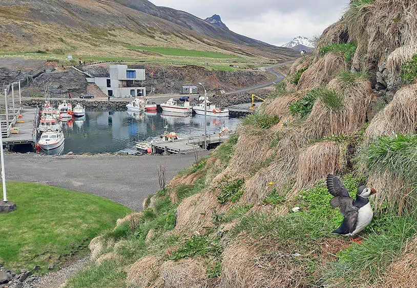
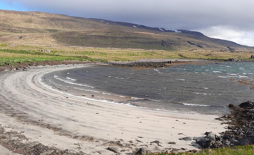
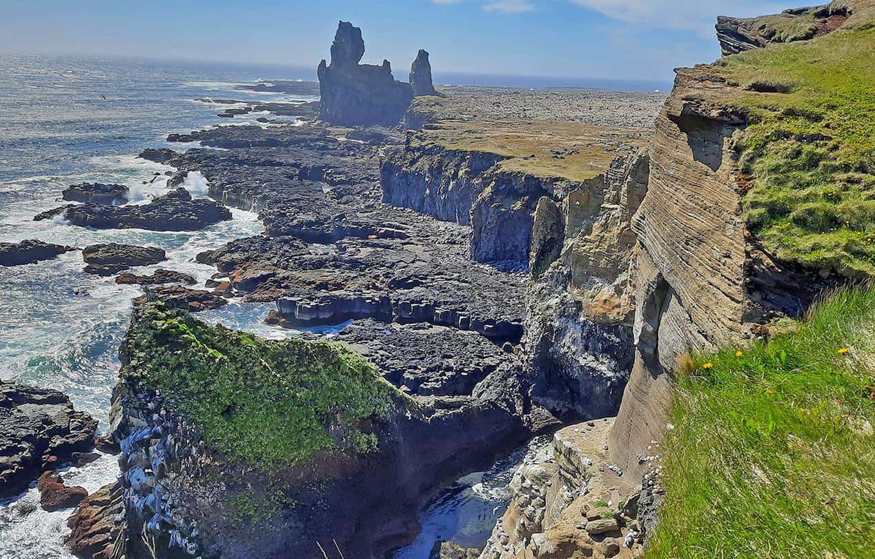
Nestled on the foot of Mount Snæfellsjökull, along the coastline of Snæfellsnes peninsula, the village of Arnarstapi is a natural hideaway, abundant with ancient rock formations and wildlife. Whereas this small coastal settlement is often regarded as a stopover or gateway to Snæfellsjökull National Park, it's an awe-inspiring place by its own right with rich history as well as an ample culinary scene that outmatches any other village across Snæfellsnes, Iceland's westernmost region.

By: Omri Westmark
Date: 20:33 08.08.21
Last Update: 13:26 08.10.21
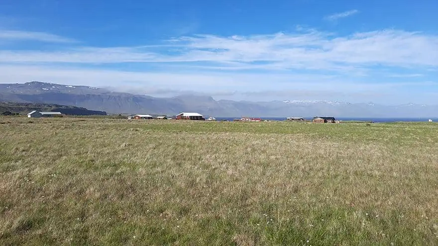
Also nicknamed as Stapi, Arnarstapi was established as a fishing village that thanks to its natural harbor and nearby herring-rich waters thrived for centuries. The Danes who ruled Iceland until the early 20th century left a prominent mark as they further developed the hamlet into a commercial fishing port that was indispensable for the entire island.
Following the modernization of Iceland and the ensuing migration of people from the countryside to the country’s capital and economic center, Reykjavik, the village’s population has dwindled dramatically. However, the recent rise in tourism pretty much revived Arnarstapi, making it once again a vibrant place, albeit with a completely different character, where the fishing industry is no longer the main source of income.
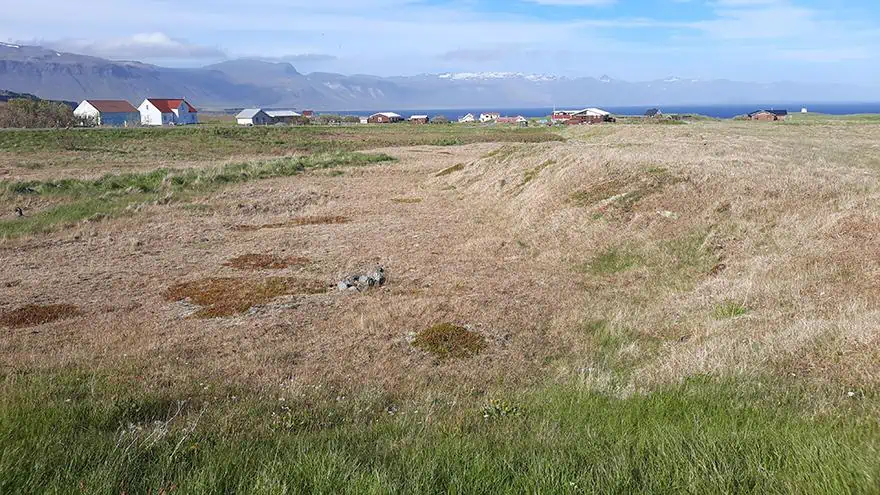
Despite its population gain in recent decades, the village is still sparsely populated with large patches of land separating houses between each other.
photography by: Omri Westmark
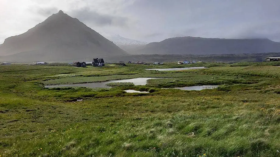
One of several historic houses throughout the village, Amtmannshúsið is a dark wooden house that formerly served as the official residence of the Danish regional governor. Its well-preserved state alongside the pyramid-shape mountain of Stapafell is a breathtaking sight to behold and photograph.
photography by: Omri Westmark
With its relatively ample accommodation and dining options, Arnarstapi is the unrivaled stopover for travelers making their way in or out of Snæfellsjökull National Park.
photography by: Omri Westmark
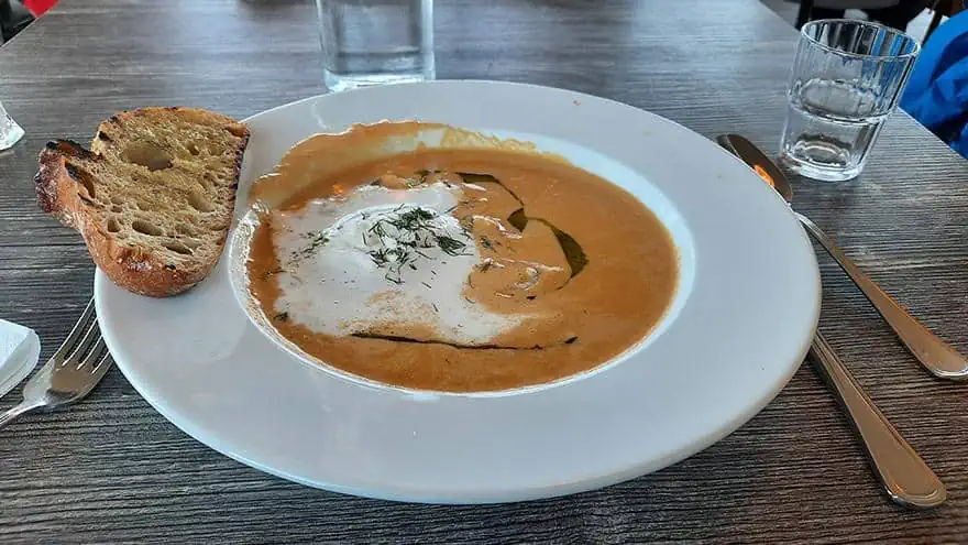
One of the village’s most recommended places to eat, Snjófell Restaurant is part of Arnarstapi Hotel and offers an assortment of international and Icelandic-style eats, including an incredibly scrumptious lobster soup, a comforting and hearty dish that makes up for the windy and cold weather outside.
photography by: Omri Westmark
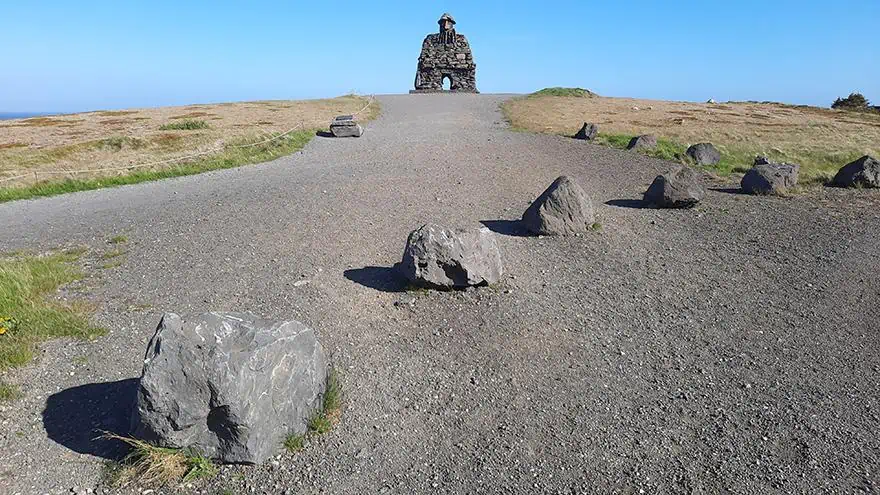
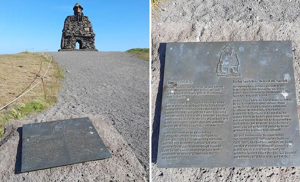
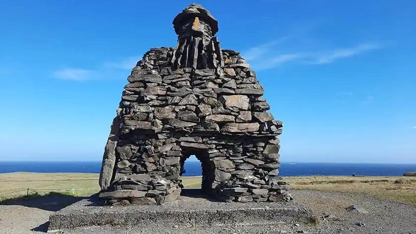
Dedicated to the legendary figure of Bárður Snæfellsás, the protagonist in the 14th century Icelandic saga of Bárðar saga Snæfellsáss, the quaint stone statue is Arnarstapi’s most noticeable man-made monument. Created by the renowned Icelandic sculptor, Ragnar Kjartansson, it perches on the village’s craggy shoreline, overlooking its spectacular rock formations.
A son of a human mother and a half troll-half giant father, Bárður grew up in Dovrefjell in Norway under the care of a mountain-dweller named Dofri, whose daughter, Flaumgerður, ultimately married Bárður and gave birth to his three daughters.
photography by: Omri Westmark
After Flaumgerður’s death, he married once again to Herþrúður, a human being, whom he had with 6 more daughters. As a result of persecution by the Norwegian king, Bárður emigrated to Iceland, where he settled with his family and a couple of friends in the southern part of Snæfellsnes peninsula, approximately at the current location of modern-day Arnarstapi.
photography by: Omri Westmark
Bárður lived in Iceland alongside his half-brother, Þorkell, whose son, Rauðfeldr, used to play with his daughter, Helga. One day when the two had played, Rauðfeldr nudged Helga when she stood on along the rocky coastline, causing her to fall on an iceberg whereby she drifted to Greenland. When Bárður heard about what happened, he lost his mind and pushed Rauðfeldr into a deep gorge, triggering a violent confrontation with his father, Þorkell.
photography by: Omri Westmark
Following his sheer ordeal, Bárður fled from Arnarstapi into the close-by Snæfellsnes Glacier, where according to legend he still resides in to these days. Over the centuries, Bárður became a mythical figure among locals, who worshiped him as the village’s protector, calling for his help whenever they encounter hardships.
photography by: Omri Westmark
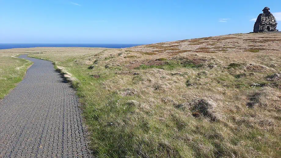
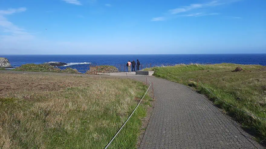
Given Bárður’s significant role as the village’s guardian spirit, the massive sculpture seems like a natural gesture that resonates with a centuries-old tradition. Additionally, the statue marks the trailhead of the coastal pathway that winds between a host of natural wonders.
photography by: Omri Westmark
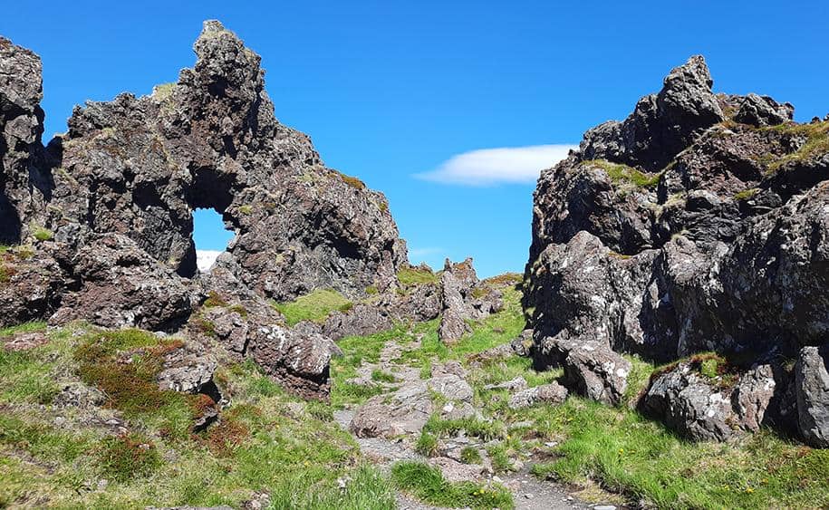
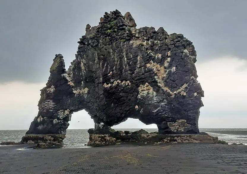
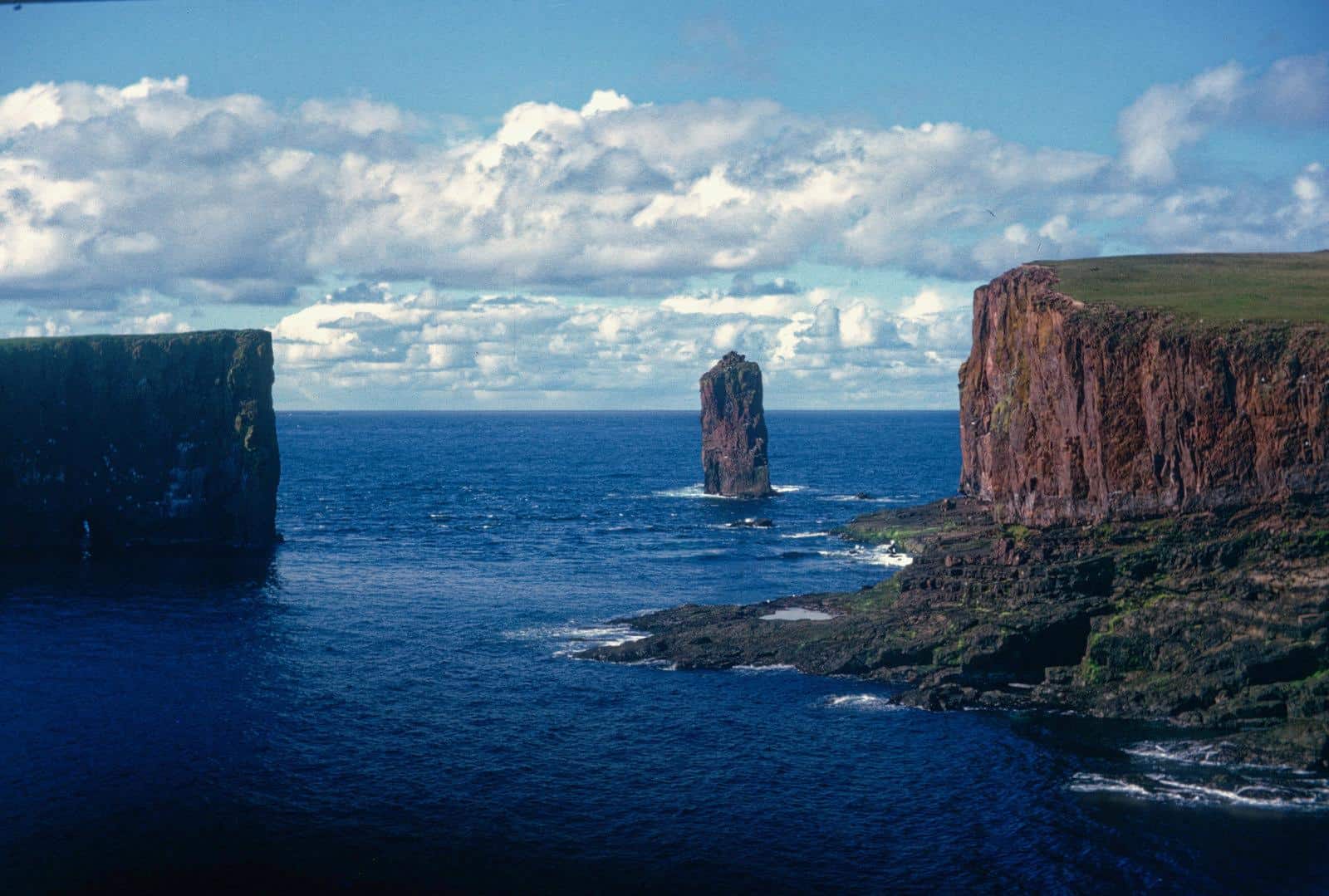
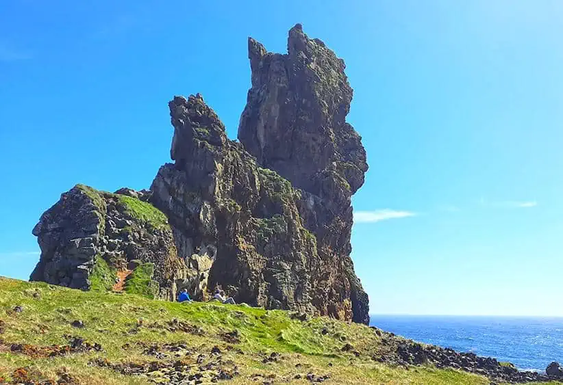
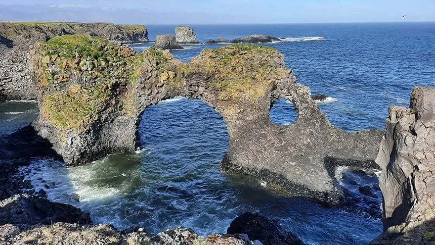
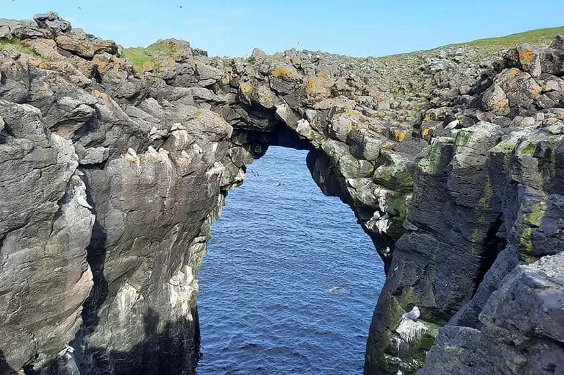
Jutting out from the North Atlantic, the stone arch of Gatklettur is a naturally formed landmark, sculptured by the waves across millennia. Despite its spectacular shape and setting, Gatklettur is far less frequented by large groups of tourists in contrary to other rock formations of its kind throughout Iceland, making it a true hidden gem.
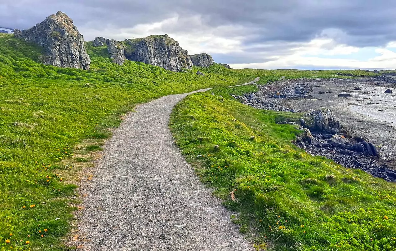
Gatklettur is accessible via the Hellnar-Arnarstapi path that traverses the village’s coastline, just a couple of minutes away from the aforementioned Bárðar Saga Snæfellsáss Statue.
photography by: Omri Westmark
After a short walk amid a grassy field, you’ll notice the small observatory that provides a direct vista of the stone arch. Some extremely dedicated nature photographers can spend hours upon hours attempting to take the perfect photo of this natural monument.
photography by: Omri Westmark
Gatklettur at its fullest glory. Once a seamless slender wedge, it was transformed over thousands of years into a breathtaking elephant-shaped double arch as the waves continuously battered the rock, perforating it twice. Stepping over the arch is strictly forbidden and entails a high level of risk, nevertheless, over the years few thrill seekers managed to climb over it while documenting themselves doing so.
photography by: Omri Westmark
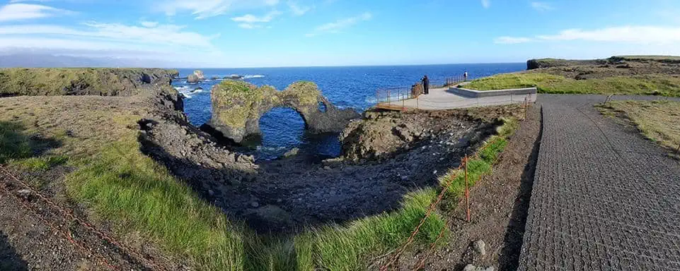
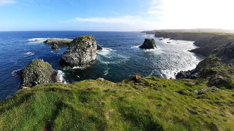
A panoramic view of Gatklettur and its surroundings. As you continue along the coastline, there are several distinct perspectives of the arch, which due to its shape tends to look utterly different from any angle you gaze at it.
photography by: Omri Westmark
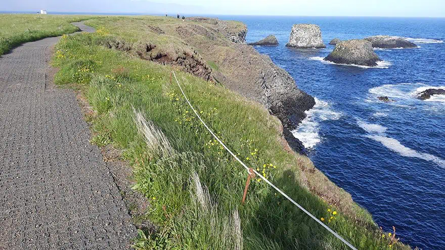
As you go further northeast along the main trail, you’ll see numerous rock formations and sea stacks jutting out from the ocean, complementing their more famous counterpart.
photography by: Omri Westmark
Among the rocks scattered at the ocean is a rugged skerry, densely populated by a colony of Icelandic seagulls, visible as tiny white dots.
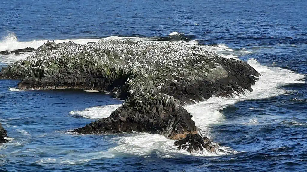
photography by: Omri Westmark
The coastal stroll is constantly brimming with the sounds of strong waves splashing over the rocks, as this region of Iceland is known for its choppy waters.
photography by: Omri Westmark
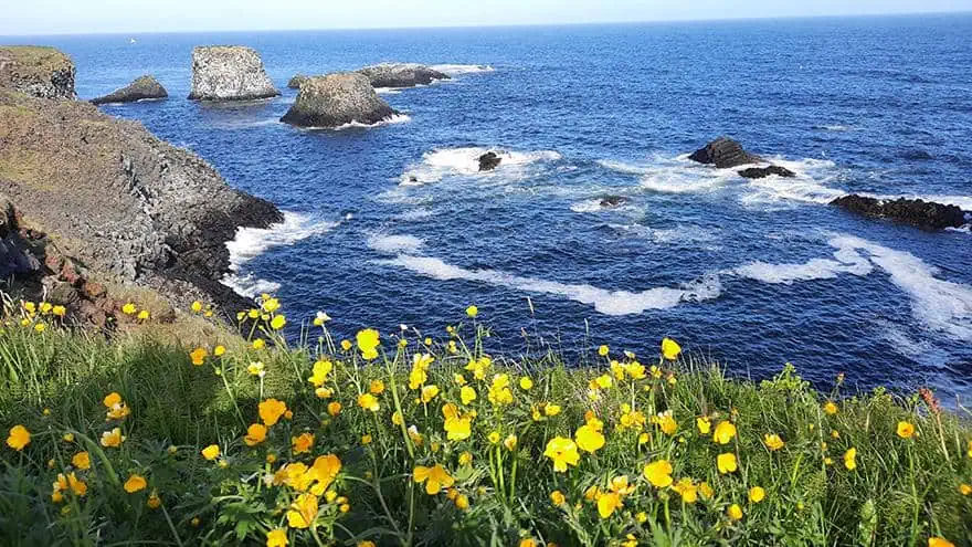
After a couple of minutes, you’ll reach a scenic spot that is blesses with a stunning vista of the numerous skerries and particularly Gatklettur. The ocean gaze is accompanied by a clamorous orchestra of seagulls, chaotically flying at every direction.
photography by: Omri Westmark
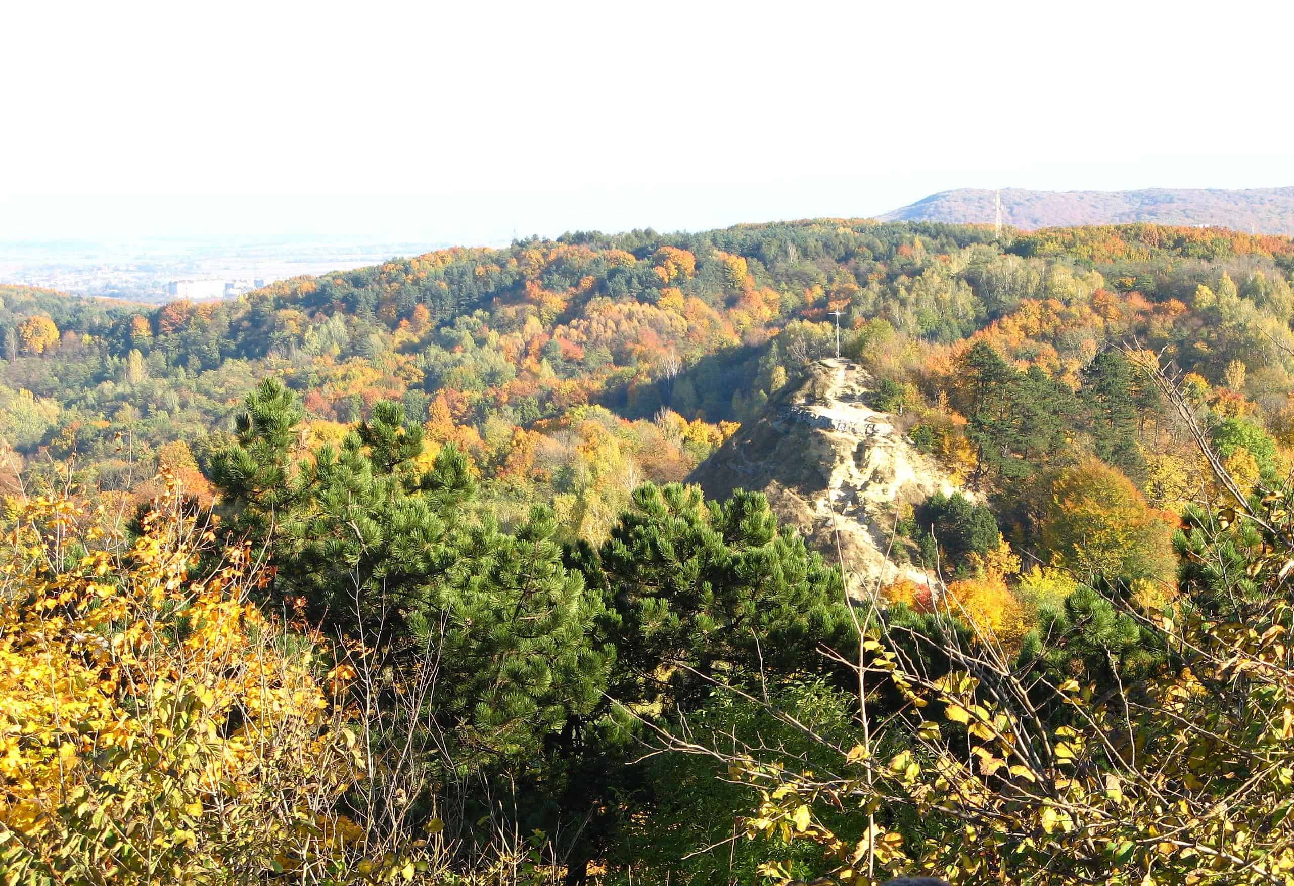
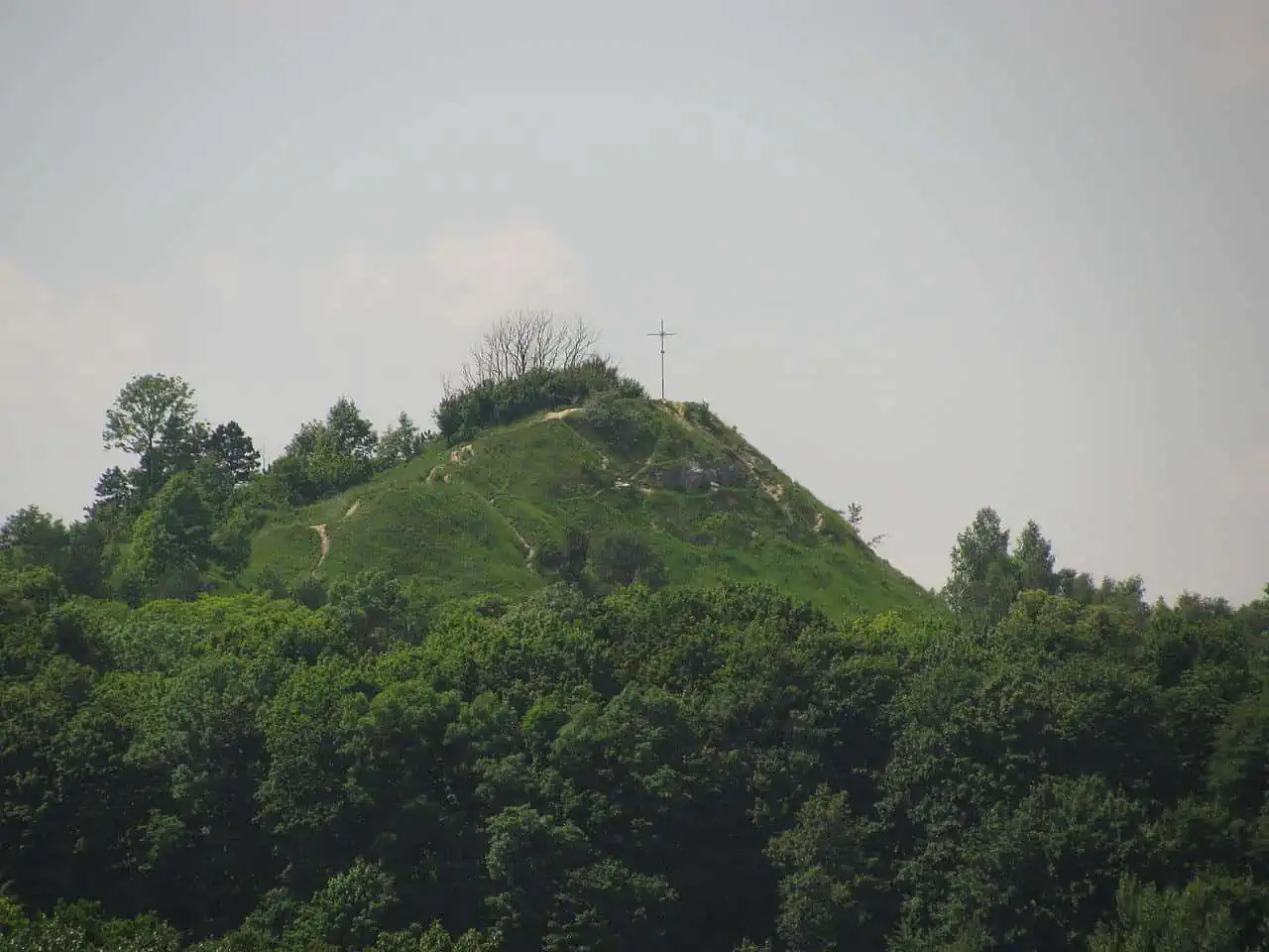
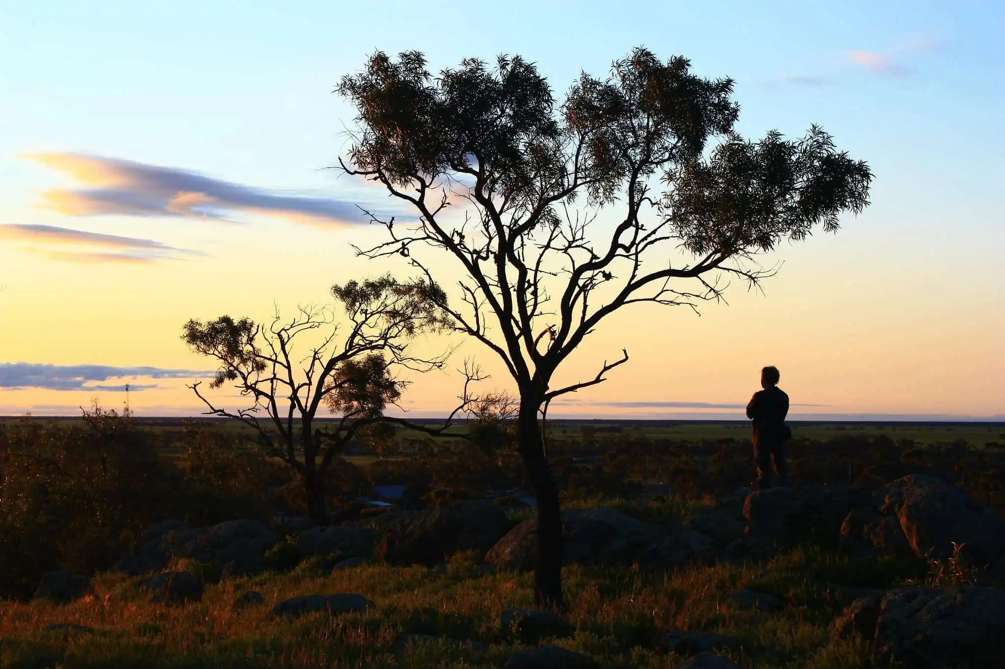
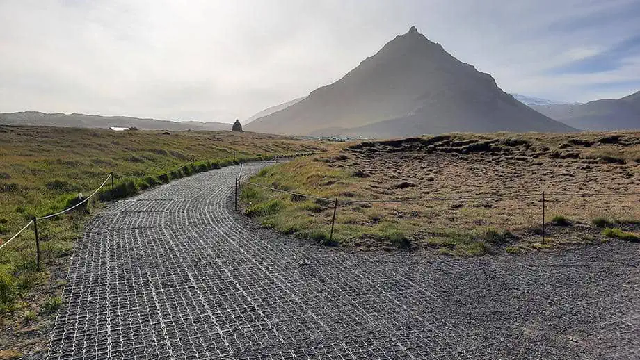
Besides the formidable snow-capped Snæfellsjökull that always looms in the background, Mt. Stapafell, a 526-meter-tall pyramid-shaped mountain made of palagonite, is a prominent feature along the trail, and for the adventurists among you also a hiking destination by its own right. Given its unique form and harmonious blending into its surrounding, it frequently stars as the perfect backdrop for many of photographs taken by professional photographers who flock to the site.
photography by: Omri Westmark
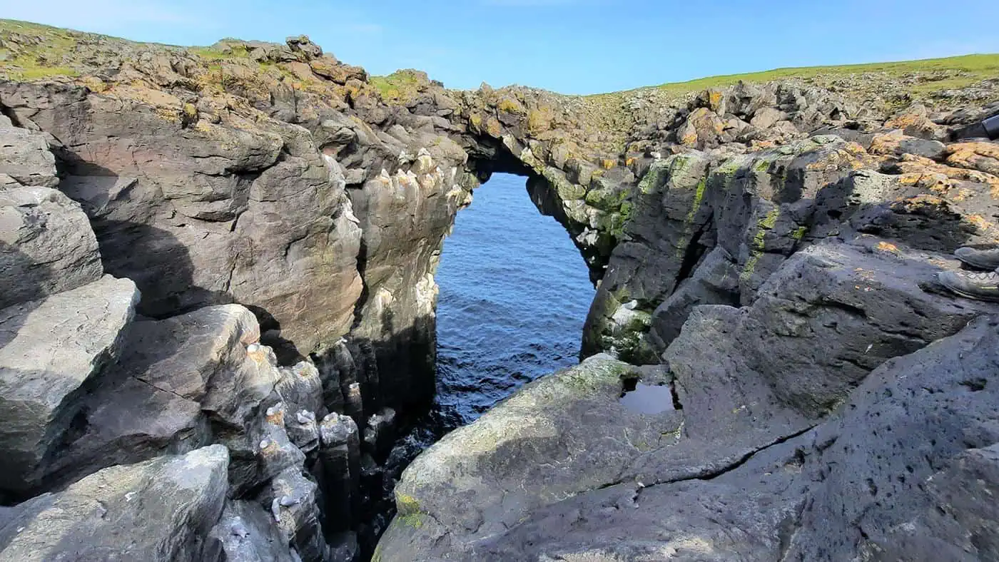
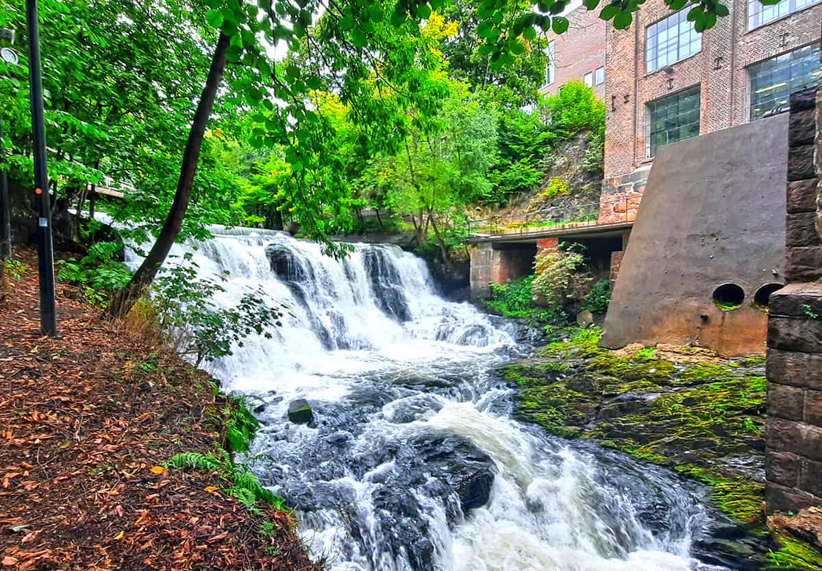
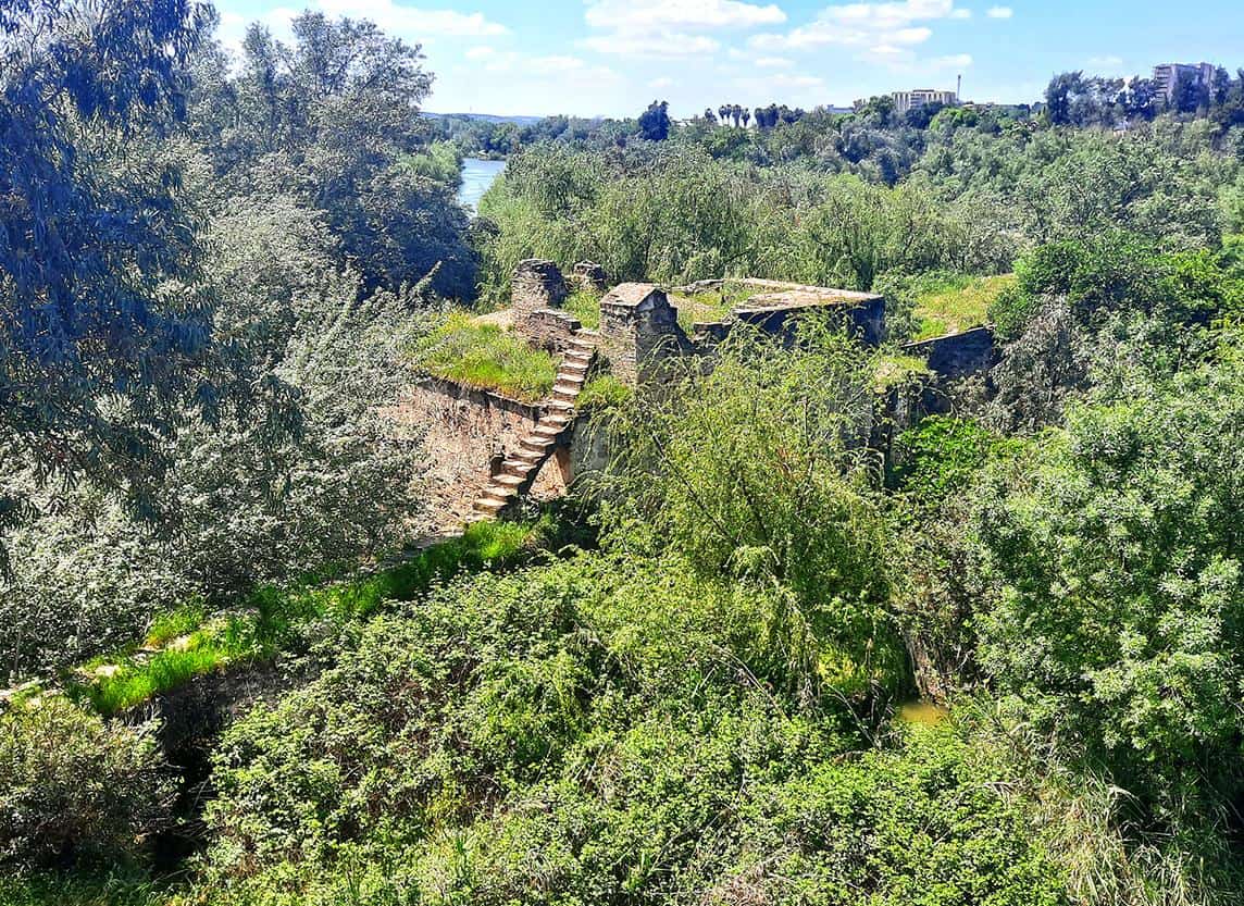
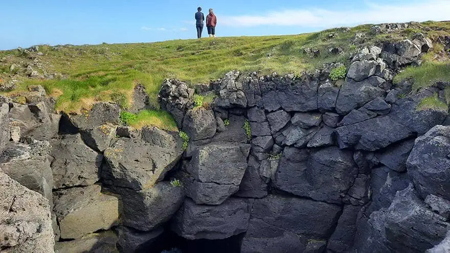
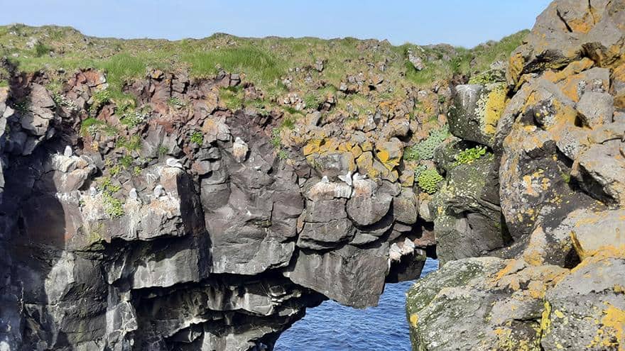
Across the world, natural arches are almost always faced with a great deal of awe, deemed as a divine creation. Whereas arches can be defined as a formation that protrudes above the ground, Arnarstapi is home to a much rarer phenomenon, a series of naturally formed bridges that do not exceed the ground level around them, providing a passage above water-filled grottos.
By now you might ask yourself whether it’s actually safe to cross those natural bridges given the way those craggy formations are often perceived, as if their proportions are exceedingly slender.
photography by: Omri Westmark
As a matter of fact, all of the three natural bridges of Arnarstapi are quite wide, or at least enough to safely cross them without any risk of falling.
photography by: Omri Westmark
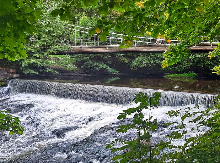
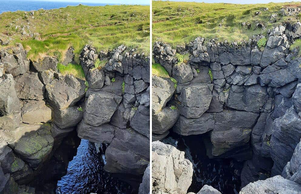
The most recognizable angle of Arnarstapi’s most famous bridge, Eystrigjá. The tourists who do come here often take advantage of the exceptional sight to make the perfect Instagram pic that will reward them with scores of likes and bewildering comments.
As in the case of Gatklettur, the natural bridges were formed over a long period of time by the sheer force of the North Atlantic’s waves, violently crushing on the rocky coastline.
photography by: Omri Westmark
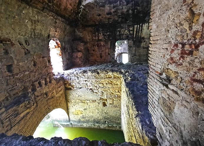
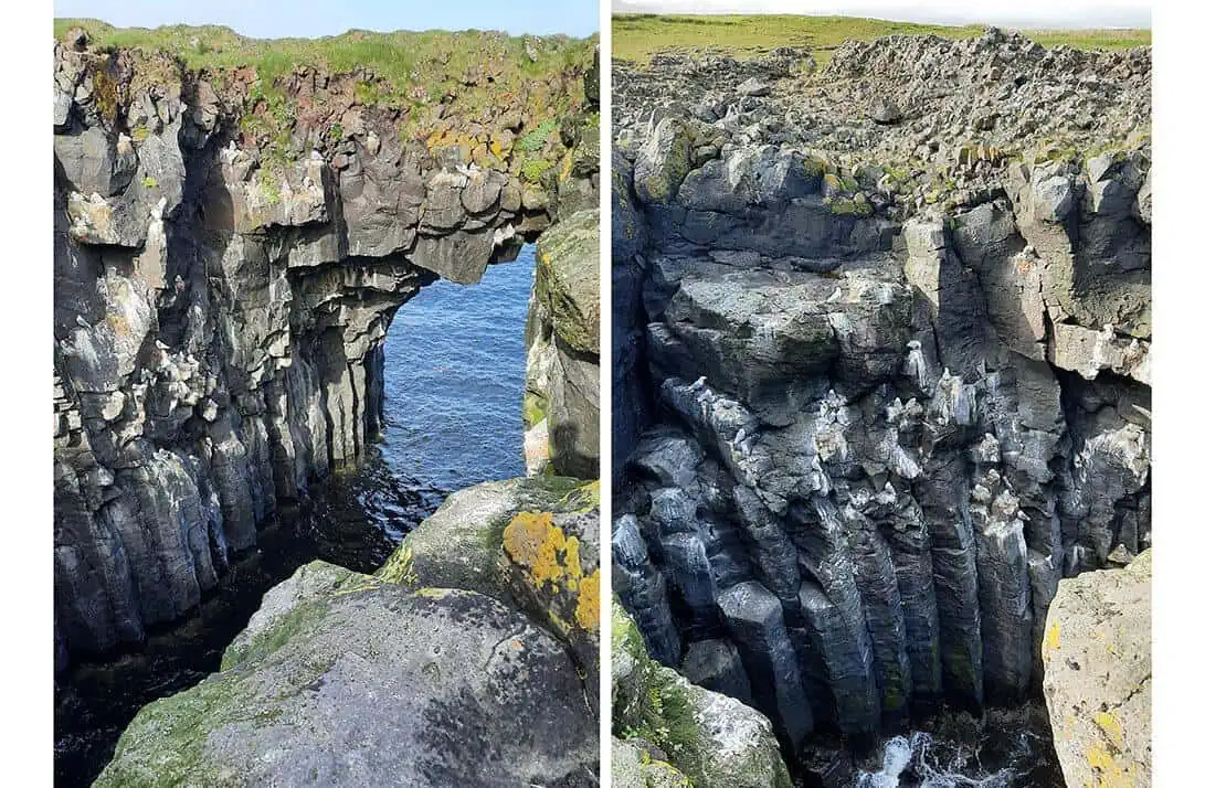
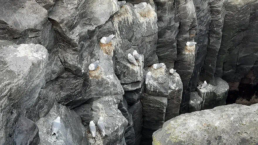
Interestingly, the vertical wall of the cove that runs beneath the arch is adorned with hexagonal basalt columns, a relatively common geological formation in Iceland, most notably at the remarkable waterfall of Svartifoss.
The hexagonal shape results from the cooling process of lava flows, where the lava shrinks in volume as it cools, triggering evenly created cracks that appear as if they were a man-made structure.
photography by: Omri Westmark
Atop each column, a pair of seagulls nest intermittently, while one of the parents is usually at sea, hunting to provide precious calories for their newly hatched chicks.
photography by: Omri Westmark
Even the most precarious parts of the arch are populated by nesting seagulls, fearlessly perching on small rocks that seem as if they are about to fall at any given moment.
photography by: Omri Westmark
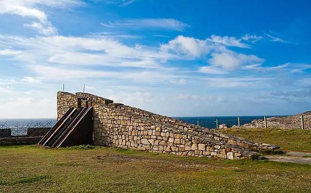
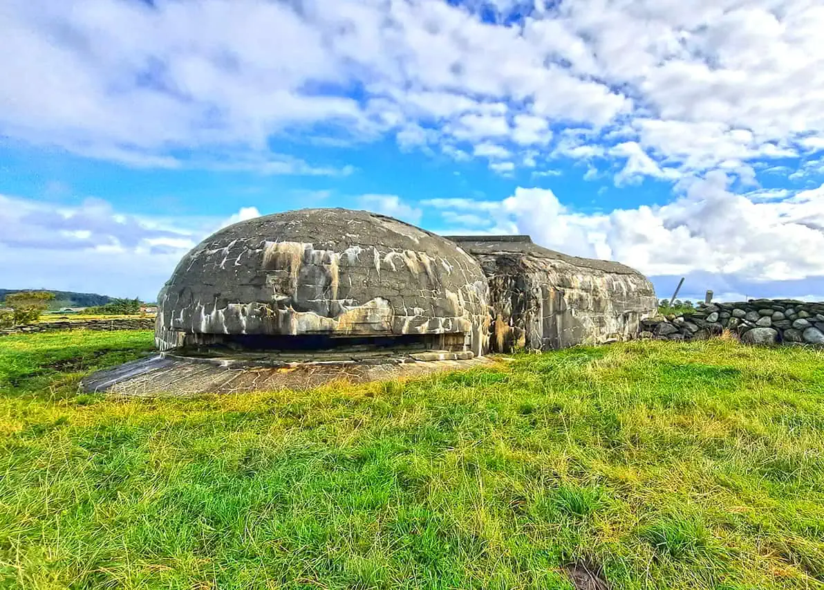
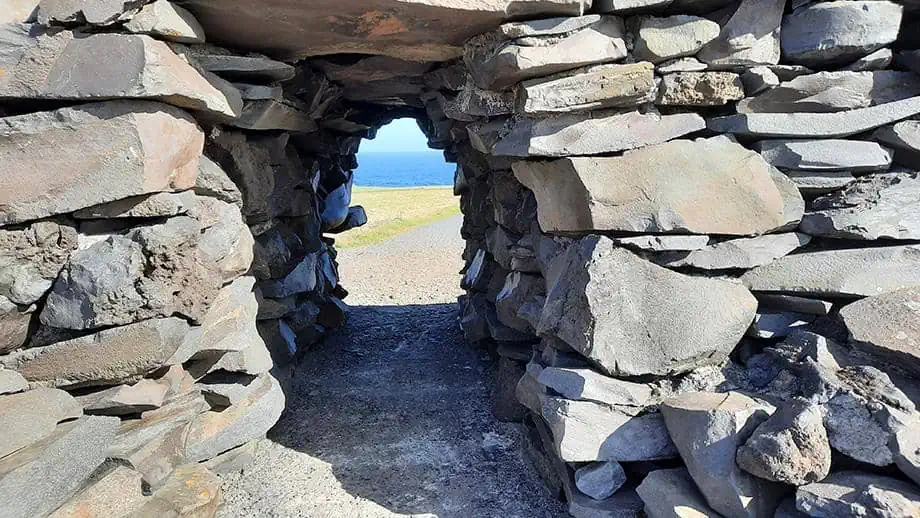
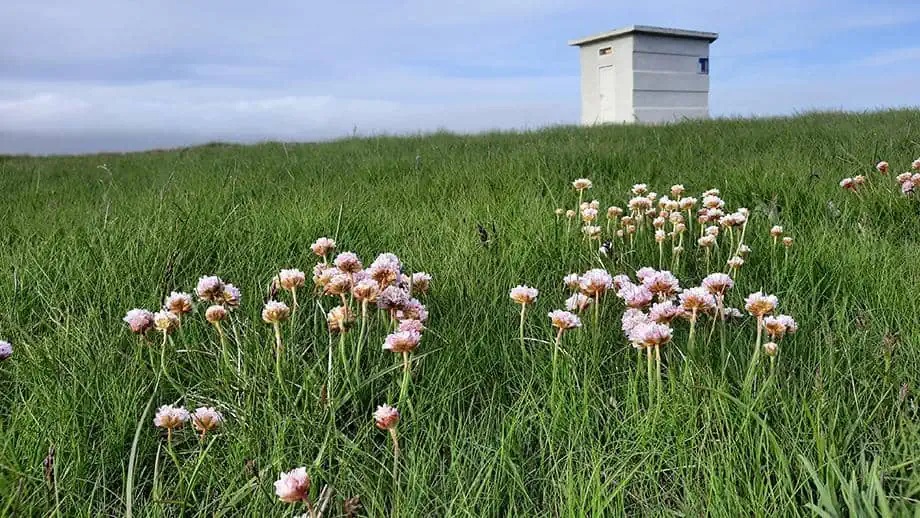
As you walk further along the coastal trail, you’ll notice a small concrete outpost, once there, you’ll have an expansive view of the impressive promontories that constitute the village’s mind-boggling coastline.
photography by: Omri Westmark
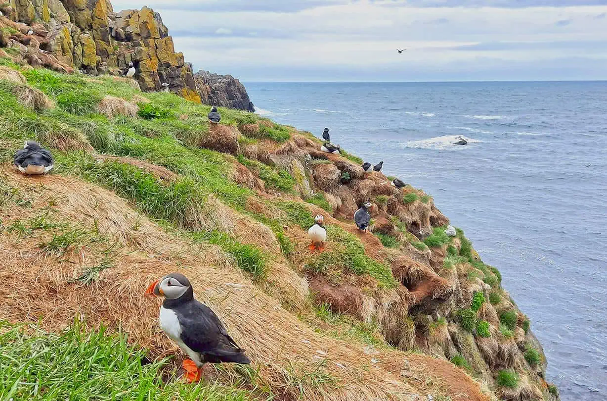
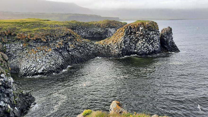
As you reach the scenic spot, you’ll have a first glimpse of the formidable cliffs that stretch along the village’s northern coastline. The cliffs’ vertical ocean-façade is patterned with an incalculable number of medium-sized rocks, some of which are covered by Icelandic moss while others serve as platforms for seagull nests.
photography by: Omri Westmark
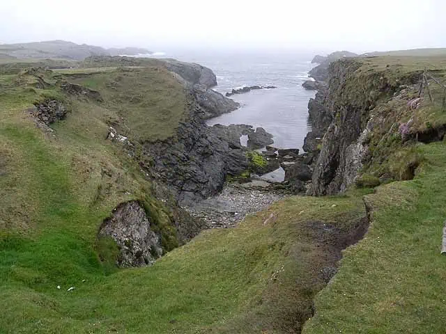
A hidden cove formed by the vertical promontories, Pumpa is a nearly triangular inlet that meets a rocky beach, somewhat the rugged Nordic version of a Polynesian nook. According to local legends, elves use to roam the cliff around Pumpa in search of a new place to live in.
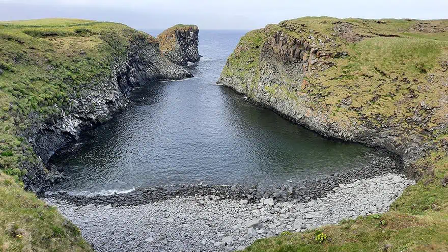
photography by: Omri Westmark
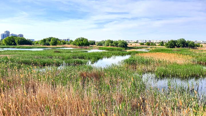
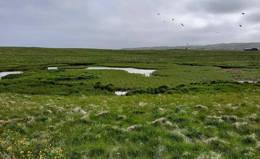
The trail around Pumpa is extremely narrow as it’s sandwiched between the cove and a freshwater pond, brimming with birdlife.
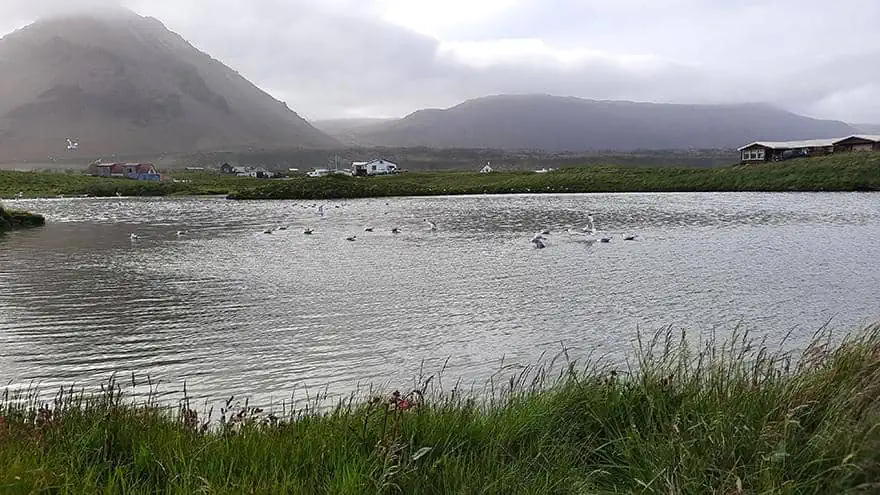
photography by: Omri Westmark
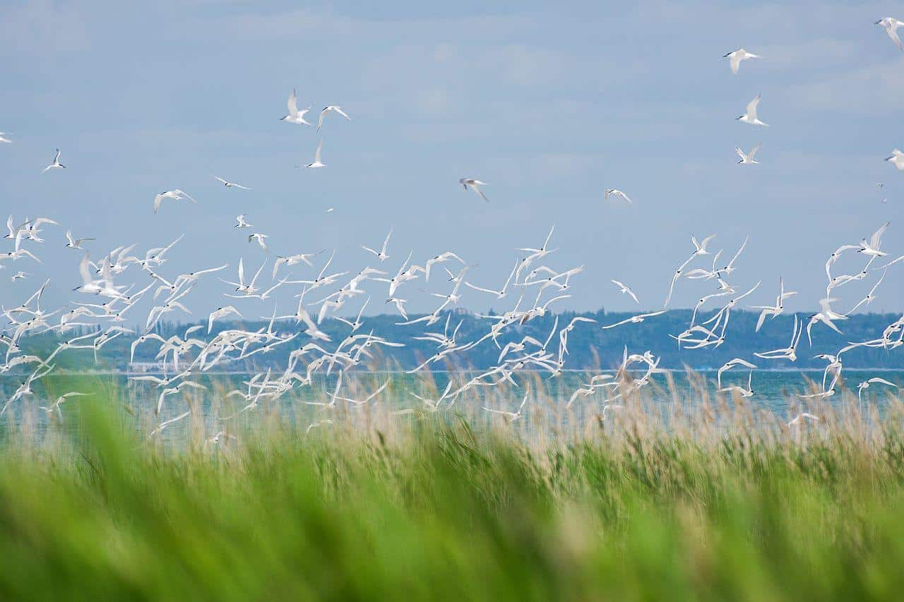
Standing out among the dozens of endemic bird species that populate those wetlands is the arctic tern. This small seabird might look harmless in first glance, however, it can get extremely aggressive if you happen to get too close to its nesting grounds, which apparently happen to be an entire segment of the trail. As you cross a certain threshold, several birds will hover around you before diving with their beak downwards, trying to reach your head. Intimidating as it might sound, this Hitchcock style attack is annoying at best, albeit most travelers just find themselves in a burst of uncontrollable laughter.
photography by: Omri Westmark