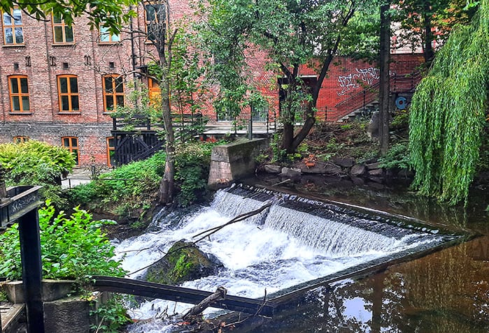
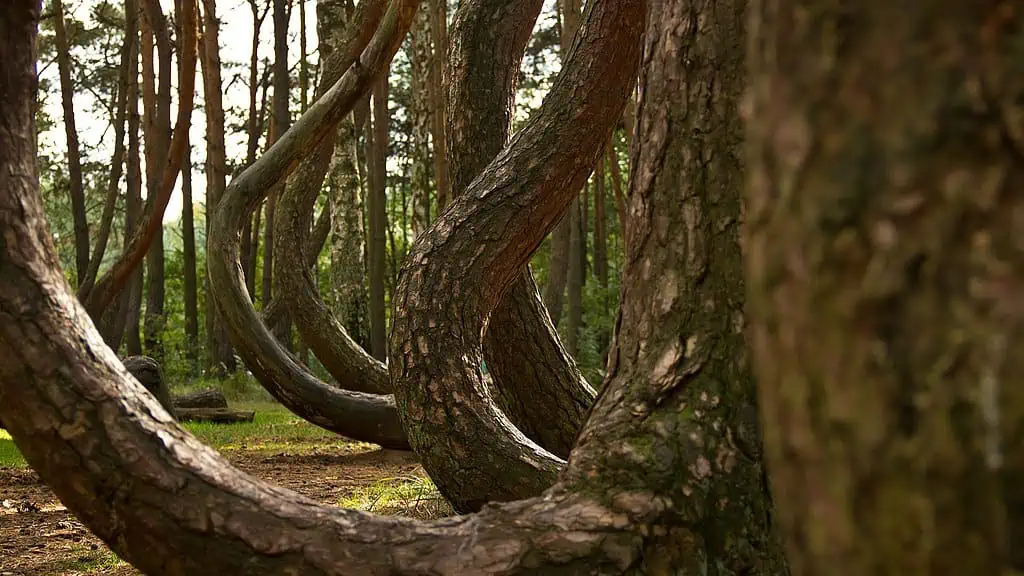
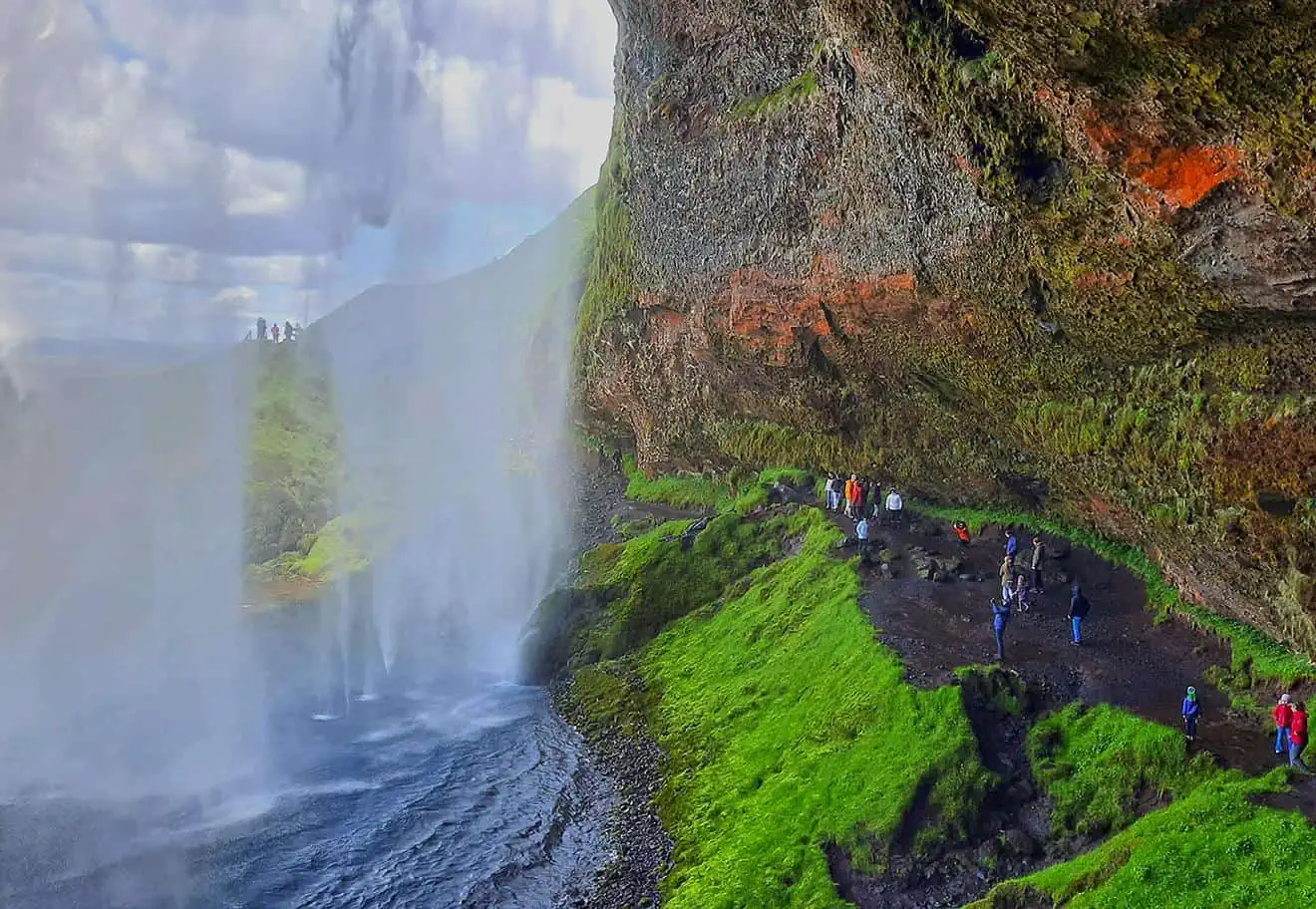
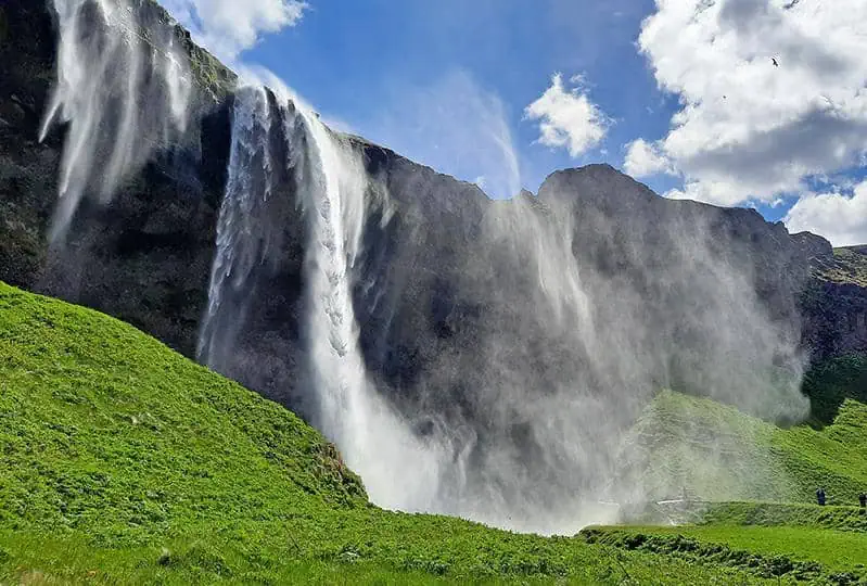
As any tourist will most probably testify, Iceland is home to an incalculable number of spectacular waterfalls, including Gullfoss, Europe’s largest waterfall, volume wise. Due to their sheer magnitude and immense beauty, Iceland’s most famous waterfalls are often crowded with visitors. Nonetheless, the country also has well-hidden waterfalls, spared from the same fate by their relative inaccessibility. Two of which, Bruarfoss and Hlauptungufoss, offer a different experience, dominated by unspoiled nature and tranquility.

By: Omri Westmark
Date: 22:48 25.10.21
Last Update: 10:59 25.06.22
While the vast majority of Iceland’s most iconic waterfalls entail merely a minimal walking distance to witness their might, Bruarfoss is 3.5 kilometers by foot from the nearest road, and as such, requires a 2-3 hours round trip just to get there. Fortunately, a large segment of the hike goes along the Brúará River and accompanied by lovely and pristine natural scenery.
Several years ago, it was possible to reach the waterfall through a far shorter route, traversing private lands, however, due to littering and defecation by hikers, the shortcut was permanently closed, forcing all visitors to take the longer path.
Because of its proximity to Iceland’s golden circle, the waterfall can be easily incorporated in a one-day trip from Reykjavik, located 90 kilometers away (one hour and 20 minutes by car).
Fed by the Brúará River, which in turn originates from the glacial waters of Langjökull glacier, Bruarfoss is miniscule when compared with the country’s most formidable waterfalls, yet what it lacks in size it makes up for in mesmerizing colors and form.
Interestingly, Bruarfoss derives from the Icelandic word for bridge, as few centuries ago a natural stone arch spanned over the waterfall, linking the two sides of the river. The bridge was eventually destroyed by a local church to prevent local peasants from crossing it and claiming the fertile lands that were owned by the diocese.
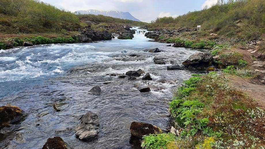
Roughly 1.5 kilometers downstream, the waterfall of Hlauptungufoss powerfully cascades southwards, serving as the less conspicuous, yet more formidable, counterpart of Bruarfoss, a bonus attraction along the hiking trail.
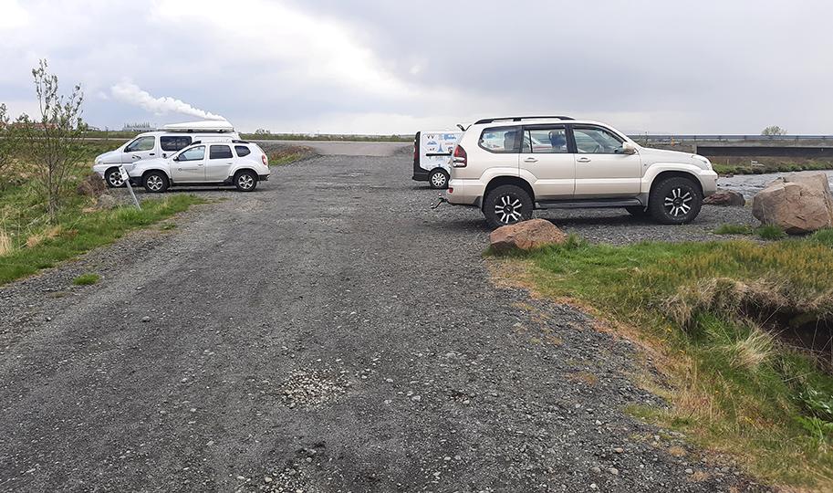
Since both waterfalls are located along the hiking trail, the furthest one can go with a car is the off-road gravel parking along route no.37 (Laugarvatnsvegur).
photography by: Omri Westmark
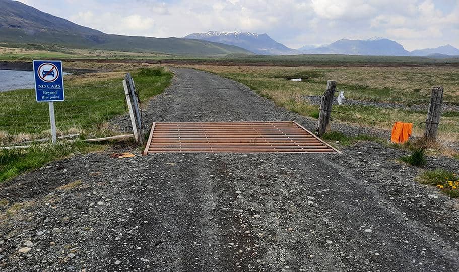
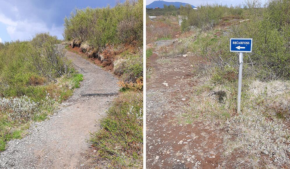
As the blue sign indicates, the entrance beyond the site’s parking is strictly forbidden for unauthorized vehicles, officially making it the trailhead. As previously mentioned, a round trip to Bruarfoss is 7 kilometers or approximately 3 hours, and with no convenience stores anywhere around, it is recommended to take with you anything you’ll might need, including food and drinks.
photography by: Omri Westmark
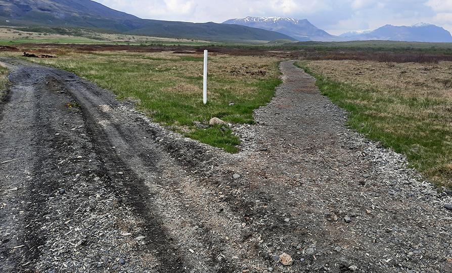
A couple of minutes from the starting point, the path diverges into two. If you wish to avoid adding an extra distance to your journey then turn right at this point.
photography by: Omri Westmark
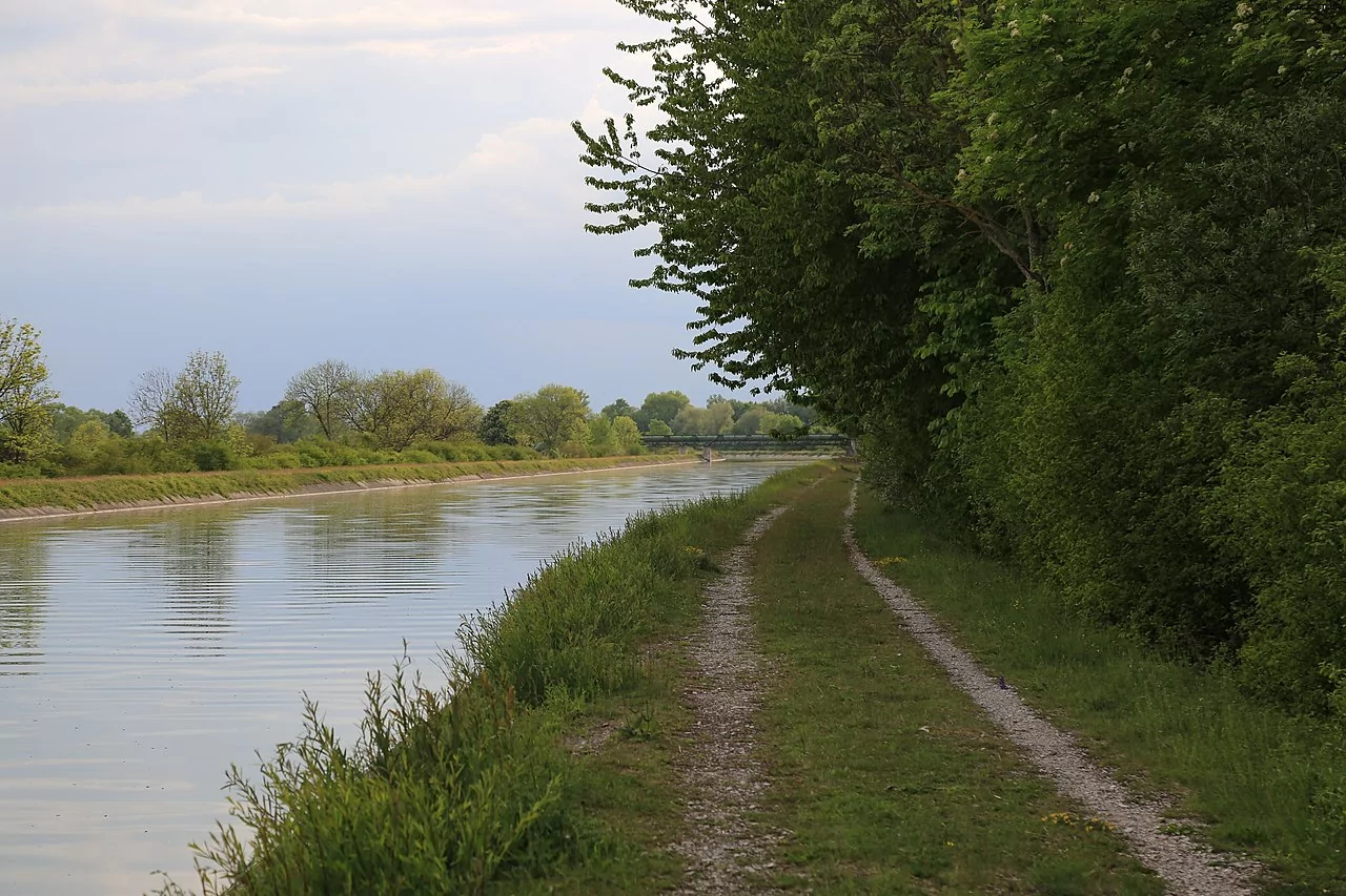
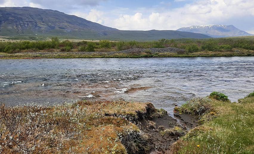
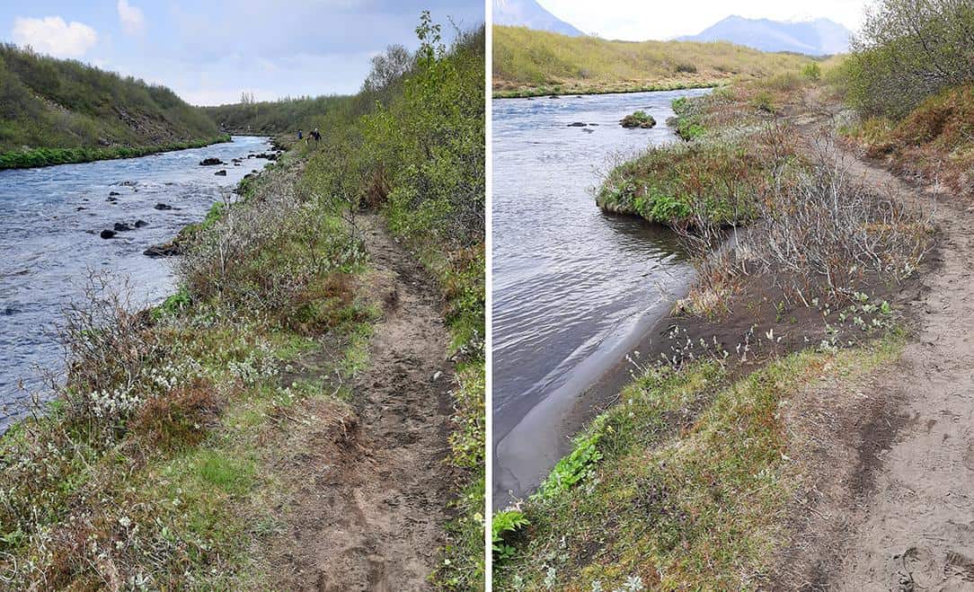
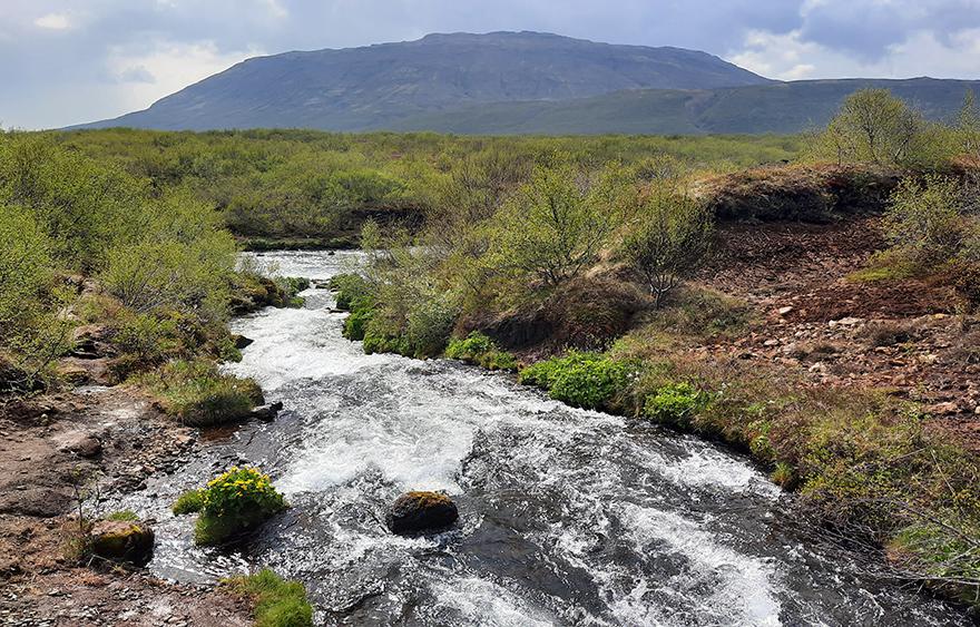
As you walk along the trail, you’ll be intermittently accompanied by the Brúará River, the aforementioned feeder of the article’s protagonists. Brúará is a tributary of the Hvítá river, which further upstream spectacularly forms the Gullfoss waterfall, Europe’s largest waterfall by volume.
photography by: Omri Westmark
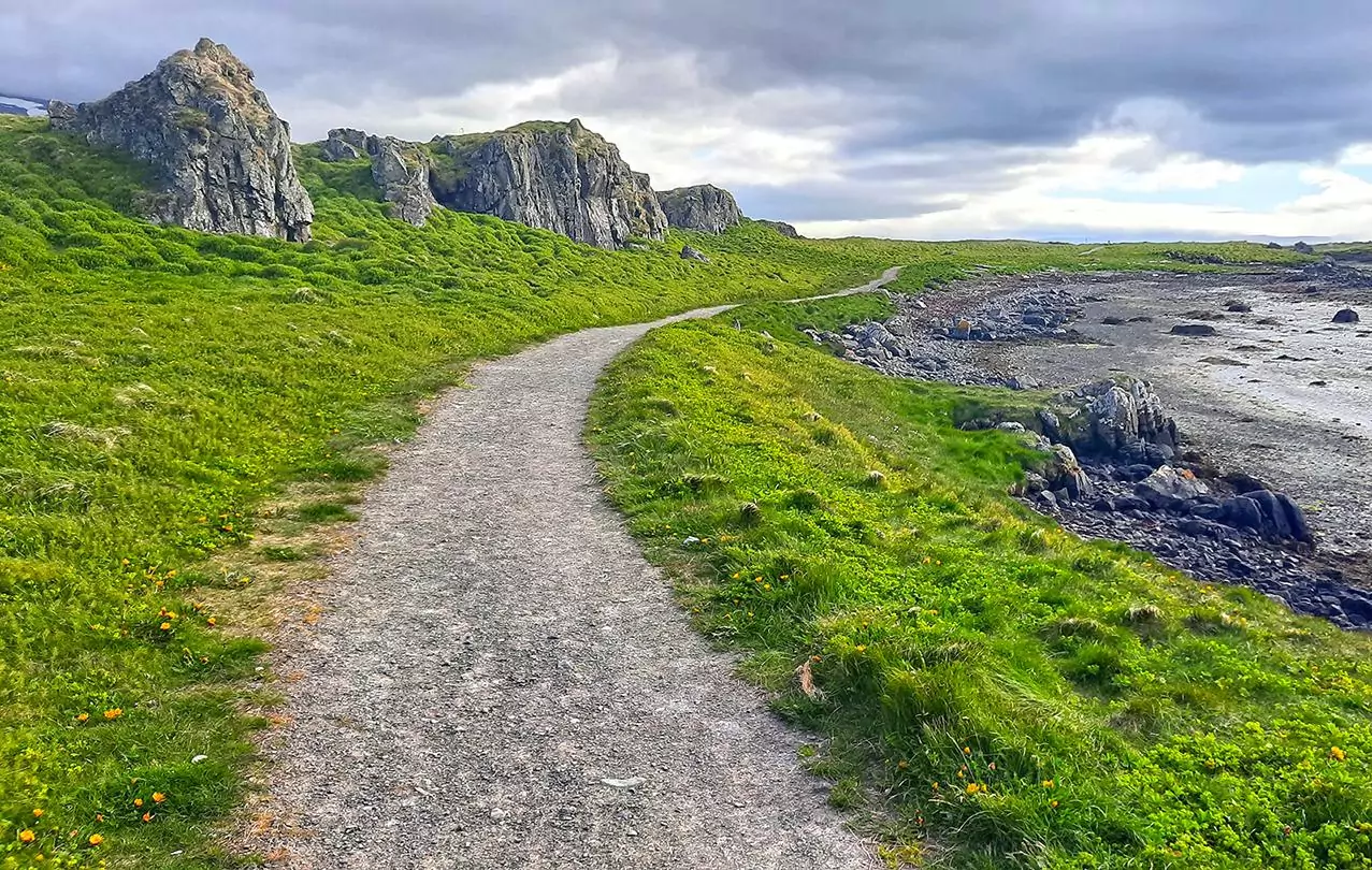
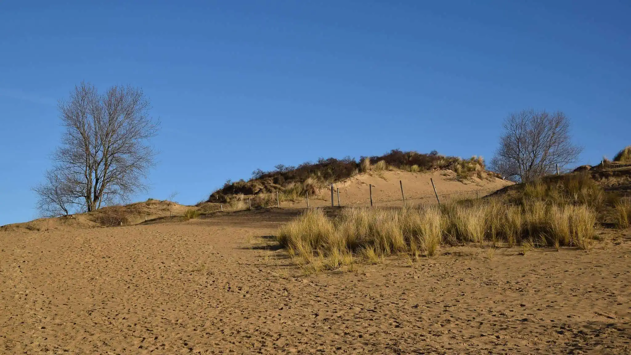
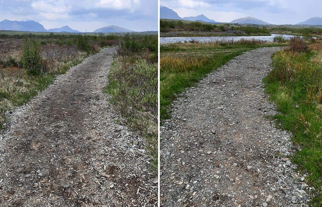
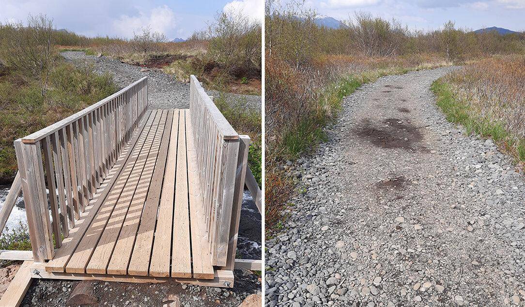
The trail’s first segment tends to be wide and easily walkable while lacking any tall vegetation at its shoulders.
photography by: Omri Westmark
After a while, as you walk along the trail, the wide gravel walkway is replaced by a narrow path that alternates between paddock slabs and rocks perching on a small stream.
photography by: Omri Westmark
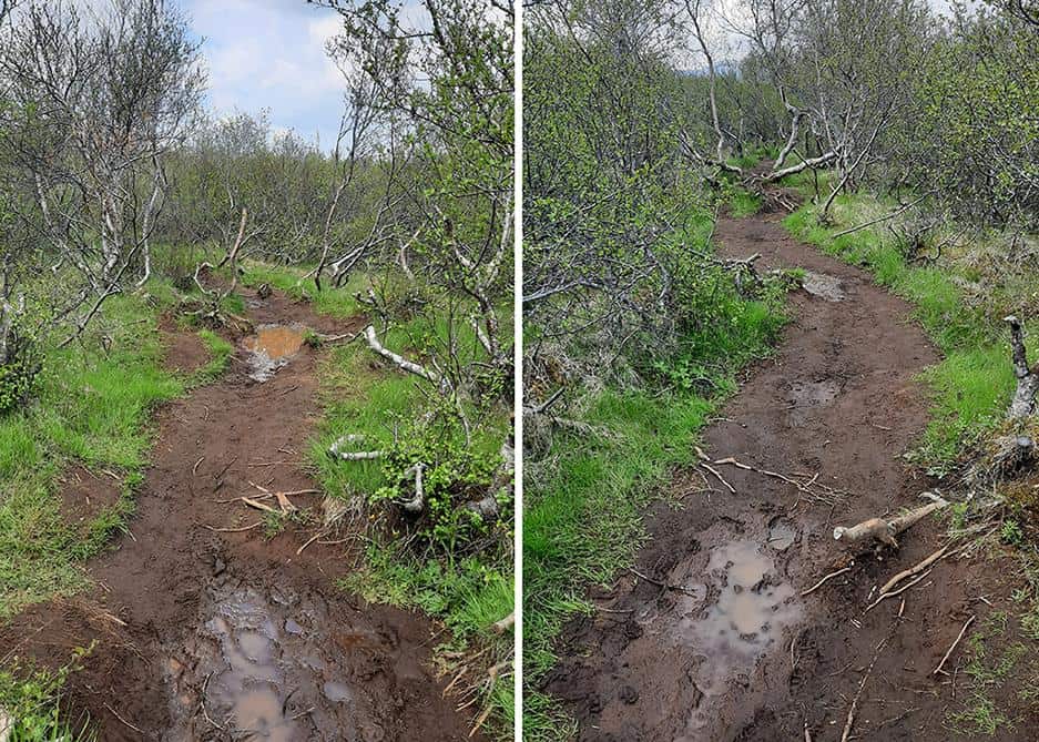
Shortly after, the sparse vegetation changes into a dense thicket of Nordic shrubs, traversed by a dirt path that in case of rain becomes a muddy, slippery and extremely challenging part to cross.
photography by: Omri Westmark
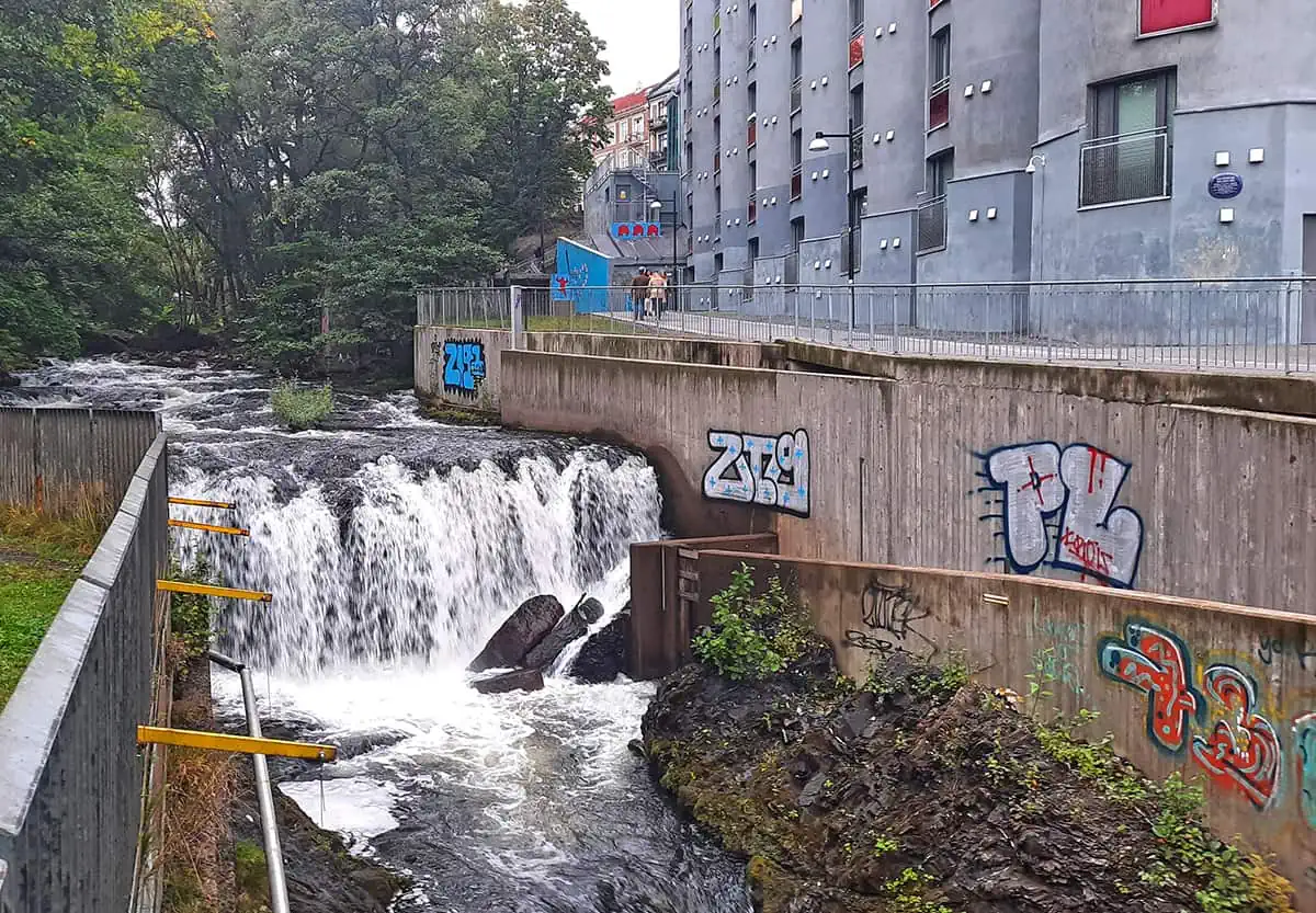
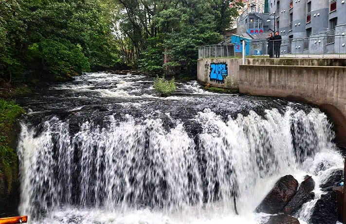
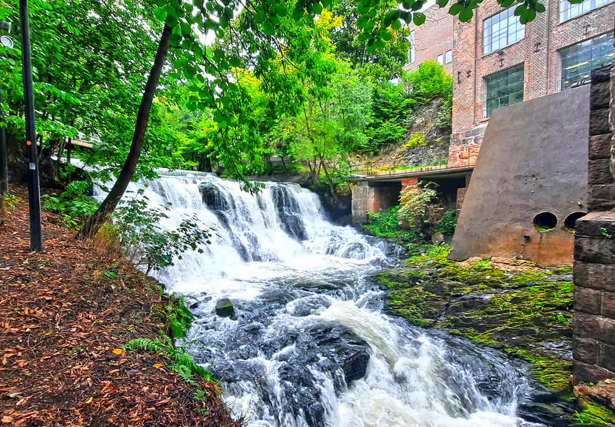
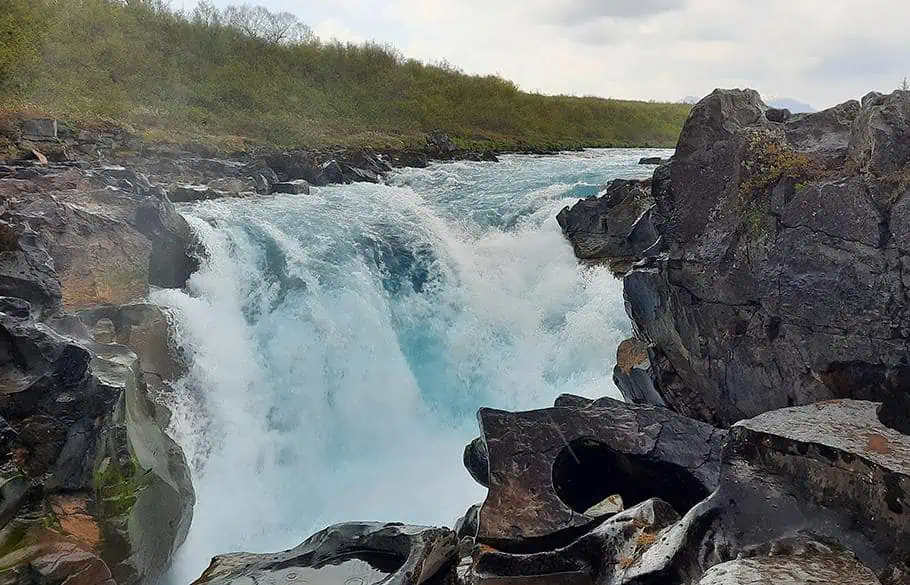
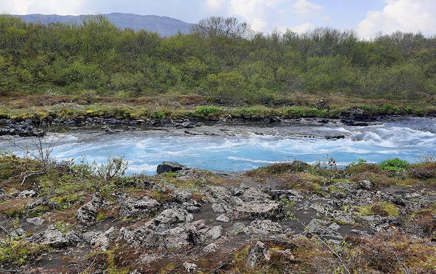
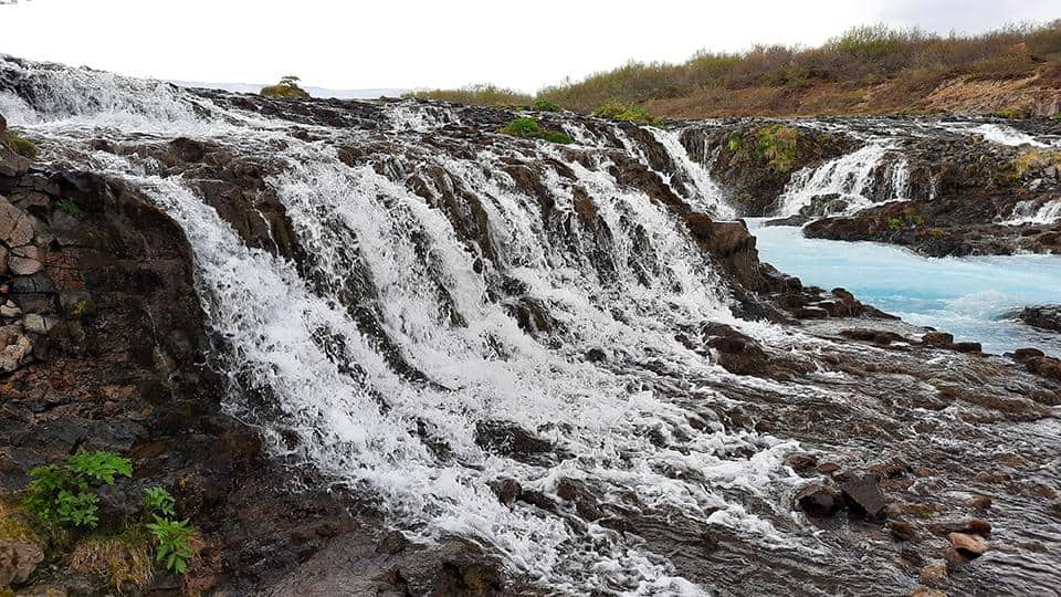
Roughly 30 minutes from the trailhead and 1.5 kilometer downstream relative to Bruarfoss, strong roars in the background cut short the otherwise complete silence. Further ahead, the rumbling beast is finally revealed, the white waters of Hlauptungufoss powerfully plunging a couple of meters, while creating a pseudo-rain in the process.
photography by: Omri Westmark
Whereas Hlauptungufoss is neither Iceland’s most eye-catching waterfall nor particularly massive in size, its slender bottleneck generates an extremely forceful stream, especially when taking into account its small scale.
photography by: Omri Westmark
As the area around the waterfall lacks any kind of infrastructure and regulations, being cautious is warmly advised. There are numerous slippery rocks, the result of the constant water splash, and so, every wrong step can result in a risky experience.
photography by: Omri Westmark
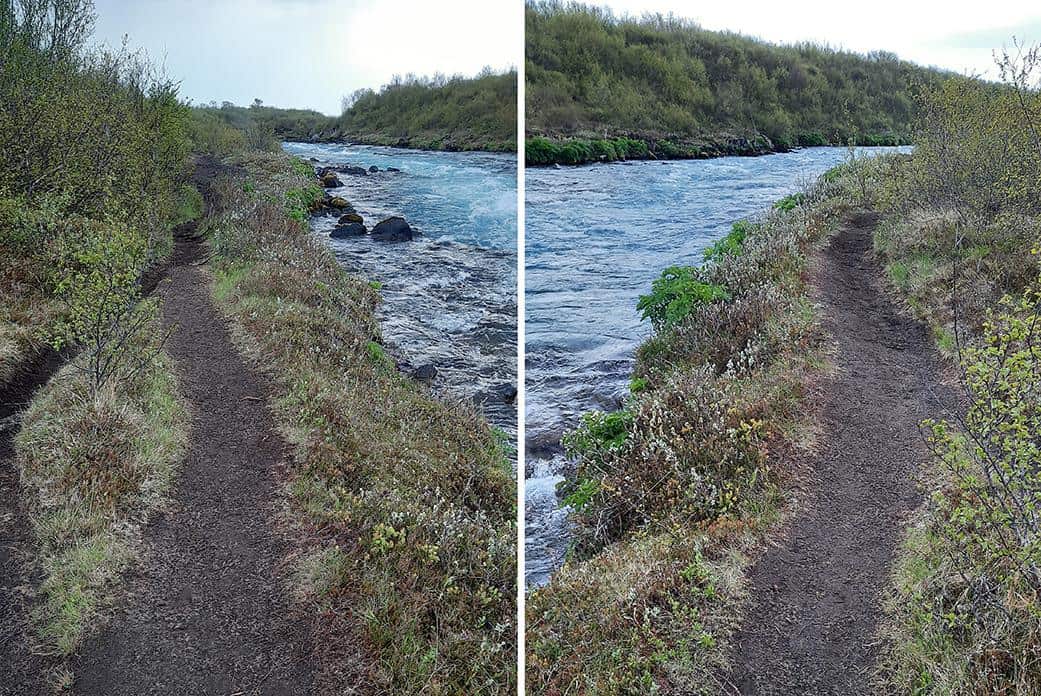
From Hlauptungufoss and further upstream, the trail is sandwiched between thick Icelandic shrubbery and the Brúará River.
photography by: Omri Westmark
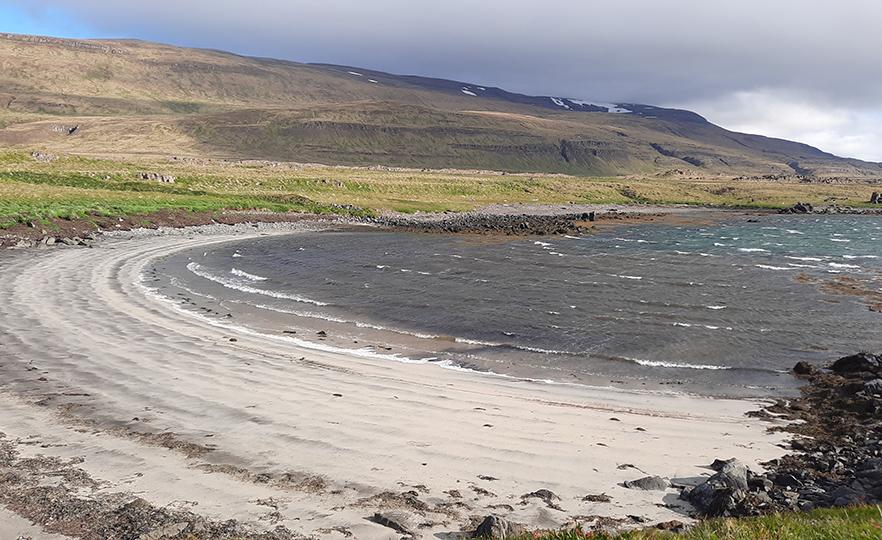
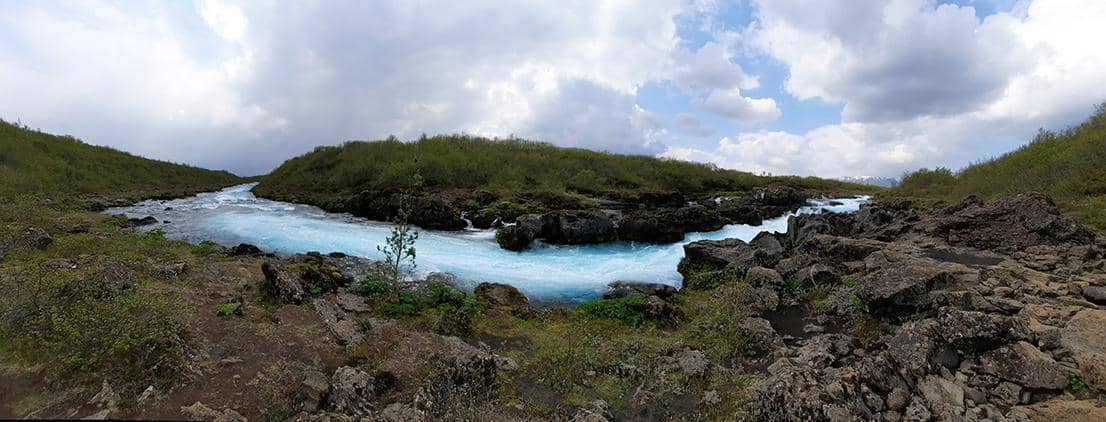
Due to their glacial origin, the river’s waters are vividly blue, except for the parts where strong stream are formed, adding the typical white hue of rapids alongside.
photography by: Omri Westmark
Somewhat eclipsed by its other two counterparts, Midfoss is a 2-meter-tall waterfall, and while it literally pales in comparison to Bruarfoss and Hlauptungufoss, it definitely serves as a cute appetizer for things to come.
photography by: Omri Westmark
The hiking trail is several kilometers long, however, the lack of any major slopes along the way makes it extremely easy, even for non-intrepid travelers.
photography by: Omri Westmark
Slightly before reaching Bruarfoss, the river lightly bends, forming a charming blueish and calm cascade, marking the end of the segment where the trail goes along the river.
photography by: Omri Westmark
A minor ascent awaits at the end of the former segment, with blue sign indicating in which direction to go. The area is also marked by other signs, warning hikers not to cross into the nearby private lands of Brekkuskógur hamlet.
photography by: Omri Westmark
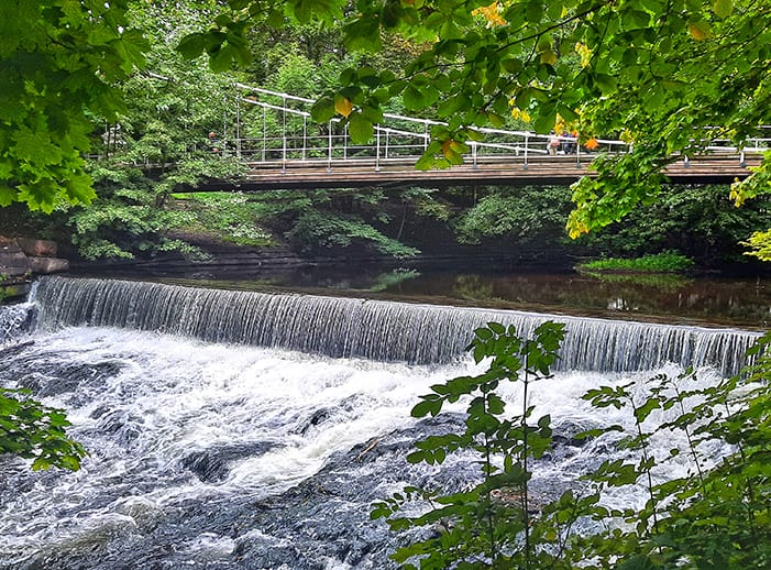
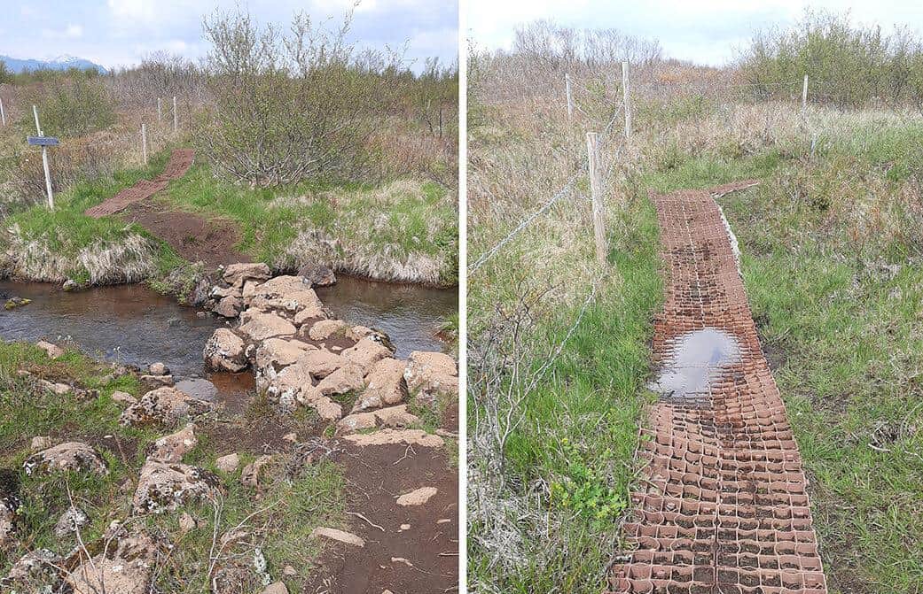
Situated about 200 meters from the waterfall, a wooden pedestrian bridge over a small tributary guarantees a smooth passage ahead.
photography by: Omri Westmark
The bridge also provides an opportunity to gaze into the surrounding semi-mountainous landscape from a higher perspective, unlike most of the trail where the surrounding countryside is concealed by the tall vegetation.
photography by: Omri Westmark
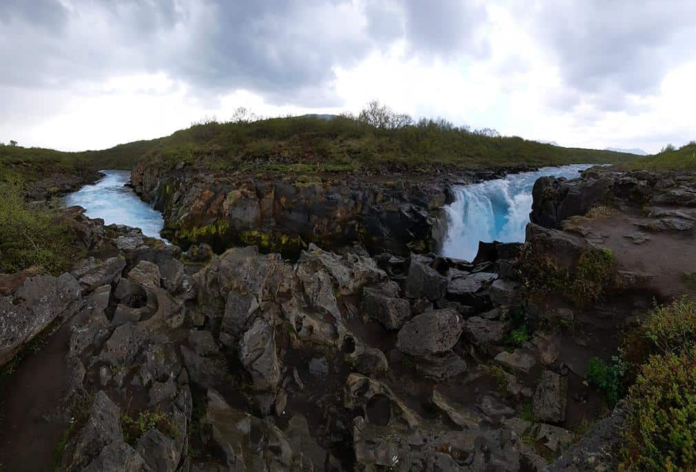
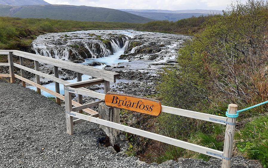
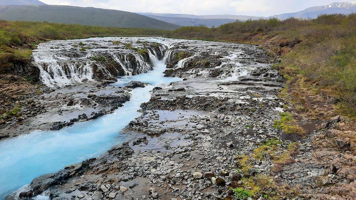
As the sign suggests, Bruarfoss looms all at once, revealing an atypical appearance, both in terms of shape and colors. The trail is seamlessly linked to a bridge from where the waterfall is seen at its fullest glory.
photography by: Omri Westmark
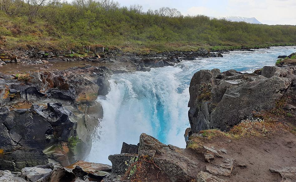
Often dubbed as Iceland’s bluest waterfall, Bruarfoss collects the river’s water into a large craggy terrace from where it plunges 3 meters through a long and narrow crevice to a turbulent pool of white rapids and intense blue waters.
photography by: Omri Westmark
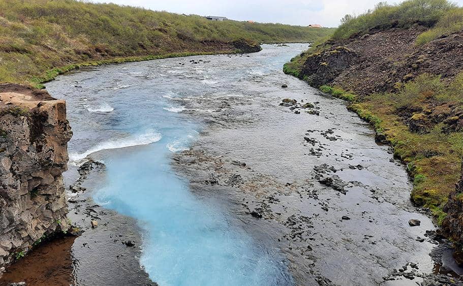
At the opposite side, the Brúará River flowing gently following the 3-meter plummet of Bruarfoss, contrasting the far more dramatic northwards vista.
photography by: Omri Westmark
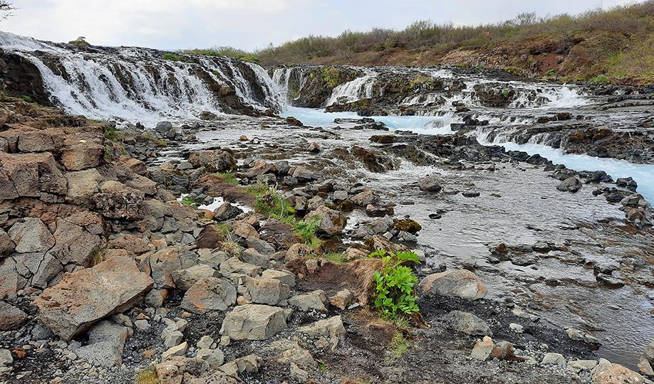
While the views from the bridge’s lookout are more than satisfying, it’s possible to get a closer glimpse of the waterfall from the adjacent rocky river bank. To get here, just cross the bridge and turn right and then downwards via the unmarked path, partly surrounded by shrubs.
photography by: Omri Westmark
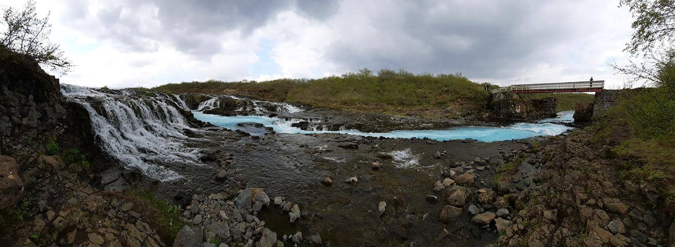
A panoramic view encompassing the waterfall, Brúará river and the bridge as all of which are seen from the lower level. Suffice to say that a great deal of caution is needed around the waterfall as sometimes the only way to move forward is by precariously stepping on wet boulders.
photography by: Omri Westmark
Nevertheless, the stunning sight of dozens of mini-falls cascading into the blueish water soup is incredibly rewarding, and even more so when considering that it’s often all for yourself to enjoy, a rare instance in an overly touristy region of a country where locals are vastly outnumbered by tourists throughout half of year.
photography by: Omri Westmark