Stretching between the Caribbean Sea and the Pacific Ocean, Guatemala is well-renowned for its spectacular Mayan Pyramids, pristine rainforests and rich cultural heritage. Whereas most tourists often flock the country's Mayan ruins, colonial towns and Pacific beaches, Guatemala also has some far lesser-known attractions, the most prominent of which is its string of volcanoes, including active ones that spew lava and ash into the sky, a jaw-dropping spectacle that simply can't be missed.

By: Linda Monia
Date: 19:43 27.03.21
Last Update: 13:40 30.07.21
Located within the 1,500 kilometer long Central American Volcanic Arc, Guatemala has over thirty volcanoes, three of which are still active. While there are numerous hiking expeditions across the country’s dormant volcanoes that offer challenging hikes and breathtaking views, none of those is comparable with a hike to an active volcano. Watching the lave flows, feeling the ground rumbles beneath your feet and witnessing the volcanic explosions are all part of a rare and unforgettable experience.
Before heading to one of Guatemala’s active volcanoes, it’s compulsory to book an excursion with a professional guide. It’s absolutely true that volcanoes can pose some real safety challenges, yet a well-experienced local guide gets governmental reports whether it’s safe to hike on a specific day. Guides are also knowledgeable about the routes which provides the best views, the ideal time to visit during the day and the fastest way down if things go wrong.
For each of the hikes, it’s recommended to bring a standard hiking gear, while the guides will usually provide tents, mats and sleeping bags for the overnight tours. Nevertheless, there are a couple of unique items you should carry with you in any case, the most important of which is a neck gaiter to protect your nose and mouth from volcanic ash. A flash light or a head torch are also necessary, as all routes either start early at the morning before sunrise or includes an overnight stay.
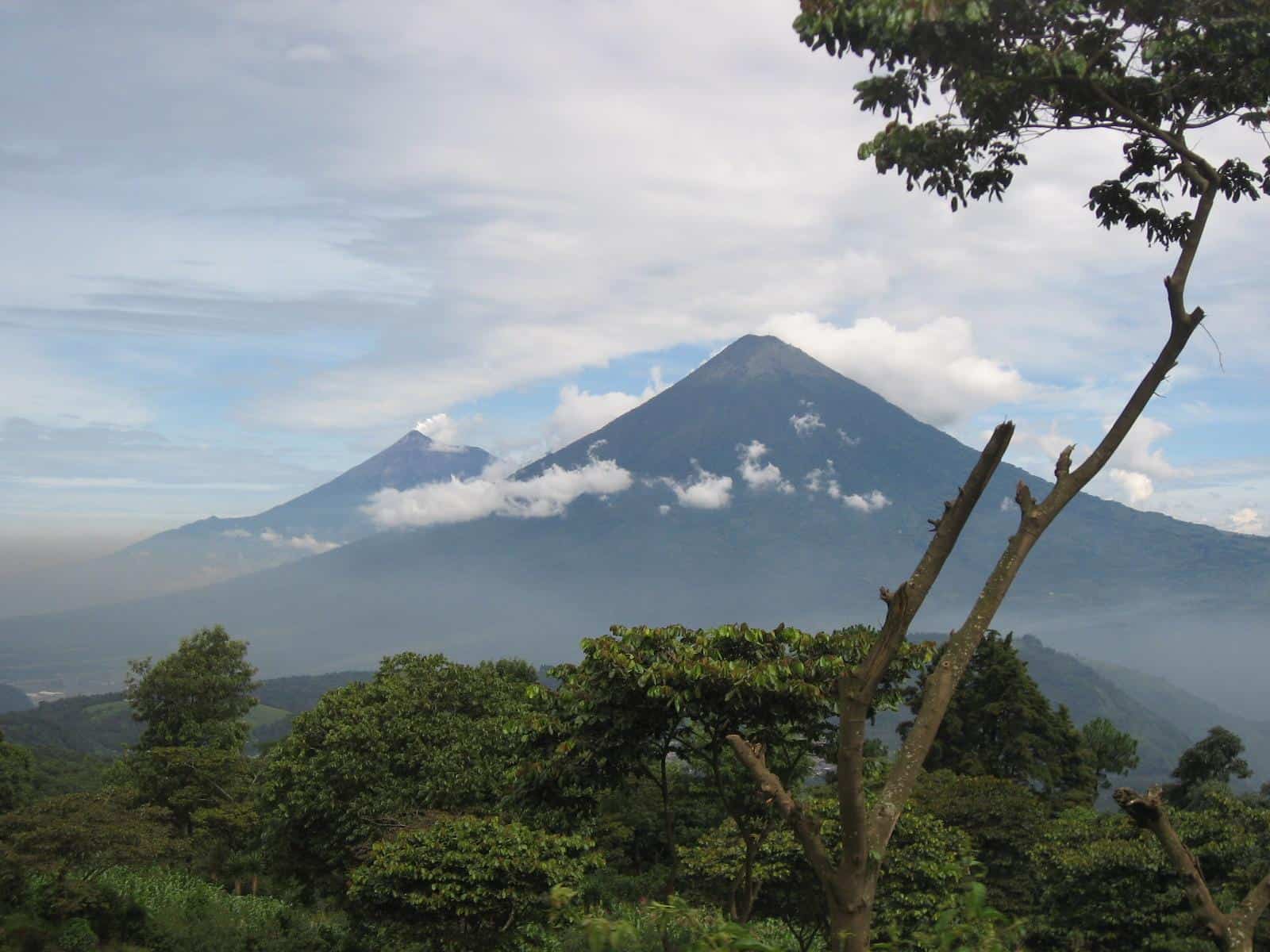
Volcán de Fuego alongside Acatenango dormant volcano
photography by: Scottydude
With its summit reachable in less than three hours and its trailhead located an hour’s drive away from Guatemala City, Pacaya is the most accessible volcano in Guatemala.
The volcano is part of Pacaya National Park, and the entire trail is within the park’s premises. The trail starts at the small village of San Francisco de Sales, and then winds through a forested area with many scenic lookouts along the way. There is a total of 457 meters (1,500 feet) of elevation gain over the 1.5-mile trail which makes for a challenging, yet reasonable hike.
Once you leave the rainforest, you’ll start picking up the volcano’s erupting noises. At first, the rumbling in the background might sound more like a thunder, however, the closer you get, the more you realize it’s volcanic eruptions you’re hearing. Pacaya has been mildly active for decades, while its last massive eruption was in 2010, spreading ash as far away as Guatemala City.
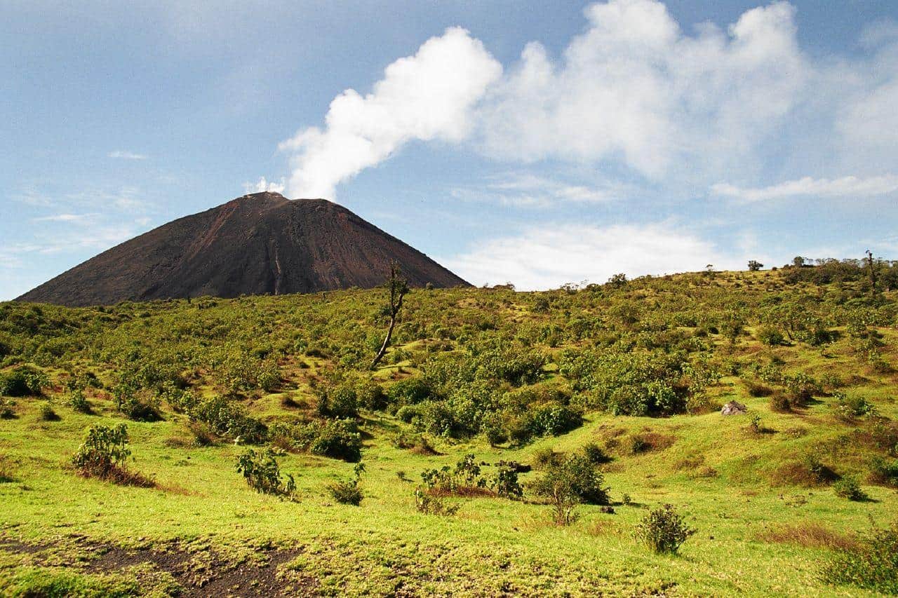
Pacaya Volcano spewing gases into the air
photography by: Bruno Girin
The unending volcanic activity creates a constant flow of lava downwards, along the volcano’s slope, not be confused with an actual eruption. Many guided tours depart around afternoon, reaching the summit during dusk, as it’s the best time to watch the glowing rivers of lava making their way down the slope, ultimately becoming part of the mountain itself once they have cooled. If you choose to hike the mountain at daytime, you’ll will still be able to witness the red lava flow, yet not as remotely clear as during the night.
The trail ends at a safe distance from the volcano’s crater, where you’ll see the cone and the lava flows out of it. Unfortunately, you won’t be able to go all the way up and look down directly into the crater, nonetheless, the stunning and expansive views at the trail’s ending point are definitely worthy. In fact, if you get lucky enough, your guide will hand you a marshmallow skewer to roast it over the scorching hardened lava stones.
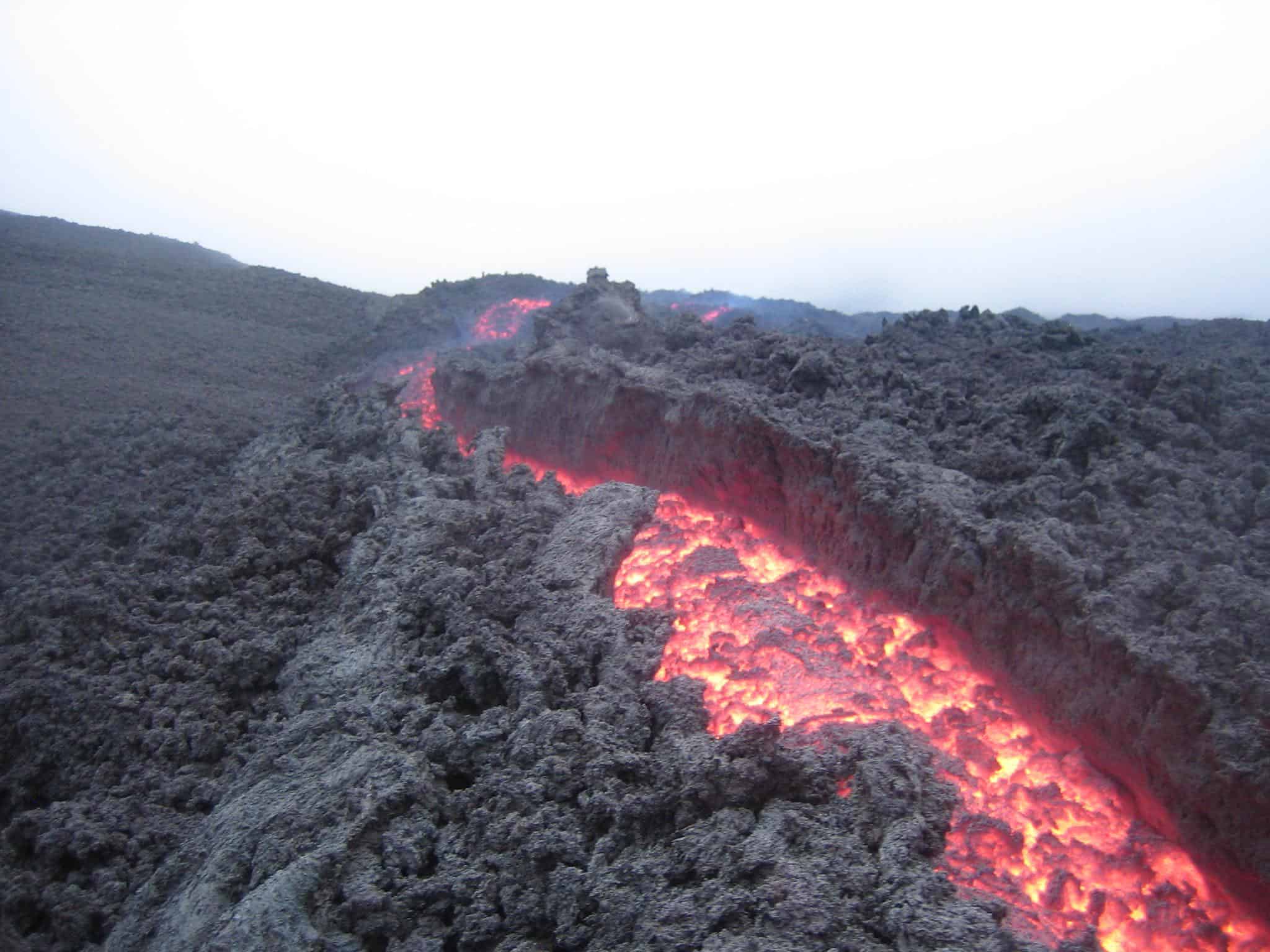
The lava flows in Pacaya
photography by: Ray Metzen
You might return the same way you ascended, however, there are also other routes downwards, including a slightly longer trip through the lava field. Interestingly, the volcano’s northwestern side is home to a large basin where the numerous lava rivers flow into. The spectacular sight is literally out of this world, as the hiking trail is frequently dubbed by travelers as walking on the surface of the moon.
Take note that this aforementioned route concludes in a different place, at La Corona parking area, about a kilometer away from the San Fernando main entrance.
Suffice to say that any trip to Pacaya requires reasonable weather conditions, otherwise you risk going all the way up without actually being able to see the magnificent volcanic crater and spewed lava.
A frontal view of Mt. Pacaya
photography by: Laurent de Walick
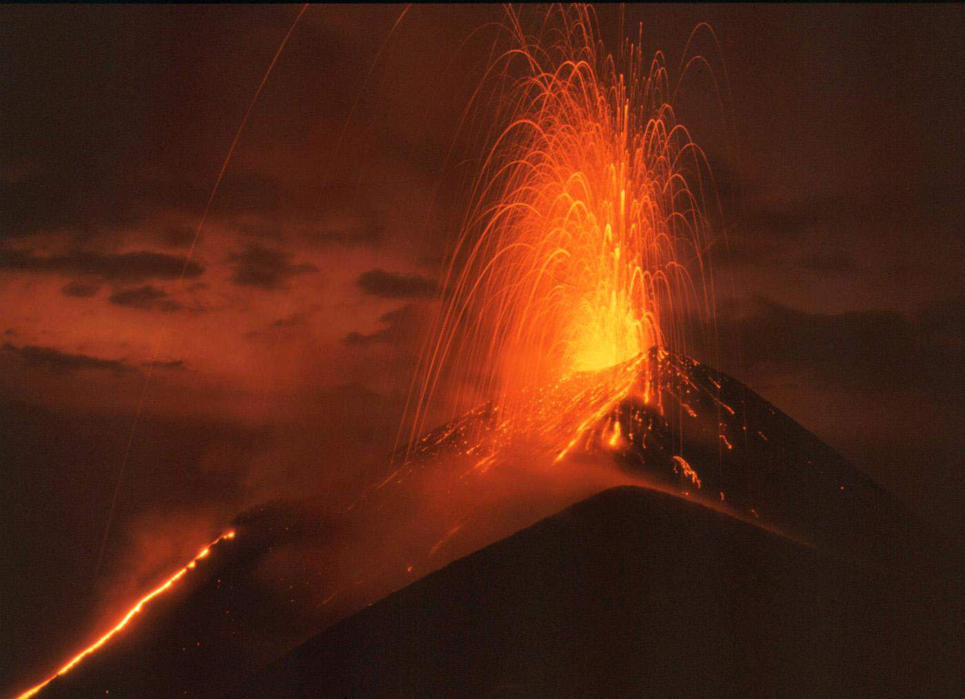
Volcán de Fuego is the most active volcano in Guatemala. The volcano’s constant activity tends to be rather vertical, spewing gases and ash every 15-20 minutes, while spurts of glowing lava occur regularly. Fuego’s violent activity makes it virtually impossible to climb, therefore, travelers hike the neighboring dormant Volcán Acatenango.
Climbing Mount Acatenango will reward any hiker with stunning views of Volcán de Fuego, that deemed by some as the most beautiful sight in all of Guatemala.
In 2018, Fuego has violently erupted, releasing a massive pyroclastic flow of solid lava, volcanic ash and gases, killing hundreds of people and annihilating entire communities all around. Following the aftermath of the eruption, thousands of people had to resettled across the country after losing their home, while some of whom still live in shelters to these days.
The trail starts in the village of Soledad, about an hour away from Antigua, making it easily accessible for most tourists. The hike to Acatenango is considered difficult, with a round trip of almost 18 kilometers and a total elevation gain of over 5,000 feet (1,524 meters), while the highest point stands at around 13,000 feet (around 4,000 meters). The hiking trail has few exceedingly steep places where you’ll have to use your hands and even hiking poles.
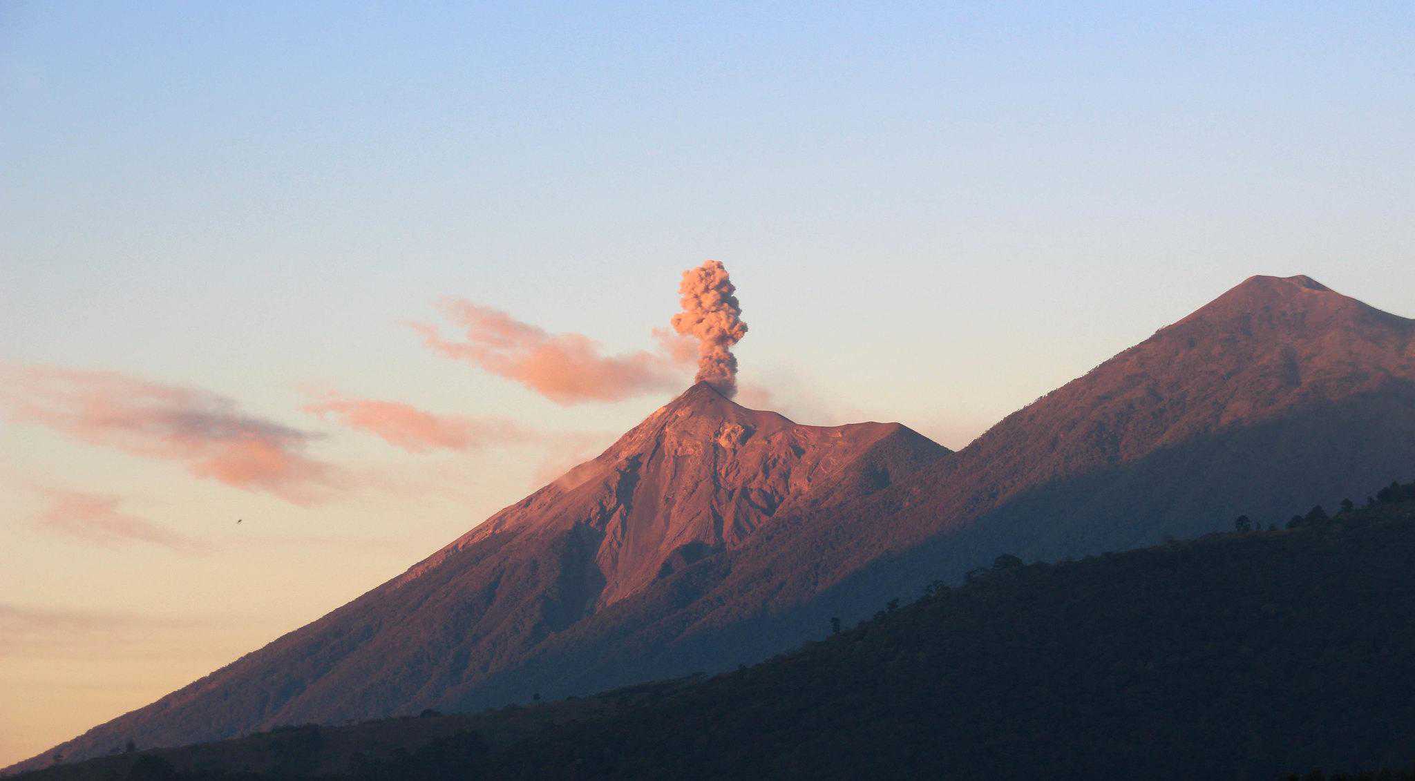
Volcán de Fuego erupting next to Acatenango dormant volcano
photography by: Darren Ridgway
While it’s more than feasible to hike Acatenango in one day, it’s far better to do so in a two-day trip with an overnight stay. The uphill hike can take anywhere from 4 to 8 hours depending on your group, fitness level and how much of a rush you are in. If you choose to take your time on your way to the summit, you’ll arrive around evening time and get to see Fuego’s lava eruptions at night. The sheer contrast between the glowing lava and the night sky is awe-inspiring.
The camping itself will be arranged by your guide and take place inside or around the dormant volcano’s crater, providing a rare opportunity to gaze at the many stars in the night-sky while listening to Fuego’s rumbles in the background.
Staying overnight also has the added value of watching the breathtaking sunrise over the volcano, particularly appealing for photographers who wish to capture the natural scenery under the best possible light conditions.
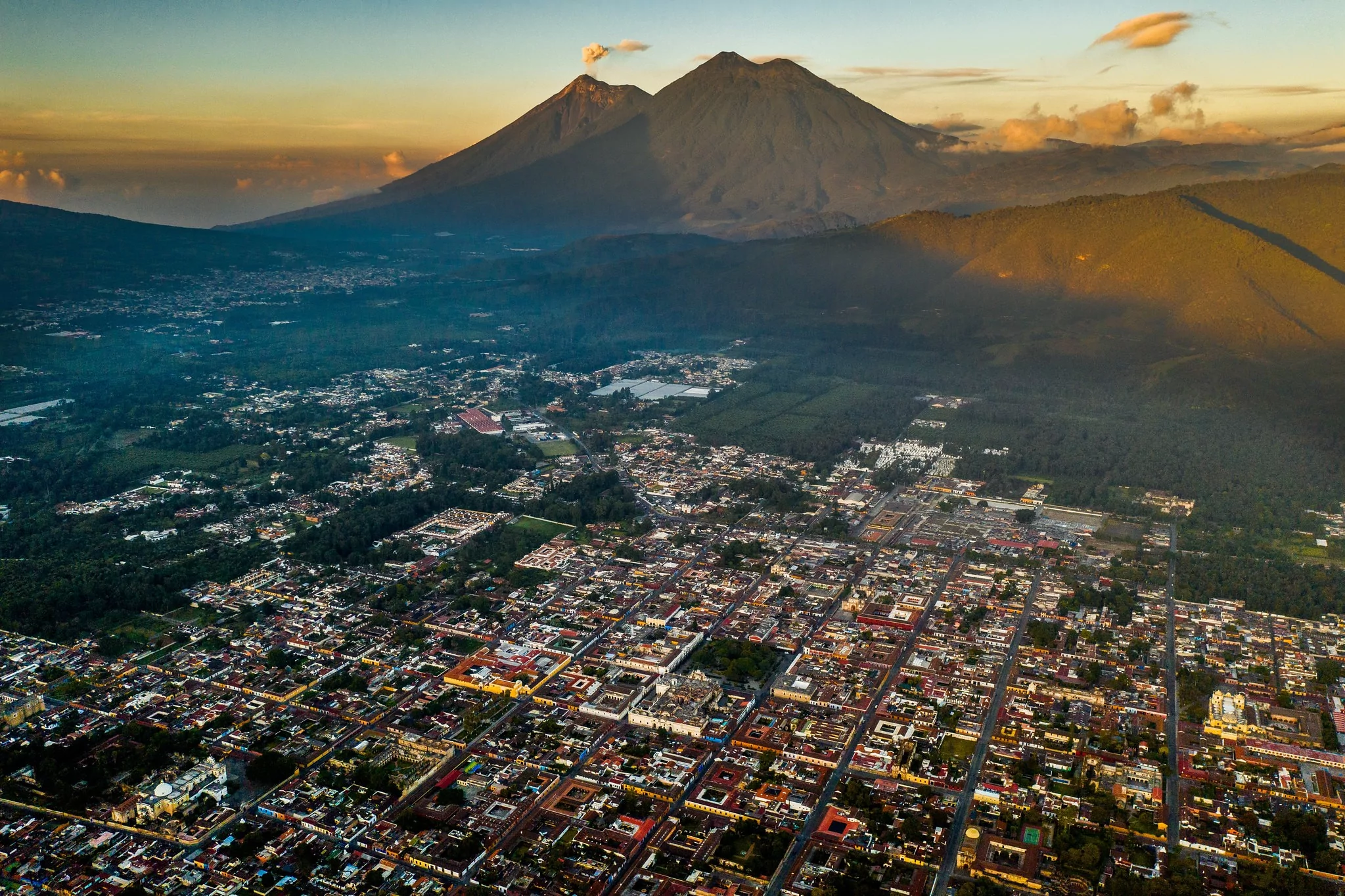
The city of Antigua on the backdrop of Fuego and Acatenango
photography by: Jose Hernandez
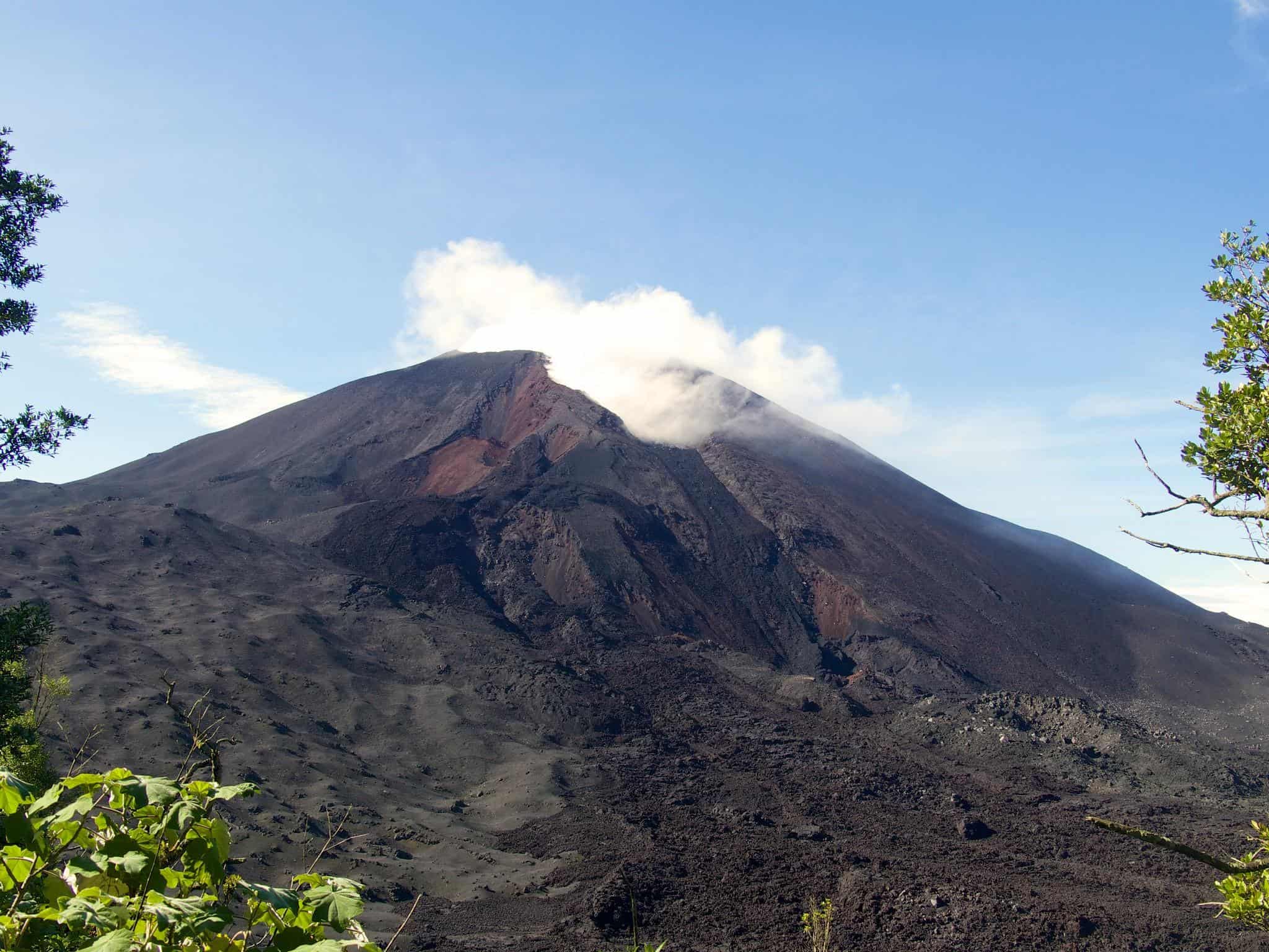
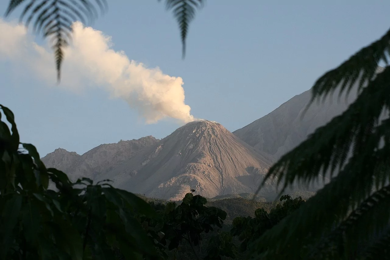
Guatemala’s third active volcano is called Santiaguito, and unlike the two other volcanoes, it is far less popular among tourists due to its remote location in the country’s western highlands. Similar to Fuego, Santiaguito is unclimbable because of the constant risk posed by the flowing lava.
Due to its volatility, the only way to experience Volcán Santiaguito is from the nearby Santa Maria dormant volcano. The uphill hike in Santa Maria culminates at Santiaguito Mirador (Santiaguito’s lookout), where you’ll have a direct vista of Santiaguito’s volcanic activity, as a matter of fact, since Mt. Santa Maria is taller, it provides a mind-boggling downward perspective of Santiaguito’s lava-rich crater.
Luckily, the hike to Santiaguito Mirador is the easiest of the three, as the total walking distance is merely 5 kilometers while the uphill ascend is more effortless for a hiking novice when compared to Pacaya or Acetenango. The trailhead is located in Llanos del Pinal Village, just outside the city of Xela.
The ideal hours for hiking to the Mirador is during early morning, so you can reach the summit by noon as visibility peaks during that time. Additionally, Santiaguito’s volcanic eruptions often consists more of ash than lava, making them far more impressive during daytime.
A frontal view of Santiaguito Volcano
photography by: DavidMPyle