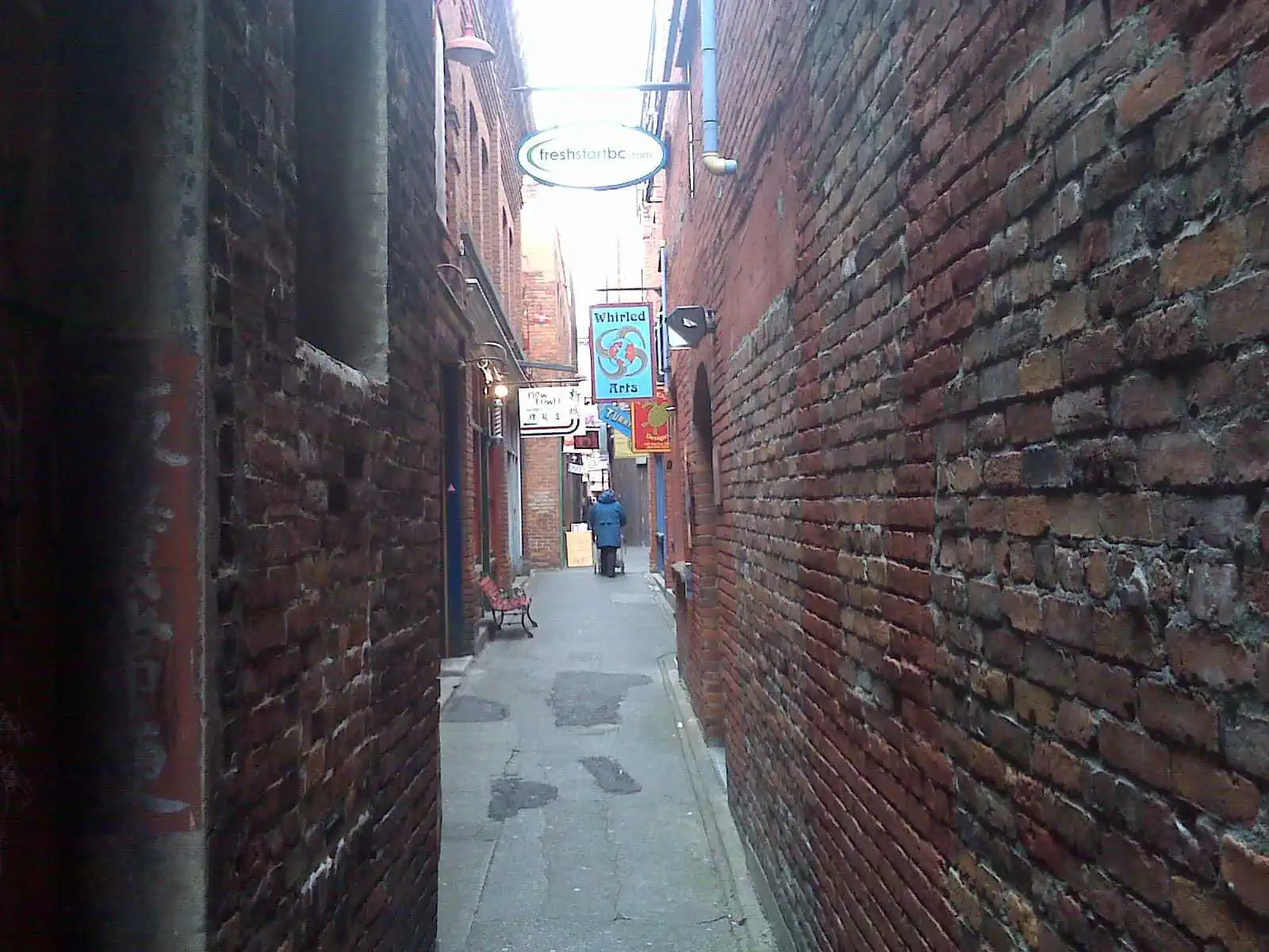
The third most populous metropolitan area in Canada and by far the largest city in the country’s western half, Vancouver is consistently ranked as one of the most livable cities in the world, as it's bestowed with breathtaking nature, safe neighborhoods and laid-back vibes. With more than 50% of its residents being non-native speakers of English, this ethnically diverse city became a tourist hotspot in recent years, as well as a gateway to the nearby nature. Despite its increasing popularity, there are still plenty of secluded nooks and off-the-beaten-path locations which haven’t been spoiled by mass tourism.

By: Claudia Engelbracht
Date: 21:04 15.08.21
Last Update: 17:08 23.06.22
During the 1950’s and onwards, Vancouver adopted a strict urban policy that dictated a construction of densely populated and mixed-use neighborhoods instead of the common endless urban sprawl. Those planning guidelines resulted in a dense urban core with hundreds of residential towers, while at the same time scores of natural sites were spared from irreversible damage by development.
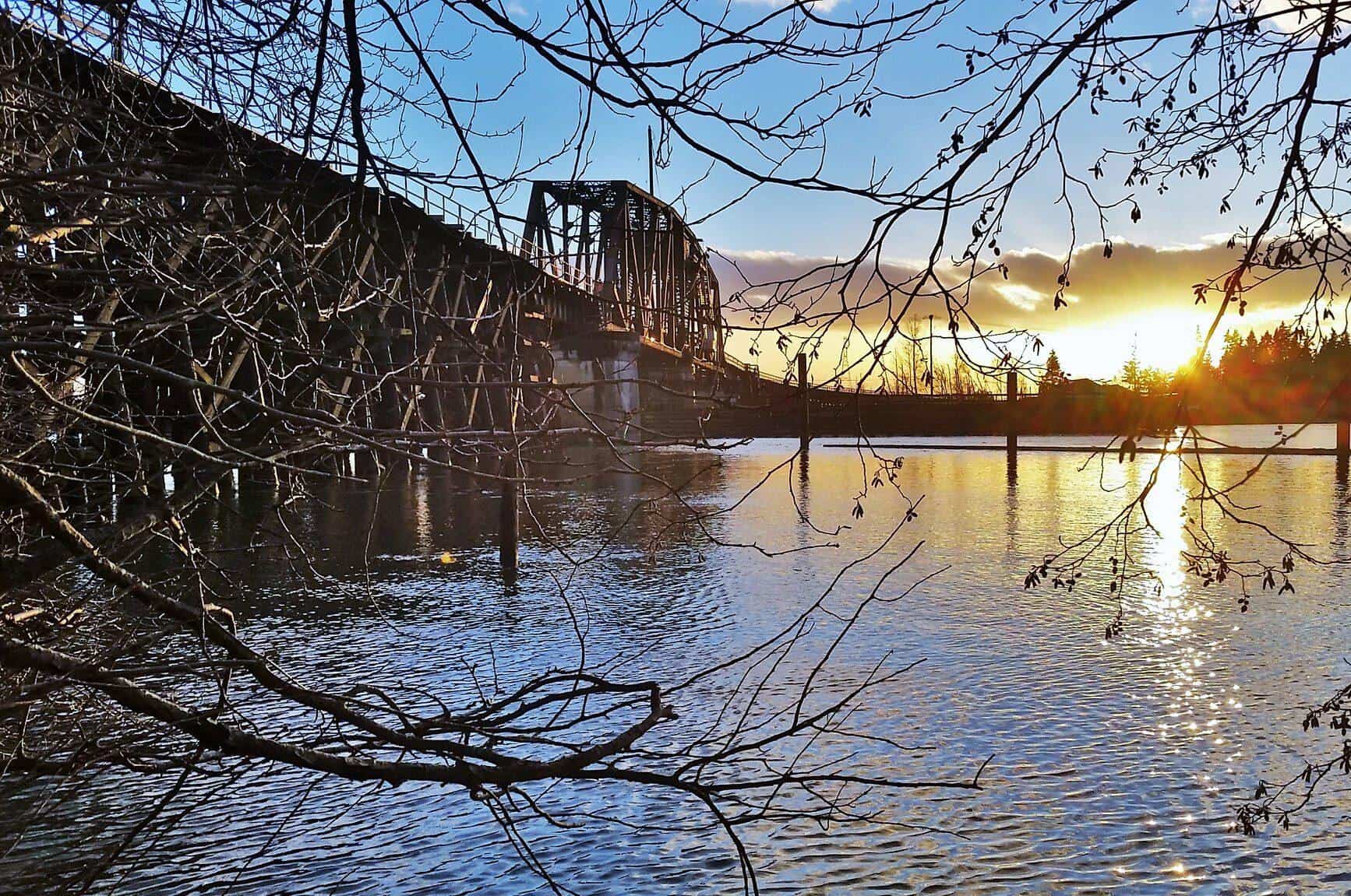
Perhaps one of the districts that benefited the most from the anti-suburban agenda was north Vancouver, known for its expansive forests and parks. At its outskirts, Lynn Canyon Park is a piece of pristine nature, brimming with native wildlife. This forested park is traversed by the epic 48-kilometer-long Baden-Powell Trail, where it culminates at the spectacular Lynn Canyon Suspension Bridge.
Built in 1912, at the same year the park was inaugurated, this narrow bridge is hanged 50 meters above a creek. The bridge was assembled by a privately owned company, and thus originally, visitors were charged with a 10-cent fee that later shrunk into 5 cents. The structure eventually fell into a state of disrepair and was closed. A couple of decades later the local council restored the bridge and made it a free-admission attraction.
What make the bridge particularly worthy besides its relative anonymity are the narrow proportions that in turn create a false sense of thrill-seeking shakiness, as any person who steps on it triggers a mini bridge-quake.
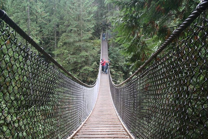
The shaky and narrow suspension bridge in Lynn Canyon Park
photography by: Chris Morisawa/ Flickr
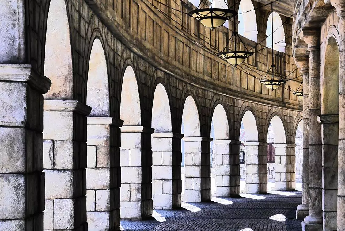
Nestled along the W 2nd Ave, adjacent to Granville Island’s Entrance, the Waterfall Building will probably won’t draw that much attention when you pass by it. Nevertheless, this 2001-built complex is an intriguing place to explore even if you aren’t an architecture enthusiast. The building was designed by the locally renowned architect, Arthur Erickson, who created a contemporary version of Brutalism.
Built almost entirely of exposed concrete and glass, this multi-use complex takes its name from the water screen that plunges into a reflection pool, which greets all of its visitors who come in through the main entrance. All of the Waterfall Building’s sections are centered around an inner courtyard that is paved with concrete tiles, coarsely divided by tall layer of turf.
However, the centerpiece of this urban block is undoubtedly the prism-shaped segment that dominates the patio. Partly surrounded by a concrete canal, it serves both as a venue for local artists and a home to an upscale tea lounge that offers a plethora of insanely scrumptious bites alongside premium tea.
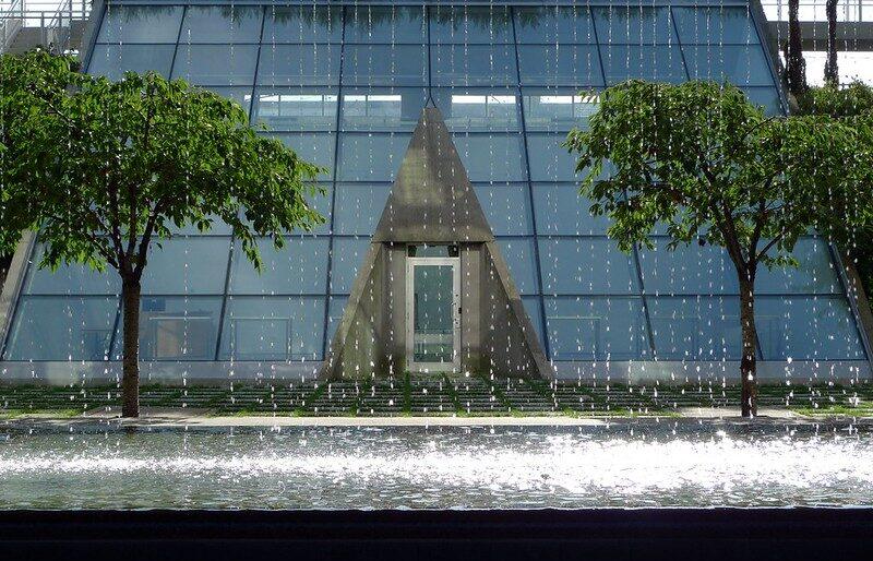
The building’s prism-shaped section as its seen through the water screen
photography by: Ruth Hartnup/ Flickr
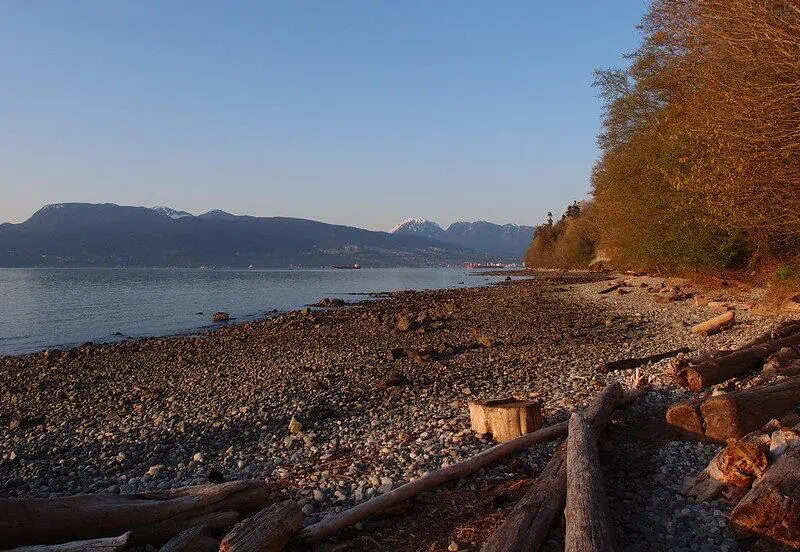
Surrounded by water on three sides, Vancouver is home to countless stunning beaches that become a magnet for sunbathers during summertime. The coastline of UBC (the University of British Columbia) on the western tip of Vancouver, is where all of the city’s more secluded beaches are located, one of which, Wreck Beach is renowned and infamous at the same time.
Linked to NW Marine Dr Road via an excruciatingly long staircase that meanders through a thick forest, the beach is a clothing optional nook, popular among local naturalists due to its relative isolation. Nevertheless, also clothed visitors are welcome as long they don’t stare or take unsolicited photos of people, or alternatively come during the winter, when the place is practically empty and the small number of visitors is well-covered.
Sandwiched between a coastal forest and the Pacific, the beach provides some spectacular vistas of the ocean. Following strong currents in 2007, a nearby log boom came apart, releasing hundreds of processed logs across the city’s western shoreline. Large portion of the driftwood washed away to the beach, where dozens of trunks are strewn to these days, somewhat defining its character.
While the beach is occasionally frequented by vendors (clothless of course), it’s recommended to bring your own food and drinks, and if you wish to swim, take note that water tends to be cold all year round. The beach is also a gateway to several natural wonders around, including a small triangular beach at the tip of a breakwater and the Foreshore trail that provides visitors with a hike along the city’s western coastline.
The Wreck Beach with its strewn driftwood
photography by: Guilhem Vellut/ Flickr
With more than 20 million passengers annually, Vancouver International Airport is the second busiest airport in Canada falling only behind Toronto. It not only serves as a gateway to small regional destinations but also connects the country with much of Asia, as a significant percentage of Vancouver’s population is of Asian descent.
Situated on Vancouver’s Sea Island, the airport has several designated areas from which dedicated airplane spotters can watch landings and take-offs. One of which, the YVR South Terminal Viewing Platform, is an elevated wooden deck with nearby free parking that overlooks the main runway.
While this outdoor platform might be susceptible to weather conditions during wintertime, the indoor airport observation deck in the main terminal can provide a great alternative if it’s too cold or stormy outside. The observatory is located in the airport’s public zone, and thus open for passengers and passersby alike, who can both use the in-house binoculars to have a closer glimpse of the aircrafts.
Alternatively, you can head to the close-by Iona Island. This small speck of land houses an animal refuge and a sewage treatment plant, which one of its pipes functions as a recreational esplanade, running along the 4-kilometer Iona Jetty. Tucked away at the end of the jetty is Iona Terminus, a scenic spot with expansive vista over the ocean, the coastal mountain ridge and airplanes making their way in or out of the airport. Take note that the jetty is inaccessible for cars, and as so, the entire journey takes roughly two hours by foot.
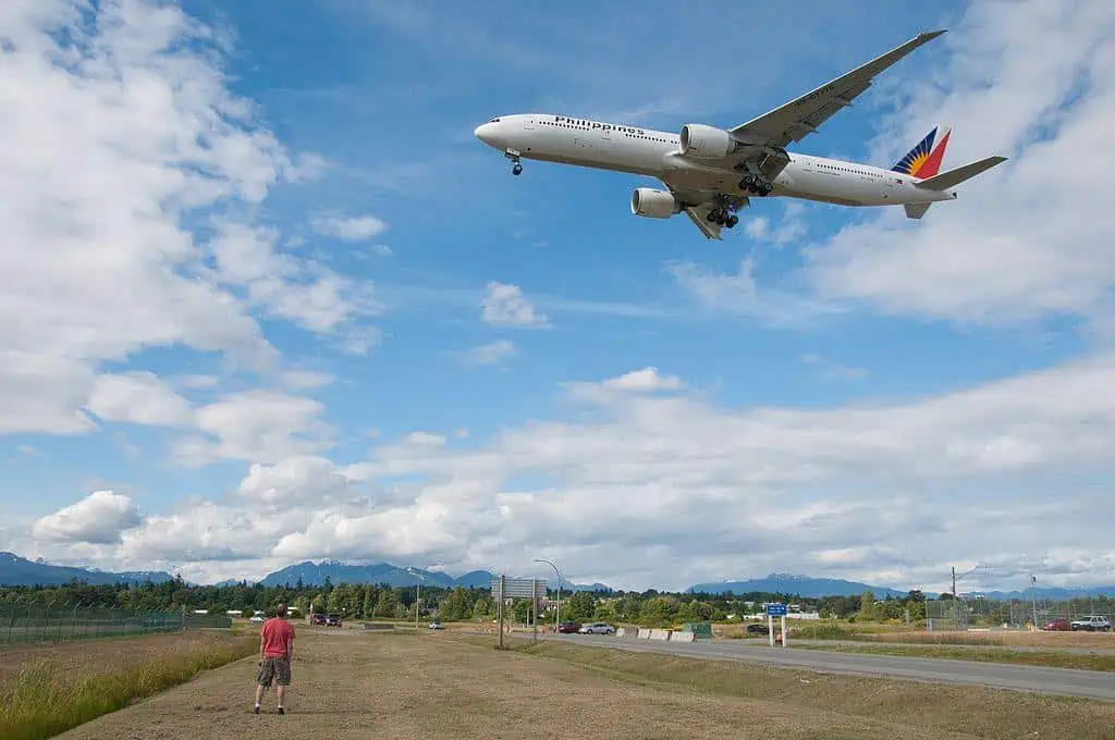
An Air Philippines Boeing upon landing in Vancouver Airport
photography by: Matthew Grapengieser/ Wikimedia Commons
The metropolitan area of Vancouver is sub-divided into multiple municipalities. One of which, Coquitlam, about a one-hour bus ride from downtown Vancouver, is home to the Riverview Hospital, one of British Columbia’s most important places during the 20th century, now lies forgotten and mostly abandoned.
After two local hospitals for the mentally ill were forced to cease all operations following overcrowding and poor conditions, the government of British Columbia purchased a vast plot of land west of Vancouver, where a brand-new hospital was established in 1904. Over the years, the hospital which treated patients with mental illness from all over the region, developed into a gigantic complex with more than 80 buildings. As part of the hospital’s therapeutic approach, an extensive arboretum as well as Canada’s first botanical gardens were created to provide a pleasant environment for its troubled tenants.
As a result of the advancement in medical treatment and antipsychotic drugs alongside a paradigm shift which sought to integrate the mentally-ill back into society, Riverview Hospital’s departments were closed one after another. The medical complex, which during its peak housed more than 4,500 patients, eventually closed its doors in 2012.
While there are plans to repurpose the hospital as an addiction and rehabilitation center, it lies mostly abandoned as of 2021. Dominated by massive brick edifices and verdant park, the hospital became a hotspot for local joggers, and more interestingly, urbex enthusiasts who regularly raid its lavish medical palaces at nights. Interestingly, even the film industry recognized the place’s eerie and mysterious nature when some of the hospital’s abandoned buildings were used as filming locations for numerous TV shows and movies, most notably Marvel’s Deadpool 2.
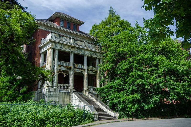
The abandoned and dilapidated West Lawn Building in Riverview Hospital
photography by: Jeff Hitchcock/ Flickr
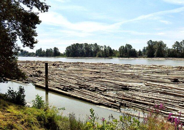
The longest river in British Columbia, the Fraser River is Vancouver’s southern border and a major artery for commercial ships. Dozens of factories and logistic centers along its banks makes it a rather industrial place where recreational activity is considerably limited. Nonetheless, standing out amid the large mundane hangars is Fraser Foreshore Park Trail, a green strip of land with scores of natural hideaways to explore.
You can either start your trip in the Riverfront Park or at the end of Kerr Street, where a long wooden pier protrudes into the river, providing an intriguing perspective of the numerous tugboats and fishing vessels making their way between the scattered log booms.
As you continue eastwards along the trail, you’ll come across Adcy Beach, which despite its name serves more as a scenic spot than a sunbathers’ paradise, blessed with spectacular river-vistas.
Shortly afterwards, the riverfront esplanade turns into a narrow pathway that intermittently traverses both a dystopian industrial landscape and thick woodland.
Eventually, after approximately 5-kilometer walk, you’ll come across the historic CNR Bridge, a swing span railway bridge that links Vancouver’s suburbs of Burnaby and Richmond. Up until 2013, the bridge’s movable part was opened by the staff stationed in a nearby outpost upon 4 successive honks by coming vessels on their way from or to the Pacific. While this hilarious practice has since been replaced by an automated system, you’ll still might be lucky enough to witness the opening of the bridge while hiking along the trail.
One of the many log-booms along the trail
photography by: Dennis Sylvester Hurd/ Flickr
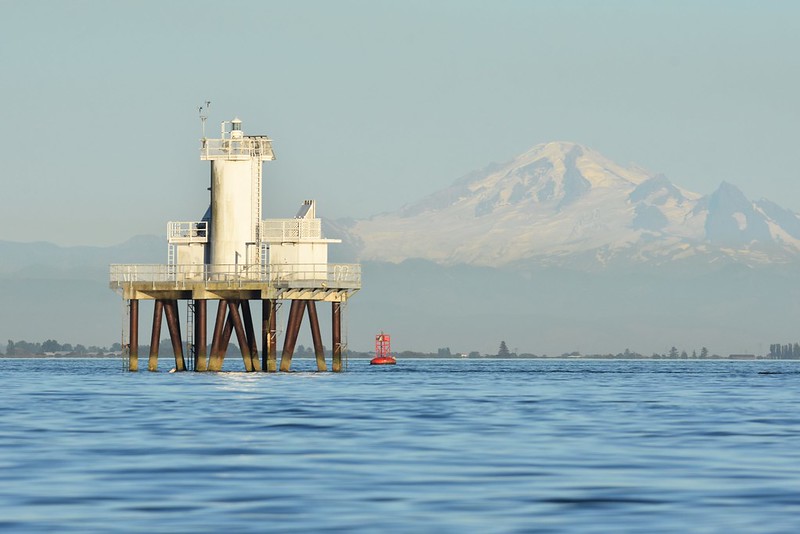
During the mid-19th century gold rush, Canada’s west coast was swarmed by a large influx of migrants, most of whom were Americans. A fear of a demographic imbalance that might trigger future territorial claims, as well as the need to provide assistance for the increasing maritime traffic led the British rulers and from 1871 onwards the Canadian government, to invest resources in demarcating the Fraser River mouth that served as a gateway to Vancouver and its surrounding heartland, merely 40 kilometers from the US border.
Originally, a vessel named South Sand Heads was sent to the estuary where it anchored at its southern part, marking the entrance to the river. Following a strong gale, the stationed ship suffered a great deal of damage that ultimately led to its replacement by a stilt lighthouse. In the early 20th century, as a result of erosion and changing sand patterns, the river mouth shifted more than a kilometer away, making the hexagonal wooden lighthouse obsolete, which was then burned down by the authorities and replaced by yet another vessel.
After more than three decades, the vessel was deemed too costly to maintain, which ironically resulted in the construction of a second lighthouse at 1956. The new lighthouse was far more massive, standing on an elevated platform that was supported by a slender steel structure, cemented with concrete to make it withstand the choppy waters.
Since the deep-sea structure is located a couple of kilometers off the coastline, it’s rather challenging to see. If you wish to spot the unusual structure, you can either purchase a tremendously good pair of binoculars and head to Garry Point Viewpoint, go onboard one of the cruising vessels around or alternatively, venture out into the ocean with your own rented yacht.
A vestige of the last Ice-Age, the picturesque fjord of Indian Arm has some of the region’s most dramatic vistas, and as such, attracts zillions of nature lovers who marvel at its pristine wilderness. Located on the northeastern part of Vancouver, in front of Dollarton area, Indian Arm is easily accessible, while its forested banks are traversed by an extensive network of trails.
Nestled in the middle of the inlet, the Boulder Island has served for centuries as a sacred burial site for the local Tsleil-Waututh First Nation. The deceased were often covered with a cedar bark and then hanged on trees for their final rest. However, the arrival of the European settlers ultimately forced the indigenous people to relocate all of the bodies into a formal cemetery on the mainland.
One of the bodies, or what left of it, belonged to a revered 18th century chief named Waut-Sauk. When the chief’s remains were transported by a kayak to his new resting place, a pair of orcas has been spotted accompanying him through the journey, a sheer rarity given their usual absence from the area.
Curiously, the island’s name derives from a large boulder that used to perch on its shore, which according to an unverified story, has been stollen by a tugboat under the cover of thick fog to be used as an anchor for log-booms.
Nowadays, the island is privately owned and therefore practically inaccessible, nevertheless, it is very much feasible to rent a canoe or paddle boat and circle the island, where you can spot the formidable bald eagles reside amid the canopies.