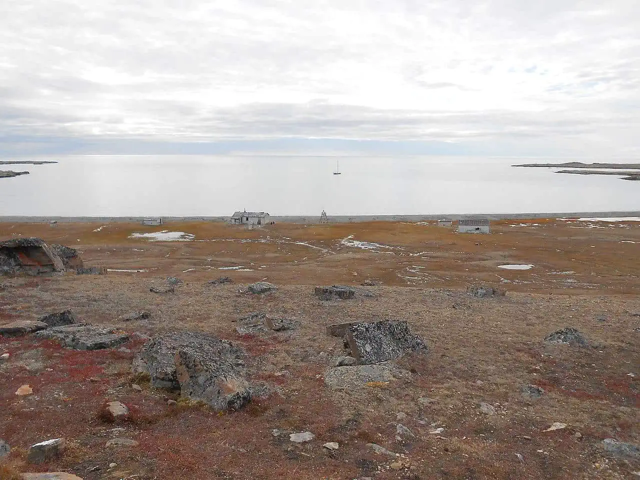
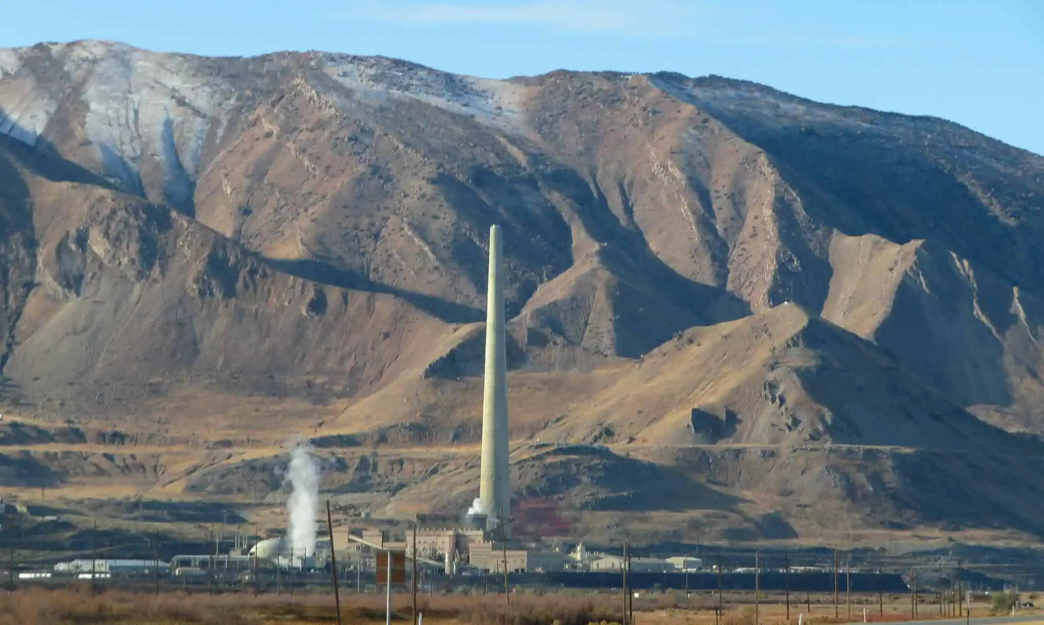
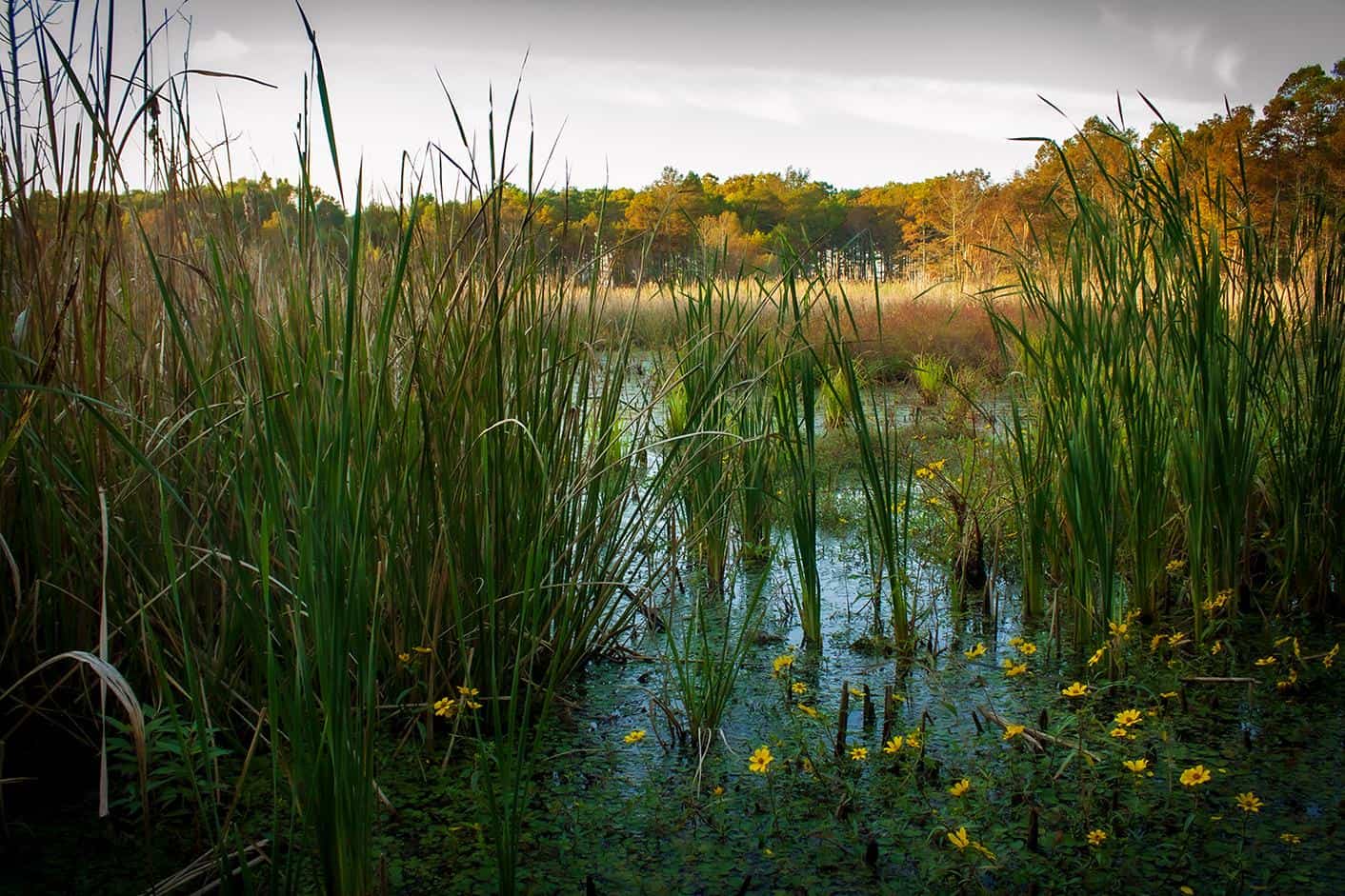
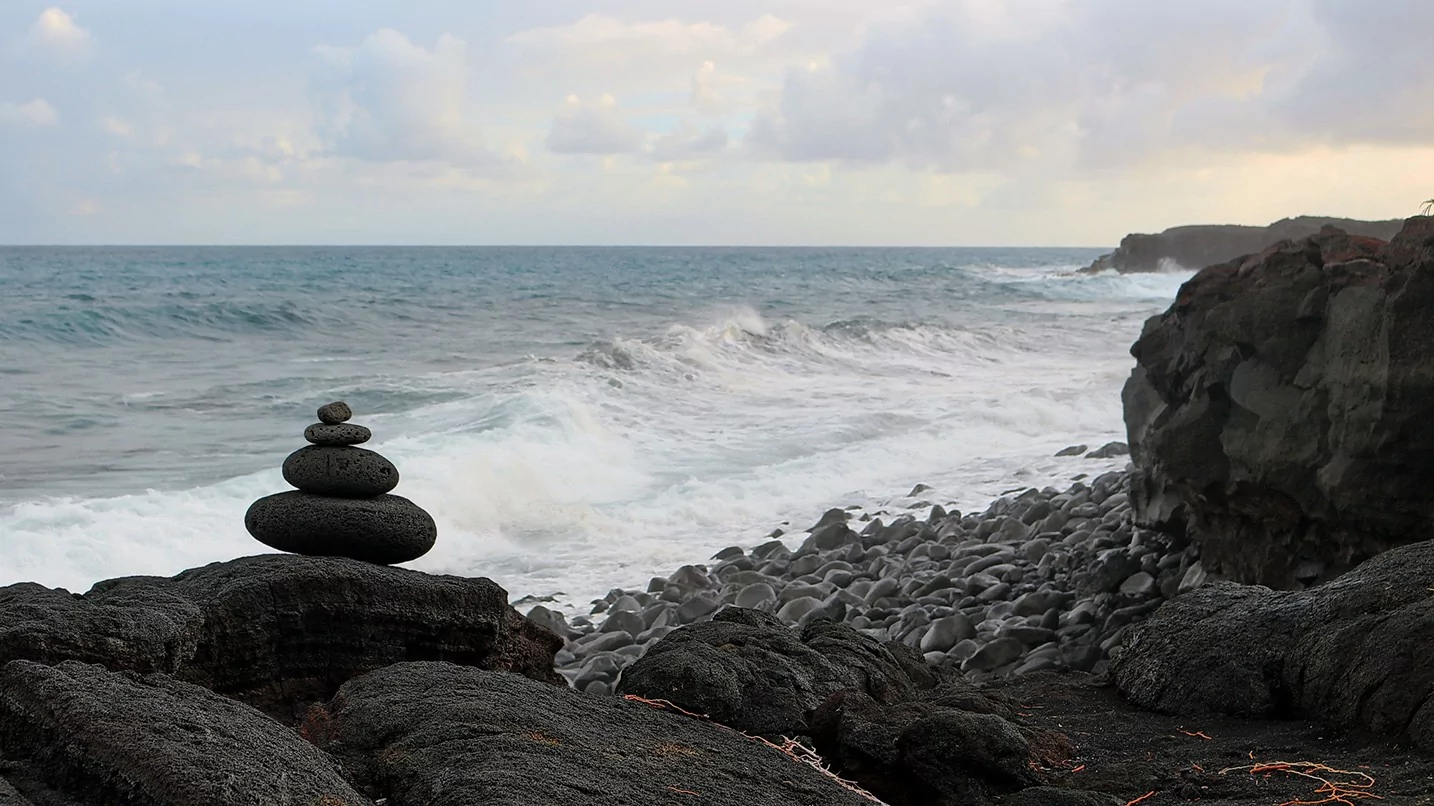
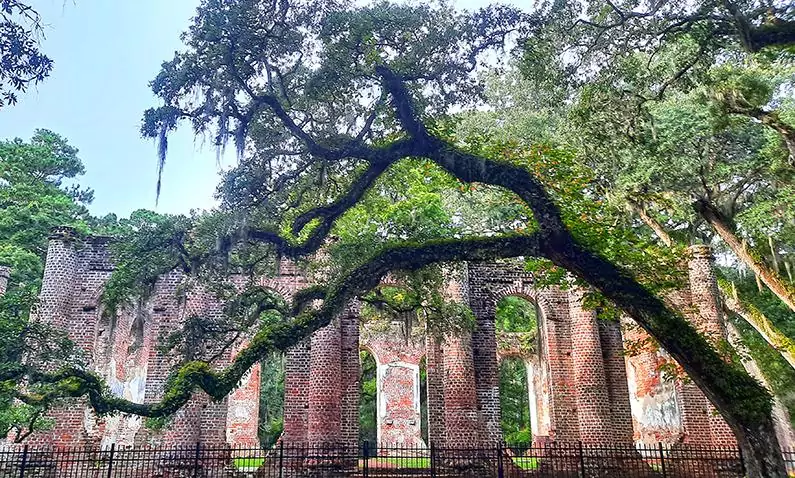
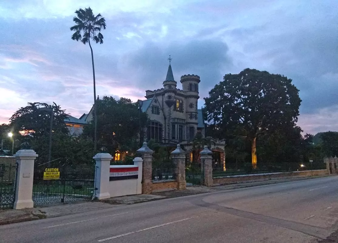
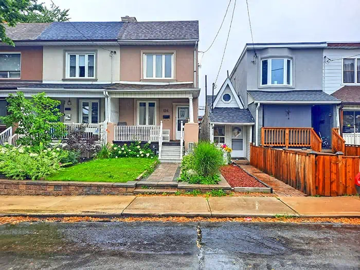
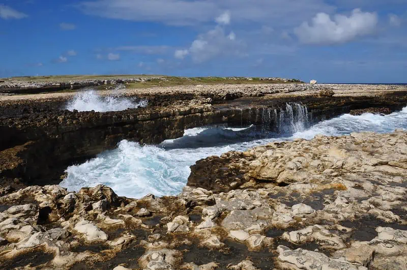
Dundas Harbour, Devon Island's former sole settlement that now lies abandoned
photography by: LawrieM/ Wikimedia Commons

Hidden in Canada’s faraway Arctic region, the island of Devon is probably one of the most inhospitable places on Earth, often defined as a polar desert. Roughly the size of New York State, Devon is the largest uninhabited island anywhere in the world, as well as the second largest island in the archipelago of Queen Elizabeth. With little or no fauna and flora, the island’s frozen wasteland bears an uncanny resemblance to Mars, making it a favorable environment for space research among scientists and as the last frontier for the most intrepid travelers.

By: Frank Skidmore
Date: 00:16 30.08.21
Last Update: 00:07 16.06.22
As the article’s title suggests, Devon doesn’t have any permanent residents as of today, yet, surprisingly it wasn’t always the case as the island’s barrenness was briefly disrupted by both ancient Inuit settlements and a modern Canadian hamlet, the latter of which existed up until quite recently.
Fearing harmful activities by foreign vessels that would ultimately undermine the national sovereignty, the Canadian government established an outpost on the island’s southeastern shore in the mid 1920’s, naming it Dundas Harbour. A decade later, a group of 52 people of Inuit descent settled in the hamlet which was now operated by the Hudson’s Bay Company.
Due to Devon’s exceedingly harsh climate, particularly during wintertime when the temperatures can plummet to a staggering -50°C, the remote village was abandoned just twenty years after its establishment. Interestingly, there was another attempt to repopulate the settlement in the late 1940’s, however, the short-lived community didn’t last for long and in 1951 Devon Island was completely depopulated.
Nowadays, there are six dilapidated buildings that constitute Dundas Harbour, including the former office of Hudson’s Bay Company and the police building. Nestled slightly north of the ghost village is one of the northmost graveyards in the world, the Dundas Harbour’s cemetery, home to merely 4 graves, one of which belongs to a man who was tragically killed while hunting walruses.
The empty hamlet is seldom visited, largely inaccessible thanks to its sheer isolation, triumphed only by the most dedicated adventurists.
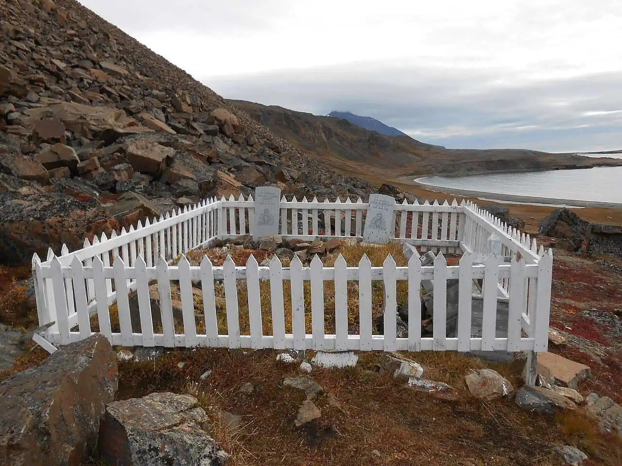
Dundas Harbour's micro cemetery, home to measly 4 graves
photography by: LawrieM/ Wikimedia Commons
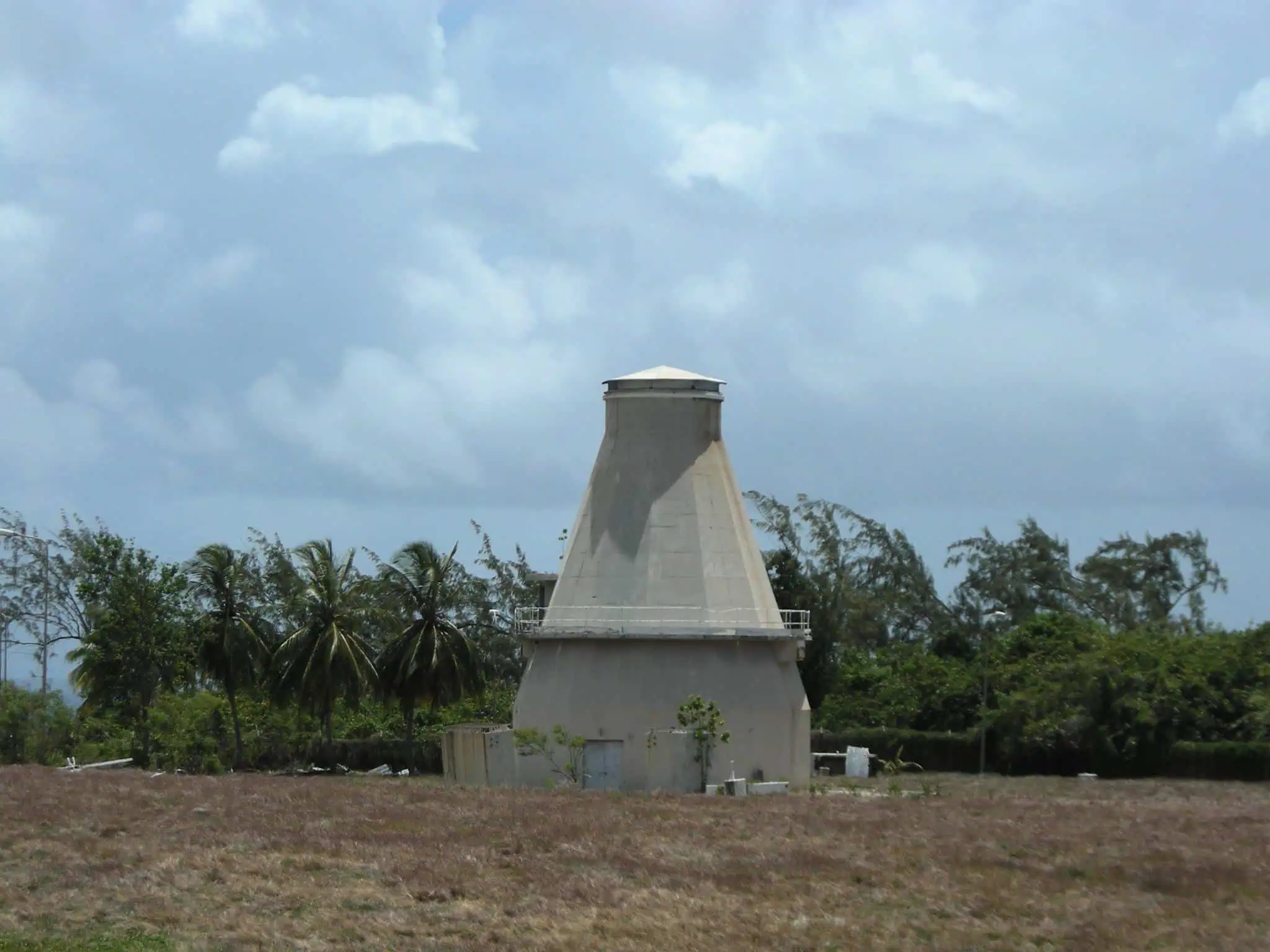
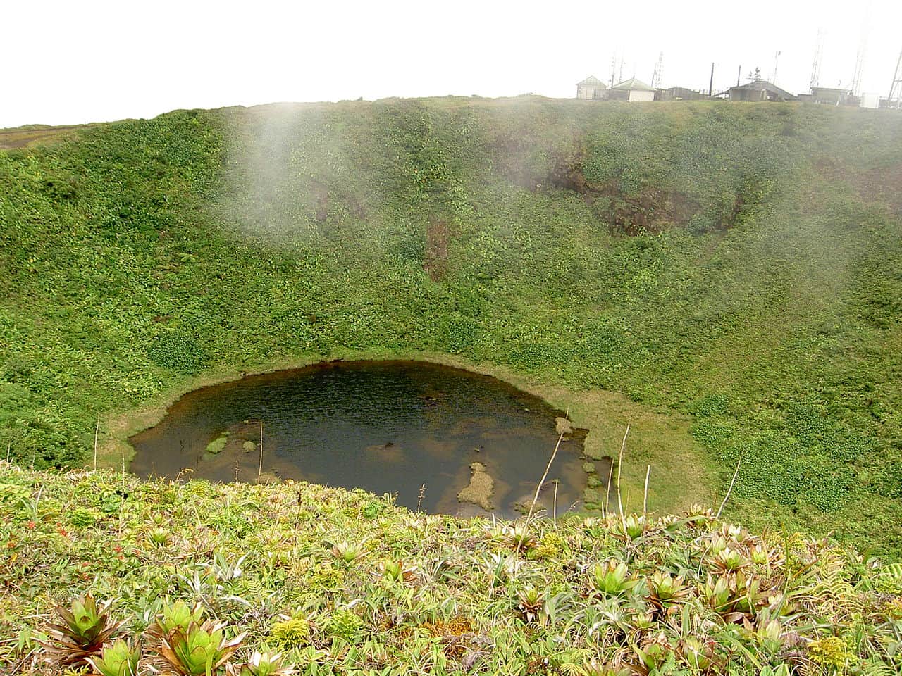
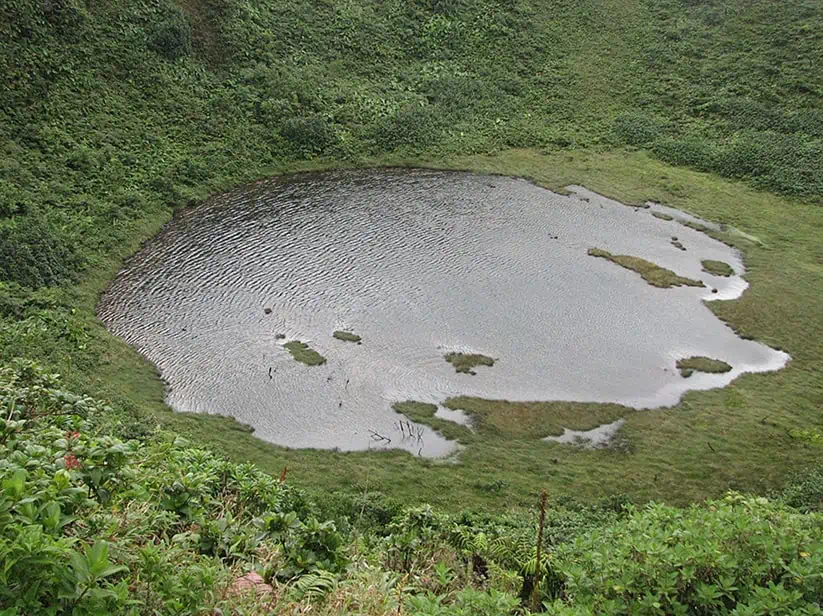
Formed roughly 40 million years ago, when an asteroid or a comet measuring 2 kilometer in diameter collided with Earth, Haughton Impact Crater is one of the world’s northmost craters which was created by a meteor. The massive amount of energy released during the impact was equivalent to 2,000,000 Tsar Bombas, the most powerful nuclear bomb ever detonated. As a result, all forms of life across hundreds of kilometers were completely decimated while a 23-kilometer wide and 1.7-kilometer-deep crater was left behind.
The freezing temperatures, lack of vegetation, windy and dry climate as well as the rugged terrain make the surface of crater one of Earth’s most mars-like environments. As such, during the last decades, several scientific missions were conducted at the crater with the aim of simulating the future challenges that astronauts will face upon a visit to the red planet, most notably the Haughton–Mars Project and the Flashline Mars Arctic Research Station.
While for the average person traveling to the Haughton Impact Crater is next to impossible, you’ll be glad to learn that a Google crew ventured out to Devon 2 years ago and documented the mars analog crater, uploading street-view photography into Google Maps service.
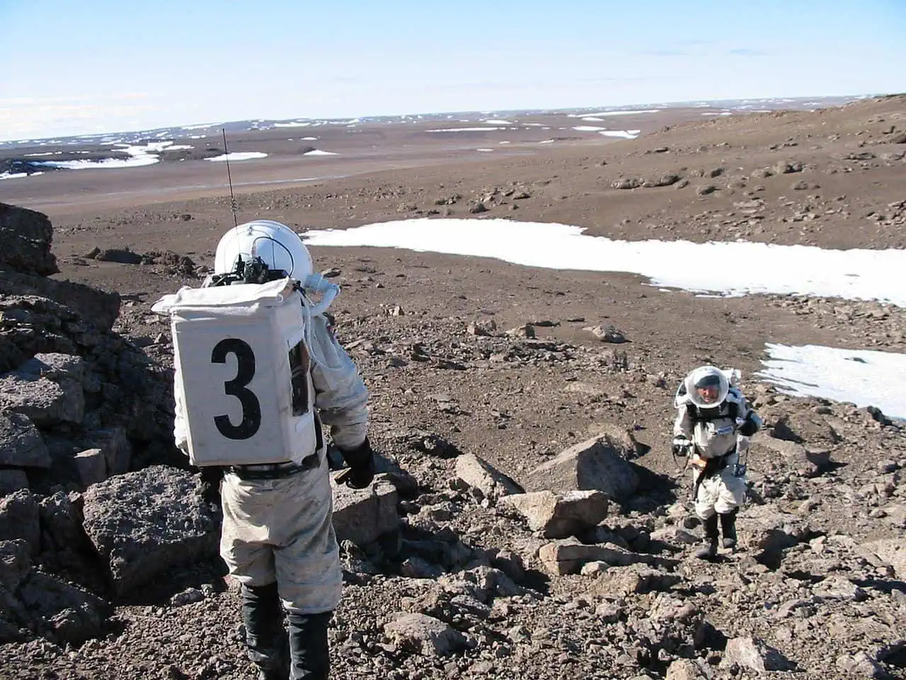
Astronaut-dressed scientists from the Flashline Mars Arctic Research Station performing research in Haughton Impact Crater
photography by: The Mars Society/ Wikimedia Commons
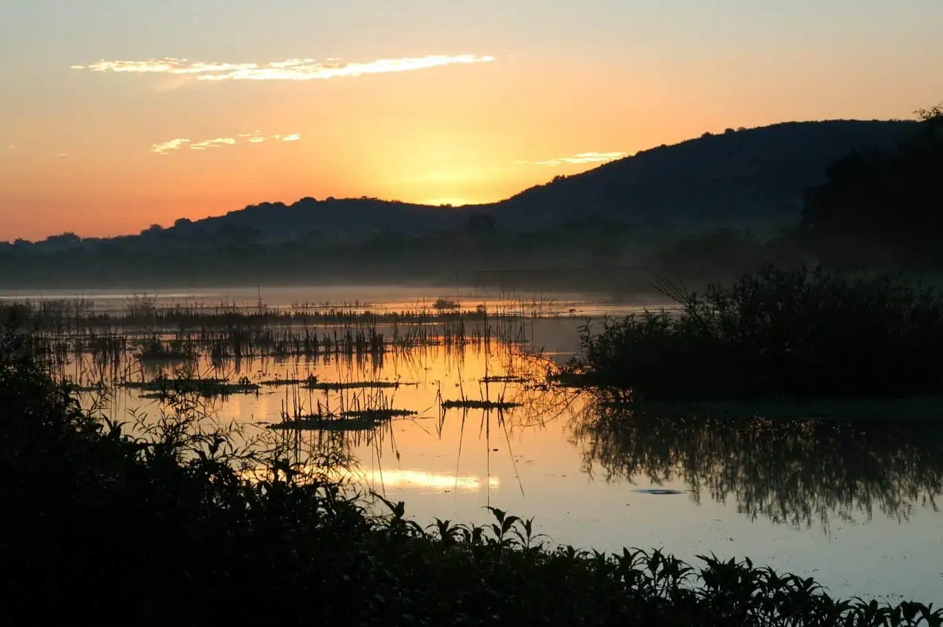
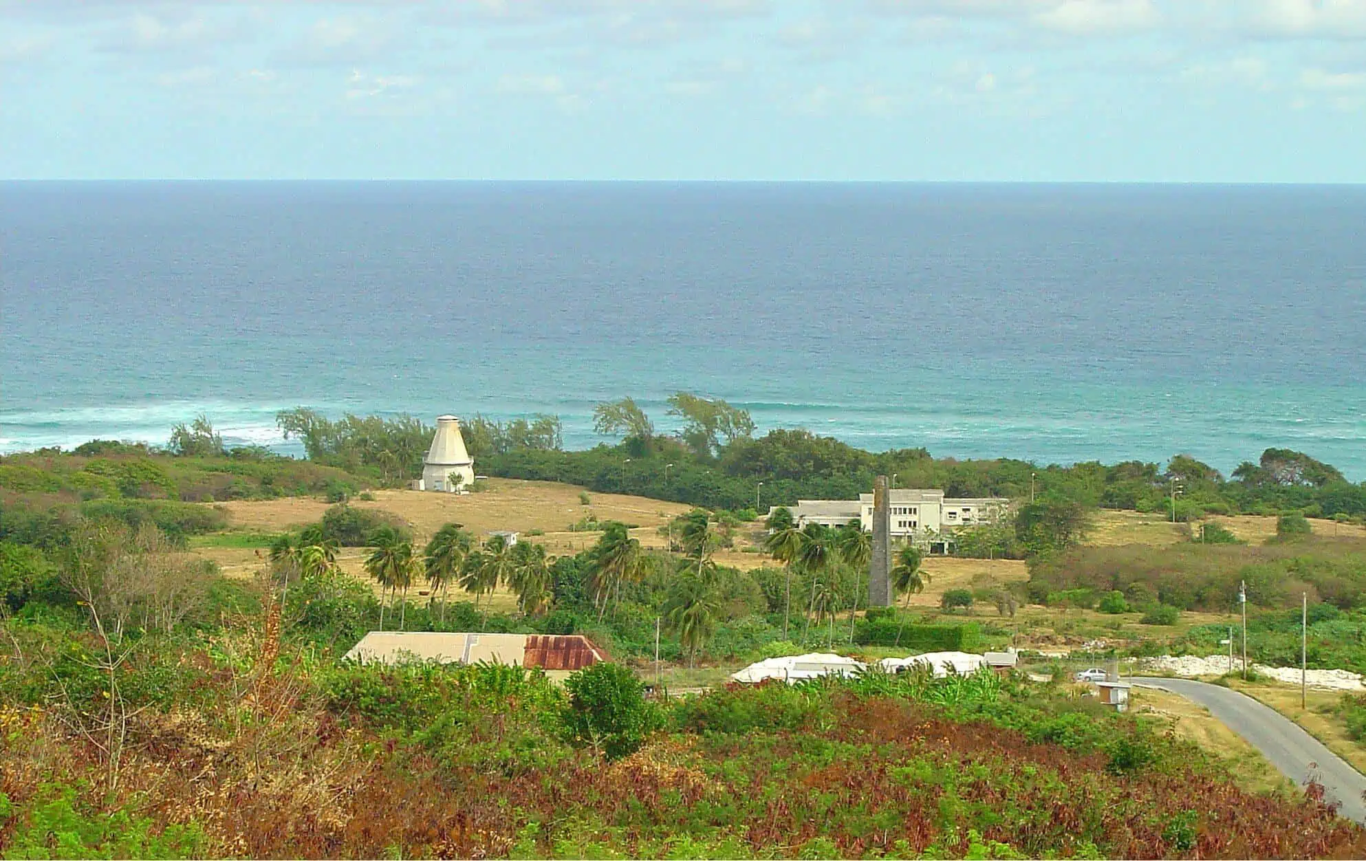
Dominated by extreme conditions almost all year round, it’s easy to see why most of Devon Island is not abundant with wildlife despite being spared from the usual hazards of human civilization. Nevertheless, one region of the island, Cape Vera, is unusually brimming with life, or more specifically seabirds. Situated on the island’s northwestern part, Cape Vera is a 245-meter-tall headland that protrudes into the Arctic Ocean.
Thanks to its seaside location and relatively mild climate (at least in Devonian terms), the cape serves as a habitat for a plethora of arctic seabirds, including northern fulmars, common eiders, arctic terns, glaucous gulls and thayers gulls, all of which nest on rocks along the coastal cliffs. If you ever manage to get here, you’ll not only be greeted by winged critters, but also by some spectacular and expansive views of the snowcapped promontory, the ocean and a series of small ponds wedged in between.

Despite its current 0 population, the island of Devon was intermittently inhabited by indigenous groups for the last 4 millennia, well before the arrival of Europeans to this remote speck of land. Perhaps the most significant silent testimony to Devon’s rich past is Port Refuge, a small bay on the northwestern tip of the island.
Strewn across an area of 900 hectares are the remnants of hamlets which were once inhabited by Pre-Dorset, Dorset and Thule people, all of whom are the ancestors of the modern-day Inuit culture. Curiously, some of the artifacts that were found at the site serve as proof for medieval commerce between the Thule People (who came after the Pre-Dorset and Dorset) and Viking colonies in Greenland.
Port Refuge’s distant past is remarkably impressive, however, what makes this faraway spot historically significant is its more recent role. Following the disappearance of a two-ship expedition that departed from England in 1845 to Canada’s Northwest Passage, five ships led by Sir Edward Belcher went on a rescue voyage in an attempt to find the missing vessels and crew members.
Unfortunately, Blecher’s lack of leadership turned out as detrimental, as disobedience and chaos amongst his crew resulted in the loss of 4 ships after being trapped by the thick ice. Blecher himself managed to seek refuge at the ancient site, hence its name. One of the abandoned ships, the HMS Resolute was later fully recovered and was transported back to England, where it was reprocessed by local carpenters who made three desks out of its timber. One of those desks, the Resolute desk, was given as a gift by Queen Victoria to the White House, where it functions today as the US president’s official desk in the Oval Office.
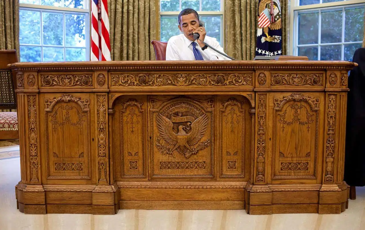
Former US president, Barack Obama, sits behind the Resolute desk
photography by: The White House
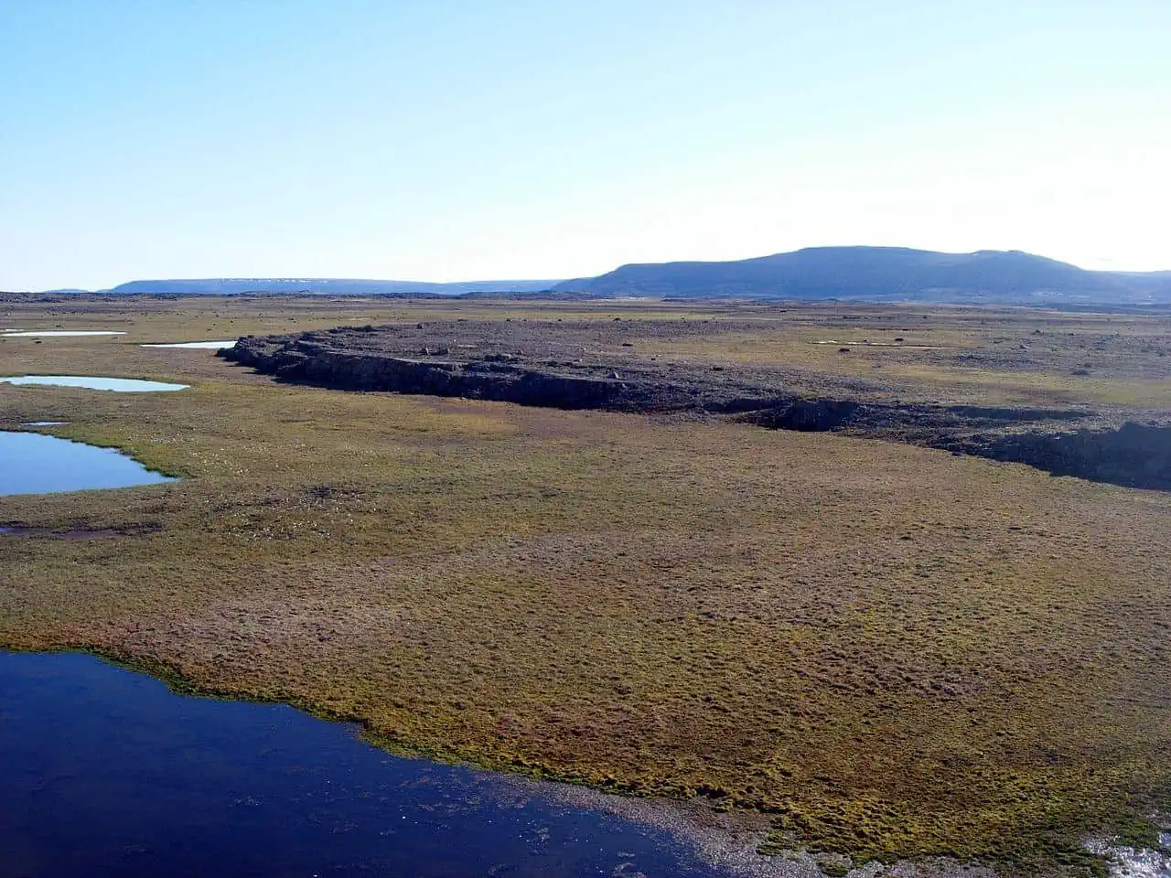
As you’ve probably realized by now, the harsh weather conditions on the island make it an unfavorable place for most plant and animal species. Therefore, it might come as a surprise that Devon is also home to the polar oasis of Trulove Lowland, a 44 square kilometer area that supports an incredibly rich arctic biome and provides a much-needed respite from the otherwise freezing wasteland.
The lush enclave is located along the island’s northeastern coast and is roamed by hundreds of formidable muskoxen, polar bears, foxes and a host of other arctic species. Unlike the rest of Devon which most often features a barren landscape, Truelove Lowland is covered by a green carpet of vegetation, as if a piece of Scottish meadow was artificially attached to the remote island.
The lush expanses of Truelove Lowland
photography by: Martin Brummell/ Wikimedia Commons