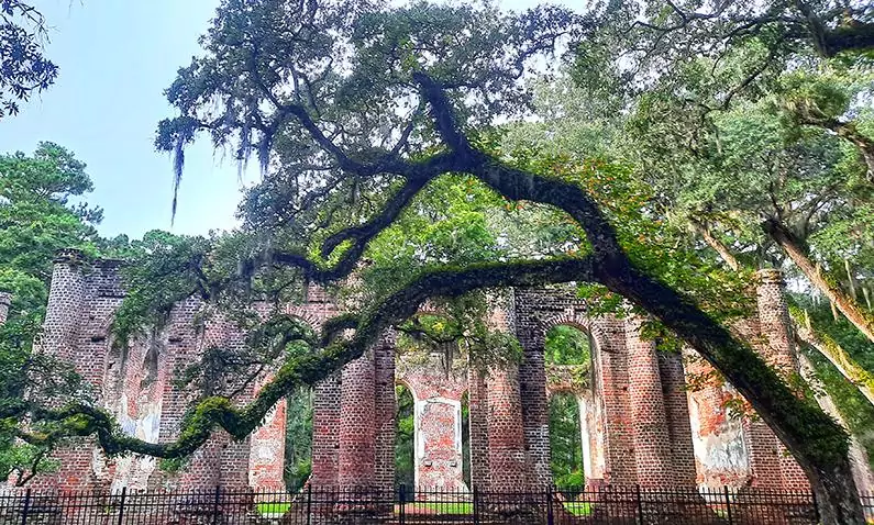
Nestled across the eastern side of the Cooper River, Charleston's affluent suburb of Mount Pleasant is considered one of the most livable places in the US, and as such, it's dominated by spacious single-family homes, many of which have their own private yacht jetty. Therefore, it might come as a surprise, but alongside the numerous recreational boats lies a well-kept secret, an abandoned vessel that serves as a vestige of once a pioneering and unusual machinery.

By: Omri Westmark
Date: 21:19 30.10.21
Last Update: 00:40 22.09.22
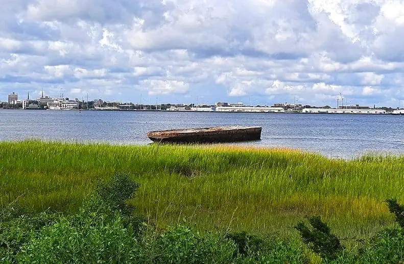
Resting peacefully in front of Mount Pleasant’s coastline for almost a century, the Old Sunken Hull, as it’s commonly known today, was the first concrete vessel and river steamer to be built in the US. Assembled by the Newport Shipbuilding Corporation in 1919, the ship was one of nine concrete-made vessels that were named after late honorable military quartermasters. In fact, the hull was officially named after Col. J.E. Sawyer, a New-York born brigadier general who played a major role during the Spanish-American War.
Initially, the ship was used by the army for a short period of time, albeit not much is known about its military function. After decommissioned by the army, the Sawyer alongside its sister ship, Maj. Archibald Butt, were purchased by Joseph Sabel, a local businessman from Charleston who visioned them as a modern mean of transportation.
Prior to 1928, when the first bridge connecting Mount Pleasant and Charleston was built across the formidable Cooper River, the only way to commute between the two cities was by boat, and so, the Sawyer River Steamer was supposed to answer the growing demand. At its heyday, the 128-foot and 700-ton vessel could carry 500 passengers.
By all accounts, the concrete vessel was briefly used to transport passengers, before being abandoned in Charleston’s Adger’s wharf, where it sank in 1926 and subsequently nicknamed the “Old Sunken Hull”. Due to the busy boat traffic in the area, the sunken vessel soon became a hazard, triggering its removal by the local authorities, which in 1929, towed it after several unfruitful attempts to its current location near Mount Pleasant, where it lies ever since.
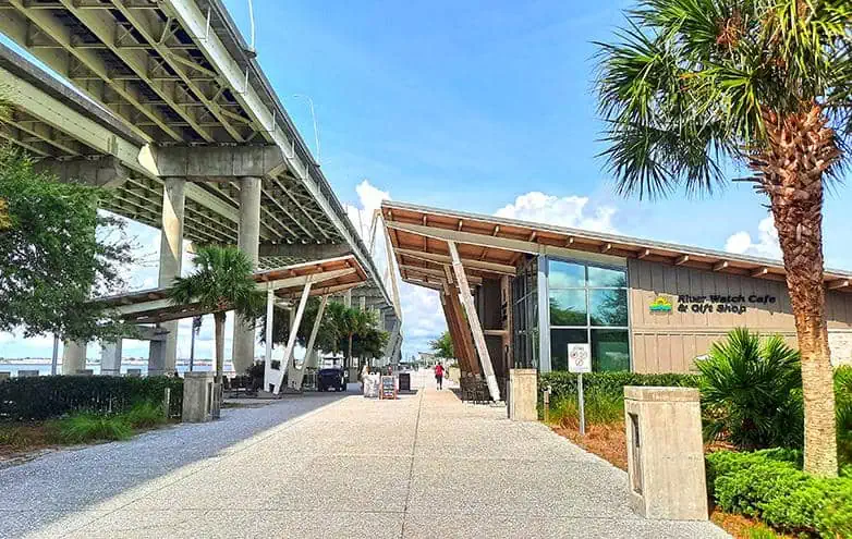
Despite its mysterious image, the Old Sunken Hull is visible from several locations along the Cooper River. The closest you can get around is a scenic spot in front of 28 Bridgeside Boulevard, Mount Pleasant, a mixed-use edifice that perches on the cooper river’s east bank.
The best way to get there by car is parking your vehicle beneath Ravenel Bridge, as it’s both shaded and free of charge.
photography by: Omri Westmark
The parking is adjacent to Mount Pleasant Pier, a recreational jetty that protrudes more than 350 meters into the river, usually brimming with joggers and families.
photography by: Omri Westmark
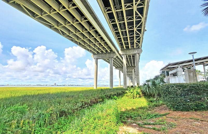
To get to the hull viewpoint, turn southwards before the pier and then walk under the bridge, whose impressive rear is jaw-dropping sight by its own right.
photography by: Omri Westmark
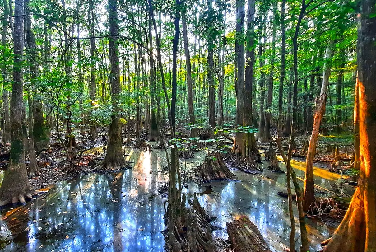
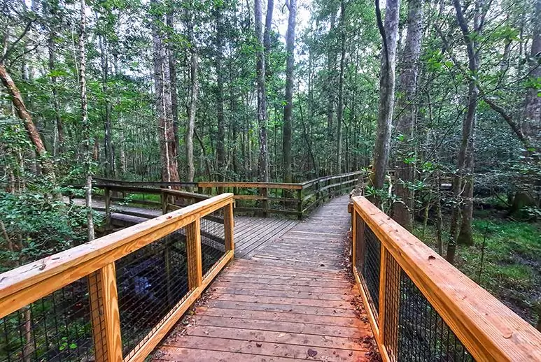
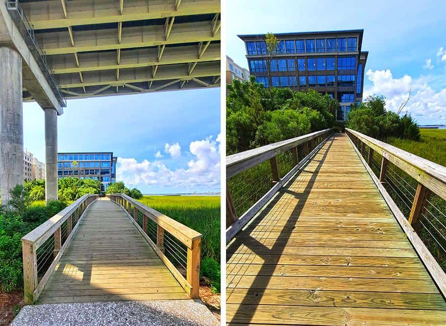
A large portion of the river bank beneath the bridge is covered by a reed-rich swamp, crossable solely by a wooden pedestrian bridge.
photography by: Omri Westmark
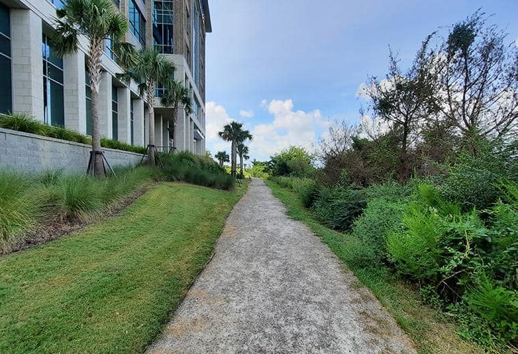
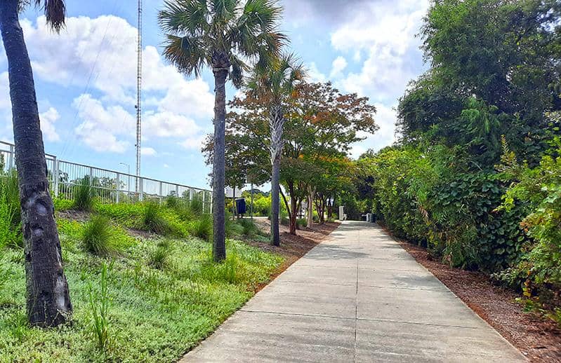
The wooden bridge merges with a gravel walkway, flanked by a tall vegetation on its western part that conceals the river entirely.
photography by: Omri Westmark
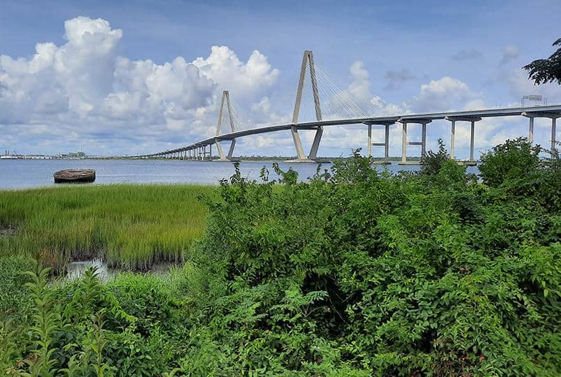
After few minutes, when the shrubbery is no longer tall, the spectacular sight of Ravenel Bridge and the swampy banks of the Cooper River are fully revealed.
photography by: Omri Westmark
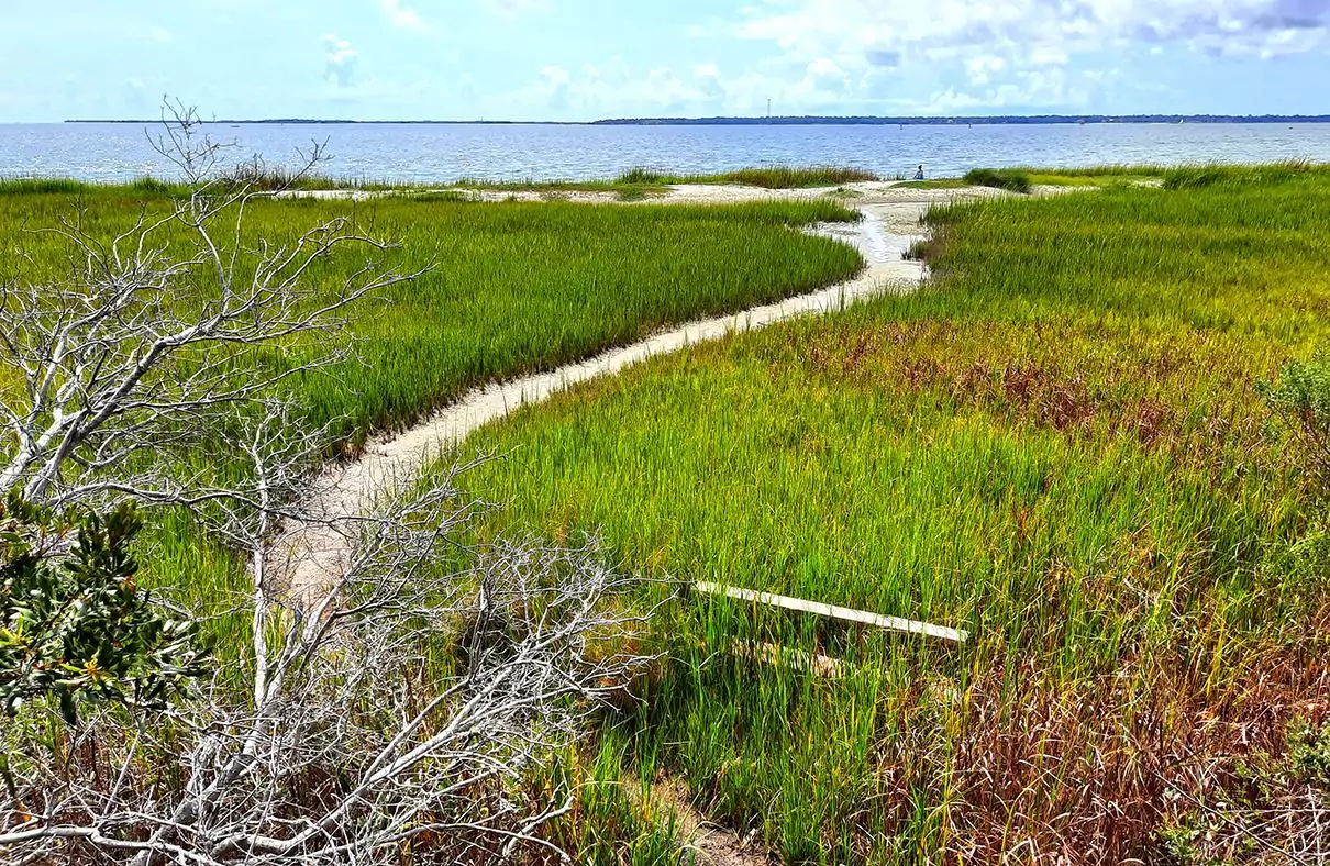
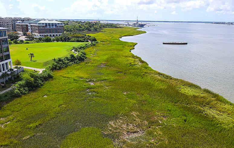
Sandwiched between the Cooper River and Mount Pleasant is a narrow, yet long, strip of wetland, serving as a habitat for myriads of species, most notably endemic seabirds.
photography by: Omri Westmark
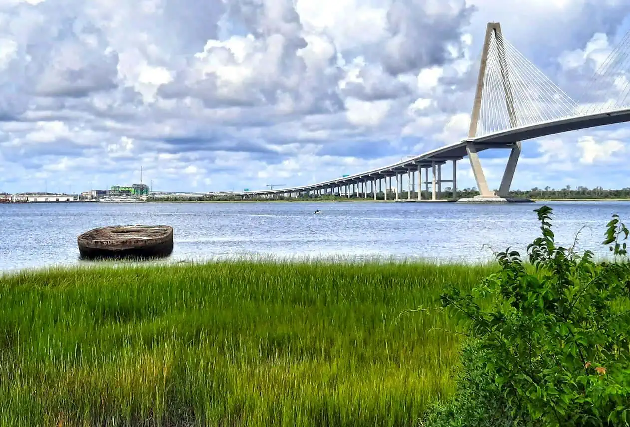
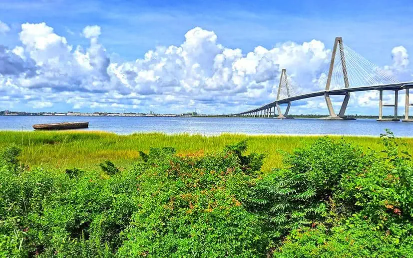
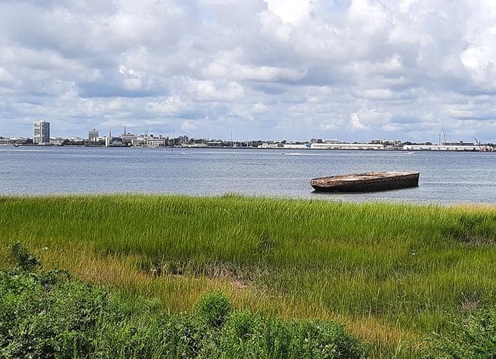
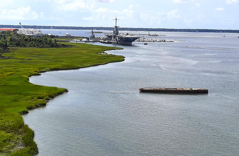
As you progress along the pathway, you’ll finally come across the article’s protagonist, the Old Sunken Hull, lying silently at the eastern side of the river.
photography by: Omri Westmark
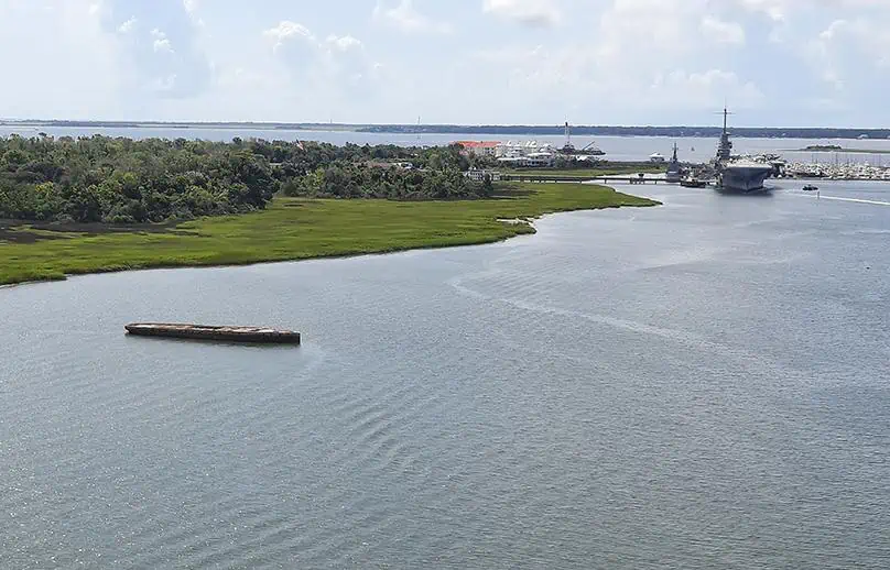
Due to the surrounding swampy terrain, the vessel is inaccessible and can only be spotted from a 50–100-meter distance. Theoretically, the abandoned ship can be approached by a motor boat, however take note that under any circumstances it’s not safe to climb over it, as a century of corrosion process rendered it completely unsound.
photography by: Omri Westmark
Apparently, this secluded and uninspiring round plaza is the closest you can get by foot without recklessly wading through the nearby wetlands.
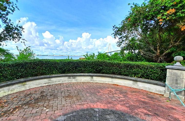
photography by: Omri Westmark
If you stand on the concrete seat, you’ll be rewarded with a stunning view of the massive bridge and the Old Sunken Hull.
photography by: Omri Westmark
While most probably no human has set foot on the concrete vessel for almost a century, birds occasionally frequent the platform, either for nesting or resting before venturing out to the river or ocean.
photography by: Omri Westmark
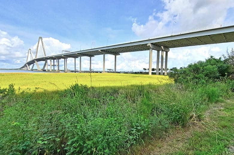
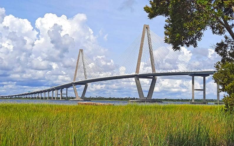
Perhaps the most dominant natural feature of Charleston, the Cooper River is massive, reaching more than 3 kilometers at its widest point. Throughout the history, the river was a source of wealth due to its ample maritime commerce but also a giant physical barrier, disconnecting Charleston from some of its satellite towns.
Before 1929, when the first bridge, John P. Grace Memorial Bridge, was inaugurated, the only way to commute between Charleston and Mount Pleasant on the two sides of the river was by boat or one of those aforementioned concrete vessels. Over the years, the bridge’s capacity couldn’t handle the growing traffic, and so, in 1966, another twin bridge, Silas N. Pearman Bridge, was constructed.
As a result, all traffic from downtown Charleston to Mount Pleasant was diverted through the new bridge, while the former bridge dealt with vehicles making their way in the opposite direction.
Following the rapid aging of the two truss bridges in the 1970’s and 1980’s, coupled with their limited vertical and horizontal clearance that restricted larger vessels from reaching Charleston’s upstream ports, local authorities were forced to take action and plan a brand-new bridge that would replace the old ones.
The current cable-stayed bridge was completed in 2005 after a tumultuous political battle, and is named after the then senator Arthur Ravenel Jr., who orchestrated the efforts and dedicated much of his time for its fruition.
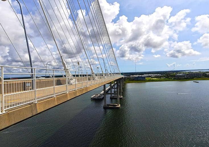
Since its inauguration, the 4-kilometer-long bridge has not only provided a much-needed solution for the region’s vehicular traffic, but also became one of Charleston’s most prominent landmarks, with its two 175-meter-tall hexagonal towers being by far the tallest structure anywhere throughout the city. Interestingly, a pedestrian walkway runs parallelly to the bridge’s 8 lanes, providing mind-boggling views of Charleston, Mount Pleasant and the Cooper River.
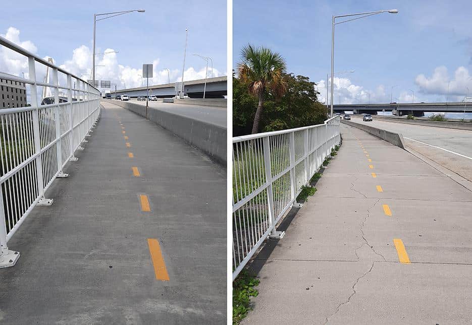
A network of paths links the Mount Pleasant Pier’s parking area with the bridge, making it easy to get there by foot.
photography by: Omri Westmark
Stretching along the bridge’s southern side, the walkway is wedged between the 8 vehicular lanes and a white metal railing. This unassuming bridge’s esplanade became a popular jogging trail for both Charleston’s and Mount Pleasant’s residents, as its sheer height offers spectacular vistas of the whole area.
photography by: Omri Westmark
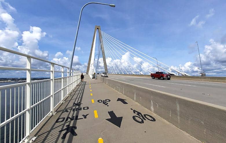
The walkway is divided between a bicycle lane and a pedestrian path, albeit the signs are not always clear or frequent.
photography by: Omri Westmark
As you ascend westwards along the bridge, you’ll immediately notice the previously elaborated Old Sunken Hull. Apparently, many of the joggers crossing the bridge are aware of its existence, yet none of whom know the full story behind it.
photography by: Omri Westmark
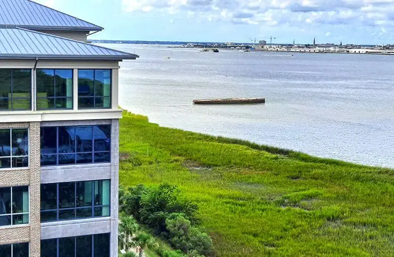
The green strip of wetland along the Cooper River is clearly visible from the bridge, punctuated by several flooded pockets of water.
photography by: Omri Westmark
The riverfront swamp ranges between 50 meters at its narrowest point to 300 meters at its widest point, and due to its lack of accessibility as there are no elevated trails, is probably best-seen from the bridge.
photography by: Omri Westmark
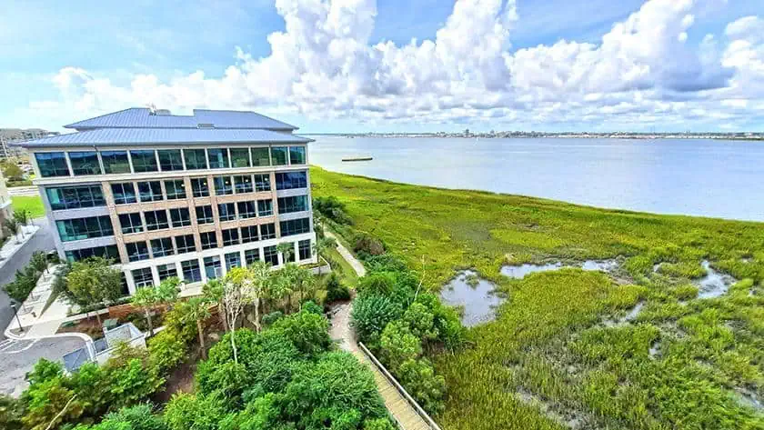
A panoramic view encompassing Mount Pleasant’s riverfront, the wetland, the river and the bridge’s walkway and car lanes.
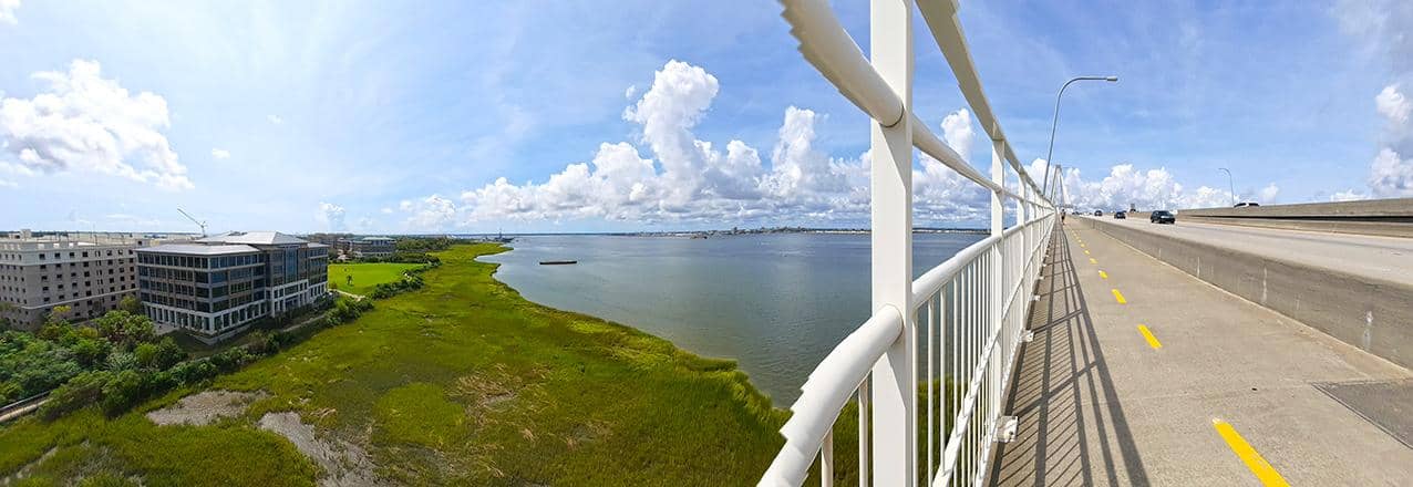
photography by: Omri Westmark
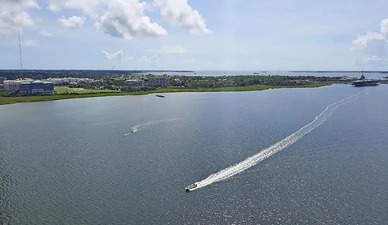
Curiously, the Old Sunken Hull is accompanied by another piece of maritime history, the USS Yorktown (CV-10), one of 24 aircraft carriers that were built during WW2. Named after the American Revolutionary War’s Battle of Yorktown, the vessel played a major role during World War II, participating in numerous battles with the Japanese Army across the Pacific.
photography by: Omri Westmark
Following the end of the war, the aircraft was modernized and redesigned as an attack carrier, serving in both the Korean War and the Vietnam War, as well as recovering the returning astronauts from Apollo 8 mission, the first space mission to leave the low Earth orbit.
The famed vessel was decommissioned in 1970 and in 1975 it was placed in Patriots Point Naval & Maritime Museum, which offers guided tours inside the aircraft carrier that soon became the highlight of the complex.
photography by: Omri Westmark
Placed every quarter of mile are signs indicating the distance to both ends of the bridge, amounting in total to 2.5 miles.
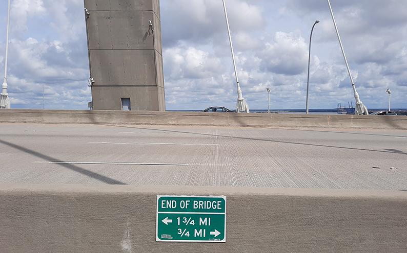
photography by: Omri Westmark
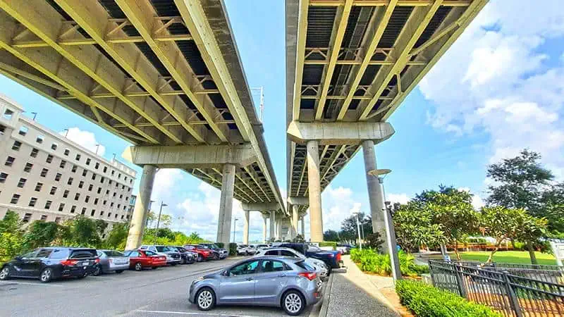
The bridge is insanely structurally strong, as it was designed to withstand all kinds of man-made and natural disasters, including ship accident, earthquakes and even hurricanes. The two diamond-shaped towers hold together 128 single cables, carrying the driving lanes a whopping 57 meters (186 feet) over the river.
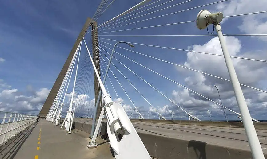
photography by: Omri Westmark
Situated in the middle of the bridge, a modest lookout with an informational plaque and a bridge logo is bestowed with a panoramic vista of Charleston, Mount Pleasant, parts of the bridge itself, the Cooper River and the Atlantic Ocean.
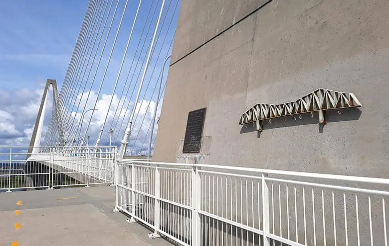
photography by: Omri Westmark
Charleston’s skyline as it’s seen from the bridge’s observatory, most noticeably are the numerous church spires, being the tallest buildings within the downtown area.
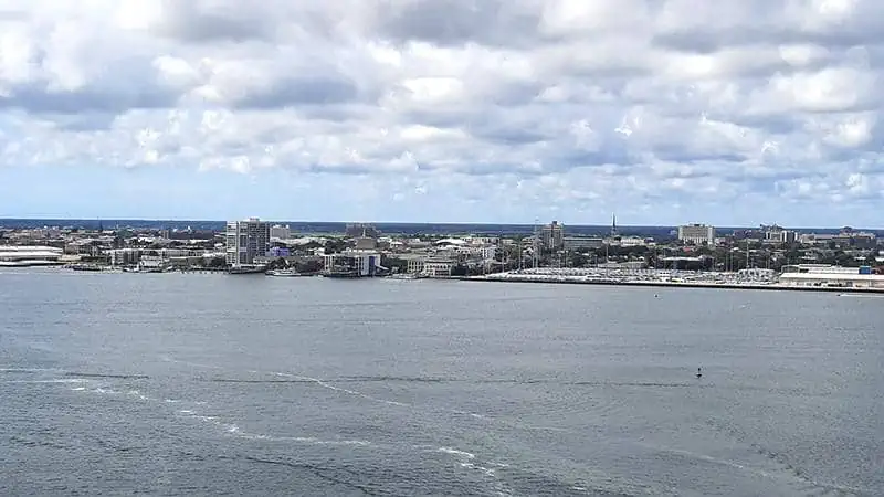
photography by: Omri Westmark
Apparently, even the bridge itself can be better appreciated from this lookout, providing an insightful glimpse into its often lesser-visible structural components.
photography by: Omri Westmark
Mount Pleasant alongside the Cooper River Estuary, which is often teeming with both commercial and recreational vessels, rapidly crossing beneath the bridge.
photography by: Omri Westmark