Stretching all the way from the Appalachian Mountains to Chesapeake Bay at the Atlantic coast, the James River is by far Virginia's largest river, majestically bisecting the state's capital, Richmond. Besides being the city's main source of water, the river also serves as a recreational epicenter, as its banks are always brimming with joggers, cyclists and passersby. Originally constructed as a measure to counter seasonal floods, the Manchester Floodwall along the James River offers alternative and breathtaking views of Richmond, yet to be unspoiled by the throngs.

By: Omri Westmark
Date: 01:22 06.11.21
Last Update: 21:57 03.11.22
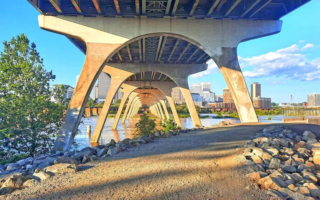
Despite being neither properly nor officially marked, the Floodwall walk’s trailhead lies beneath the Manchester Bridge, at the southern bank of the James River.
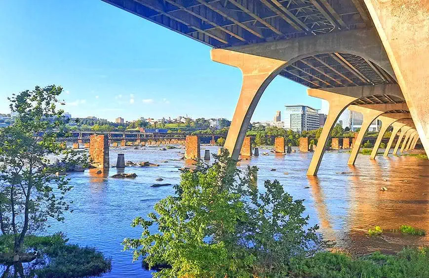
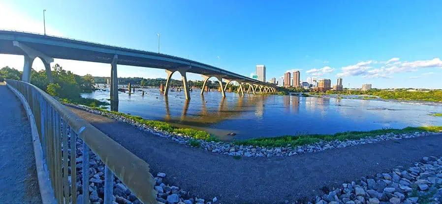
Linking Richmond downtown area with the former independent city of Manchester, the 885 meter long Manchester Bridge replaced the old Ninth Street Bridge in 1972, which was far more susceptible to flooding due to its low elevation.
photography by: Omri Westmark
Following a series of 8 severe flooding events between 1969 and 1987, the local authorities constructed in 1994 a massive barrier along the James River, protecting Richmond’s most vulnerable lowlands from future floods.
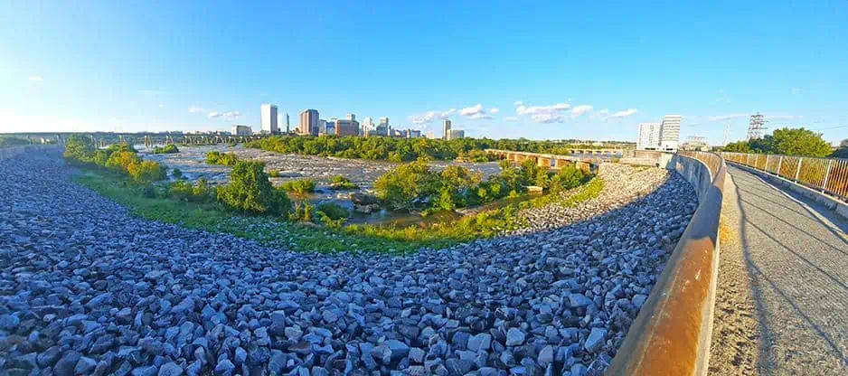
The barrier, officially known as the Manchester Floodwall, extends more than 2 miles along the river’s south bank and alternates between different types of countermeasures against the inundating waters, including a 600-meter-long levee and a similar portion of an anti-flooding wall.
photography by: Omri Westmark
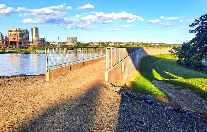
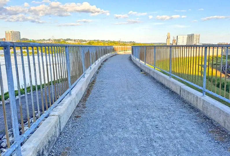
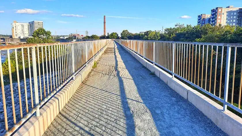
The first segment of the trail is the walkway atop the earthen levee. Enclosed by double-railings, this elevated narrow path is bestowed with some of Richmond’s most spectacular views, often devoid of a large pedestrian traffic that is more common in other recreational esplanades along the James River.
photography by: Omri Westmark
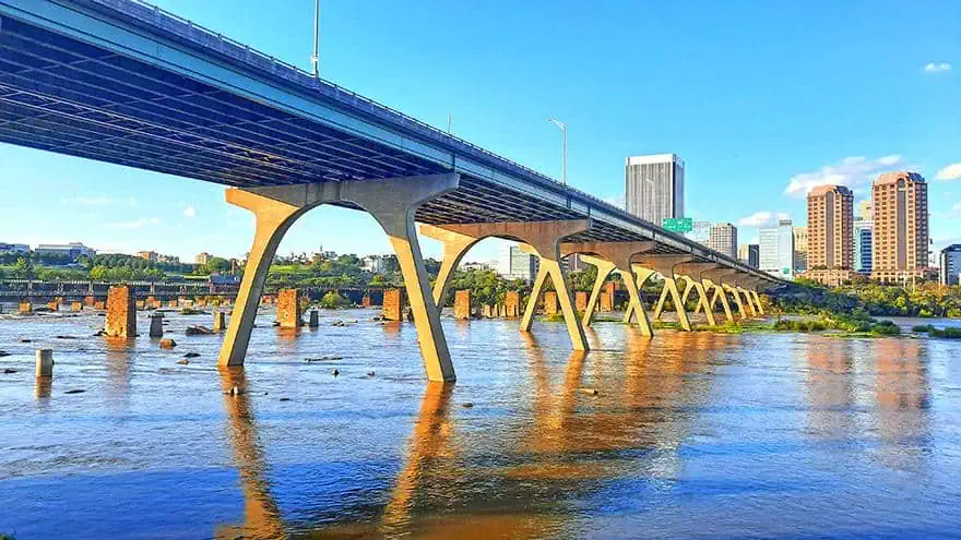
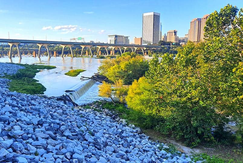
Perhaps the Floodwall’s most iconic sight is the Manchester Bridge spanning over the river with Richmond’s skyline looming in the background. If you look closely enough you can spot the remnants of the old bridge that was submerged shortly after the inception of its modern successor.
photography by: Omri Westmark
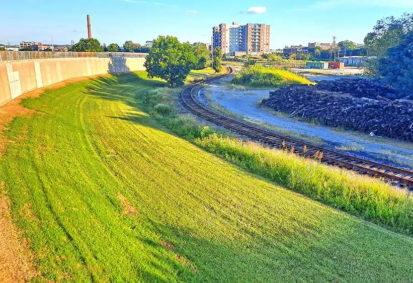
The levee’s walkway is wedged between the river and a wide strip of grass, the latter of which is designated to prevent the growth of tree roots that might compromise the floodwall’s soundness. The lawn is bordered by a single railway and stacks of lumber, strewn across the former site of Norfolk Southern depot, where routine repairs of steam locomotives once took place.
photography by: Omri Westmark
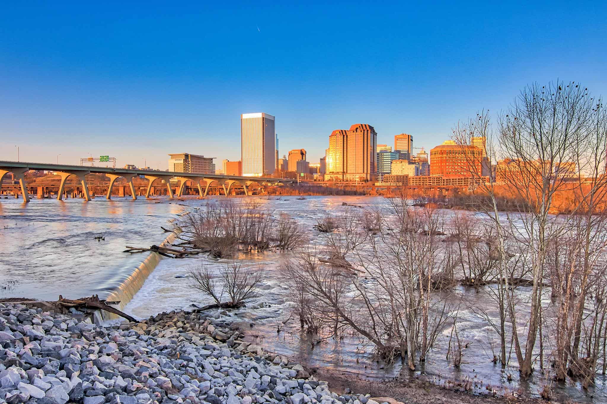
Along the Floodwall is a rectangular scenic lookout with expansive views of the James River, Manchester Bridge and Richmond’s skyline.
photography by: Omri Westmark
Also known as the Manchester Dam, a diagonally shaped platform across the river regulates the flow of water and diverts part of it into the nearby Manchester Canal, an old man-made waterway that was formerly utilized by the area’s several factories and corn mills for electricity generation.
The dam also serves as the only safe passage for white-water vessels heading further downstream.
photography by: Kelly Verdeck/ Flickr
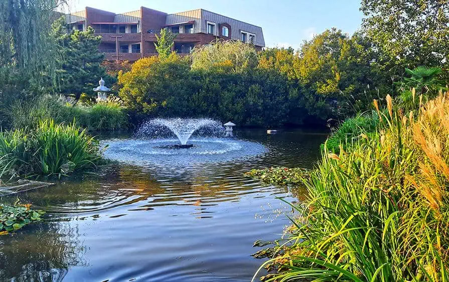
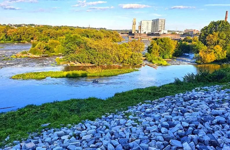
Tucked away in the middle of the river are dozens of small islands that serve as a habitat for a plethora of species, most notably migratory birds. The islands’ insulation from any harmful human activities as well as predators makes them an ideal place for nesting among Canada geese. Additionally, the abundance of fish, especially during the spring, when swarms of herring and rockfish make their way upstream to spawn, attracts many bird species, including kingfishers, ospreys and great blue herons.
photography by: Omri Westmark
In turn, the masses of birds throughout the river make the Floodwall a great place for birdwatchers who can spot birds aviate on the backdrop of Richmond’s iconic skyline.

photography by: Kelly Verdeck/ Flickr
Bewilderingly, in spite of its astronomic price tag of around 143 million dollars, the floodwall project overwhelmingly offset the initial costs, as the accumulated damage as a result of floods in the decades prior to its construction were estimated at a whopping 140 million dollars.
photography by: Omri Westmark
The Richmond’s segment of the James River is dominated by numerous rapids, and as such, it quickly became a hotspot for white water boaters, many of whom carry their gear along Floodwall walkway on their upstream for another rafting session.
photography by: Omri Westmark
As you go eastwards along the trail, you can spot one of James River’s most conspicuous islands, the Sharp’s Island. This tiny speck of land is merely one acre, but what it lacks in size it makes up for in historic, natural and even geological significance.
For 75 years the local Sharp family called this island home, before their house was consumed by one of Richmond’s notorious floods. The island was eventually purchased by Andy Thompson who transformed it into the only legal camping site throughout the city, available for rent in Airbnb. Even if you don’t have any plans to camp in Sharp’s Island, you can still visit this natural nook by a canoe or a boat, and witness the rich biome that flourishes over there, particularly during the springtime.
photography by: Omri Westmark
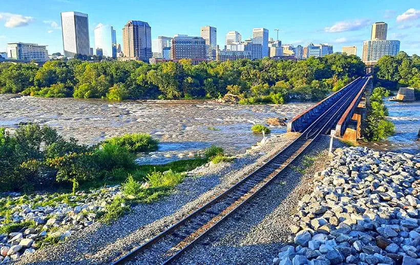
The floodwall rail bridge with Richmond’s skyline in the background.
The bridge is part of Norfolk Southern Railway’s infrastructure, which as previously mentioned also once included the Norfolk Southern Roundhouse. Nowadays, the bridge is mostly used by freight trains transporting pulpwood, as traditionally the south bank of the river was and still is home to several paper factories.
photography by: Omri Westmark
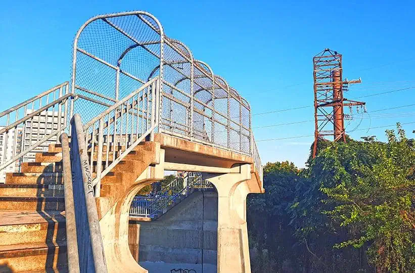
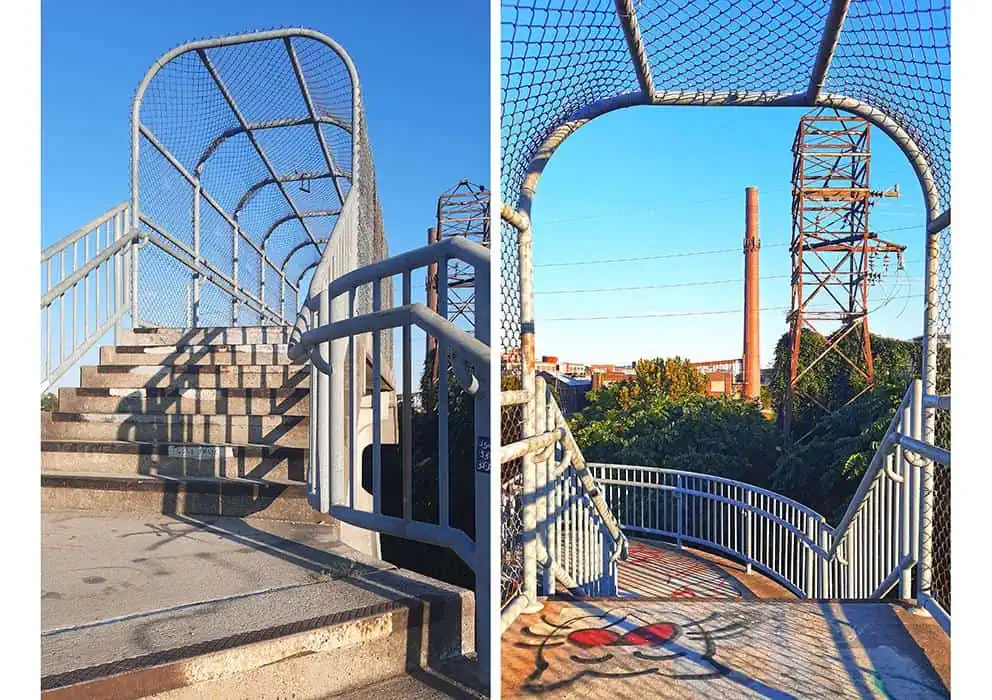
The staircase and the fenced passage mark of the end of the Floodwall’s main and most scenic segment.
photography by: Omri Westmark
The passageway span over the Floodwall’s Swinging Gate, an opening in the barrier that grants access for Norfolk Southern trains. The gate is designed to automatically close during an emergency event, when river’s water level reaches a certain height that could result in flooding.
photography by: Omri Westmark
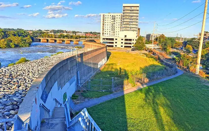
The next segment of the Floodwall comprises of a 30 feet tall concrete wall that is almost completely inaccessible for pedestrians. Therefore, the trail deviates from the river route and goes along the Manchester Canal.
photography by: Omri Westmark
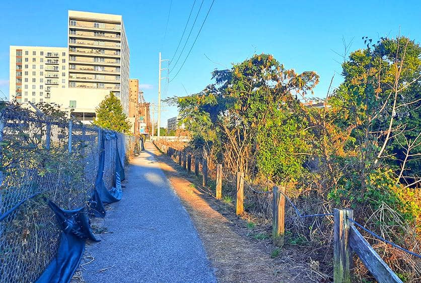
As you descend the staircase, you’ll arrive at a narrow path, sandwiched between the Manchester Canal and the wall. Unlike the scenic riverfront esplanade, this segment of the Floodwall walk is rather modest in terms of its visual attractiveness, and yet, there is still a couple of interesting places to explore around.
The pathway ends at the South Falls Tower, a brand-new residential building (on the left side), where it merges with the Floodwall Park, a small patch of lawn. While this small-scale park is far from being an attraction by its own right, it has a concrete staircase that leads into a lookout atop the Floodwall, bestowed with breathtaking views.
photography by: Omri Westmark
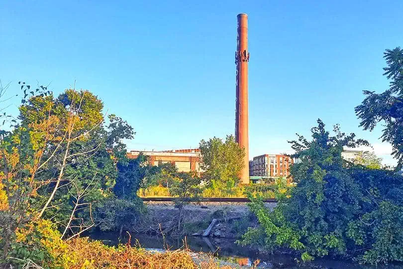
Once an independent city and today part of Richmond, Manchester’s old town is dominated by tens of factories, some of which date back to more than a century ago. Standing out amid the industrial landscape is the seemingly abandoned Sampson Paint Factory.
photography by: Omri Westmark
Built in 1899, this two-story brick building features insanely large windows and a brownish chimney that carries the name of the brand, and surprisingly, has been continuously operating since the 19th century.

photography by: Omri Westmark
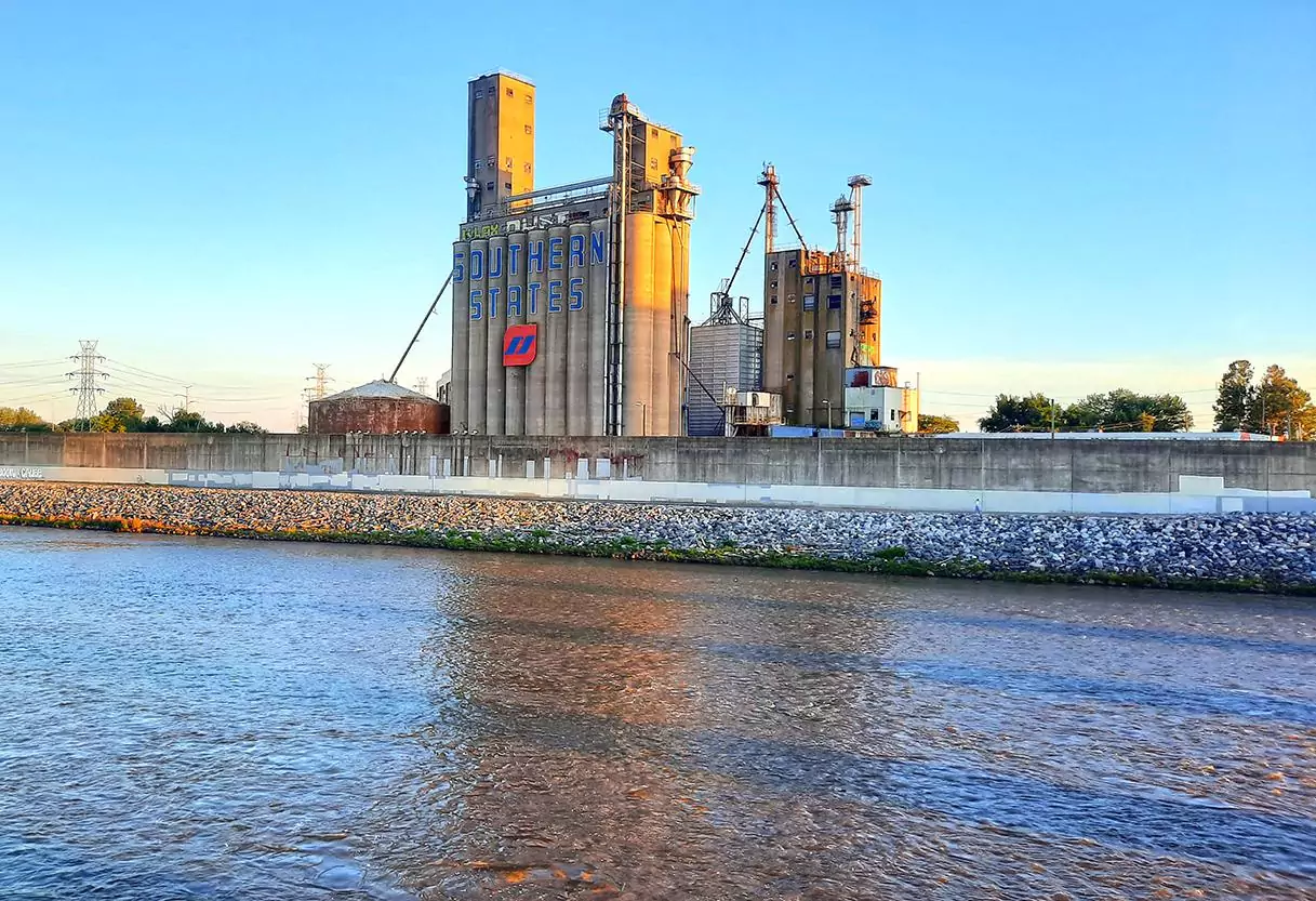
Across the S 14th Street is another worth-visiting vestige of Manchester’s industrial legacy, Southern States Cooperative’s grain storage towers, which in recent years became a magnet for urbex enthusiasts and graffiti artists.
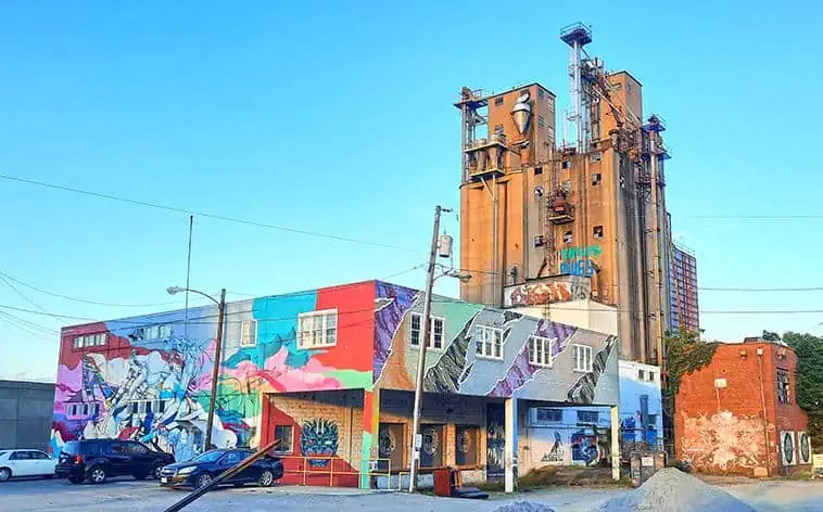
photography by: Omri Westmark